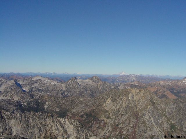
Argonaut Peak to Little Annapurna (left to right)
This was a great fall trip to a not too frequently visited peak in the Stuart Range. Although not technically difficult, the climb does presents some difficulties for a day climb, mainly in the physical and route finding departments. The route is class 2 but I would question the class 2 rating of the route as a whole. The approach is fairly long whether you approach via Long's Pass or Beverly Creek/Forth Creek. There is slightly more elevation gain if you approach from Long's Pass but it is slightly longer if you approach via the Beverly Creek/Forth Creek trails. It was a toss up, and I decided to take the Beverly Creek/Forth Creek approach for no other reason than it would be entirely new terrain.
As I drove across Snoqualmie Pass the DOT thermometers read 21 degrees at the west summit and a frigid 16 degrees at Hyak. I arrived at the Beverly Creek Trailhead (Highway 97 to Teanaway Road (FSR 9737) to the end of spur road 112) around sunrise and started hiking up the Beverly Creek Trail (FST 1391). In 0.4 miles the trail reaches a junction with the Bean Creek Trail (FST 1391.1). I kept left on the main trail and hiked another 2.2 miles through forest then more open slopes to reach the junction (c.5200') with FST 1226.1. I followed this trail uphill for 0.6 miles to the pass between the Beverly Creek and Forth Creek drainages.
|
Argonaut Peak to Little Annapurna (left to right) |
|
|
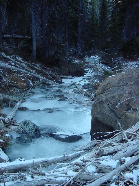
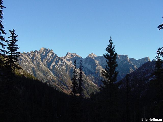
At the pass there is yet another junction, this one with the Forth Creek Trail (FST 1218). The trail leads straight down the gentle slopes for 3.3 miles to reach Ingalls Creek and the Ingalls Creek Trail (FST 1215). It was cold enough for long enough that Forth Creek and its tributaries where largely frozen solid. I began to wonder what Ingalls Creek was going to be like.
|
Forth Creek |
|
|
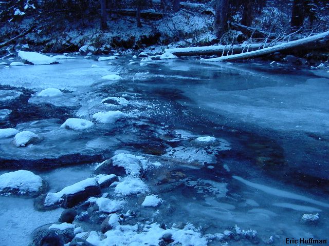
I arrived at Ingalls Creek and found that it was partially frozen but there was water running below the surface of the ice. Fortunately, the rocks that one would normally hop across on appeared to have solid ice above and around then. I crossed slowly probing with my ice axe.
|
The Ingalls Creek ford |
|
|
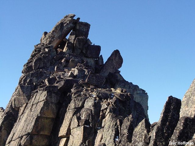
After reaching the Ingalls Creek Trail, I headed downstream a couple of hundred yards then started up an easy forested slope. Basically, I headed straight up on slopes just west of the main gully on the south side of Argonaut Peak. After some bushwhacking, the brush and trees turned to talus and easy open slopes. The gully forks at about 7000' where I wondered which way would be better. I continued up the main gully even though I couldn't see very far up it. The gully is at the base of the steep slabs of the south face and after a fair amount of class 2 scrambling I reached the top of the gully (c.8200'), just below the summit ridge. Expecting to see an easy way to gain the ridge I found nothing that was class 2. To the right there was an easy gully that had a more difficult maneuver at the top (I descended this way and it is easier than the way I went up). To my left there appeared to be an equally viable route. I went left and thought "this doesn't feel like class 2" as I swung from a horn to reach a rappel station. Once at the slings it was easy to gain the ridge where I got a view of the top. The summit is comprised of two large slabs, one leaning against the other to form a ceiling about 25 feet high. The final summit scramble up the ridge was class 2 (circle left around the summit slabs). There are some deep holes on the west side of the summit that could be dangerous if concealed by snow.
|
The summit of Argonaut Peak |
|
|
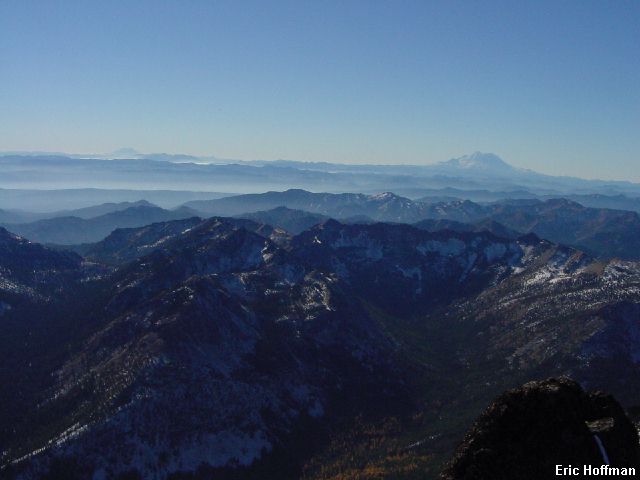
It took 5 hours to reach the summit and having gotten there faster than I had expected, I relaxed on the summit for a while. The views were great, especially for November. There was virtually no wind but it was cold. My thermometer said 23 degrees, but it also says REI...it wasn't above freezing but it sure felt warm sitting in the sun.
|
The view to the south |
|
|
|
The view to the north |
|
|
I descended the same way I came up except for the descent from the summit ridge down to the top of the gully. The return to the pass between Beverly Creek and Forth Creek was no better than the return to Long's Pass. It is gentler but longer but still uphill. I reached the trailhead just before dark.
References:
Cascade Alpine Guide, Volume 1, 2nd edition; Fred Beckey; 267, 270-271