The Boulder-Park Cleaver Route from Boulder Ridge
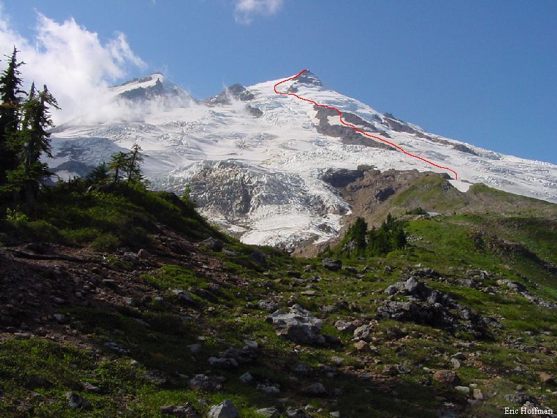
Joined by Andy Johnson and John Mefford, we had a great time on this Mt. Baker east side route. This route is more strenuous than the Coleman-Upper Demming or Easton Glacier routes, but is not technically difficult. The Boulder-Park Cleaver route offers some interesting, particularly in late season.
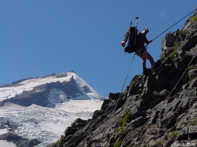
The trip begins at the Boulder Ridge Trailhead (c.2700') which is reached by driving Baker Lake Highway 17.8 miles to FSR 1130. Turn left on FSR 1130 and continue 1.5 miles to FSR 1131. Drive FSR 1131 to its end in 4.2 miles. The Boulder Ridge Trail (FST 605), is nearly flat as is meanders through the forest to reach a bog at two miles. There is little to show the way across the bog, but once across it the tread can once again be followed as it begins climbing toward Boulder Ridge. After ascending several hundred feet in the next mile, the trail breaks out of the trees and continues toward the Boulder Glacier's terminal moraine. The trail becomes more of a path before arriving at a rocky slope with a deteriorating fixed line dangling down it. The rock, class 3, presented the first challenge of the climb. It is not difficult, but seems more so when you are carrying a fully loaded pack. Once above, the path continues to the crest of Boulder Ridge. The ridge is a pleasant hike with nice views of Bakers east side and Mt. Shuksan. A good camp site is at 5,700' where the heather ridge gives way to snow and ice.
|
The Boulder-Park Cleaver Route from Boulder Ridge |
|
|
|
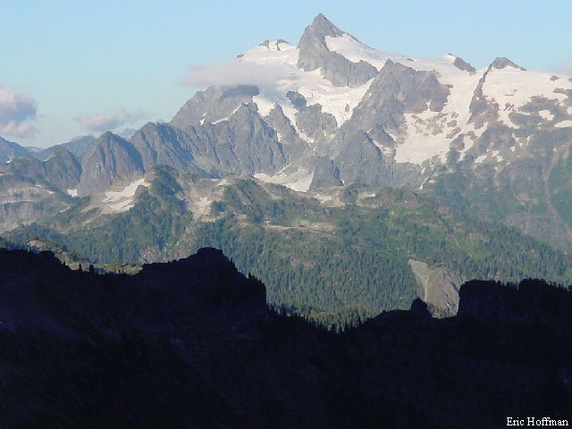
Mt. Shuksan from Boulder Ridge |
|
|
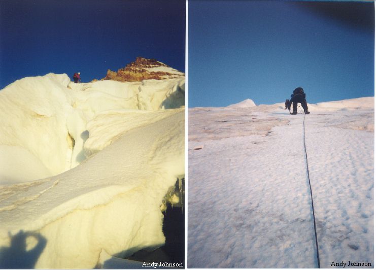
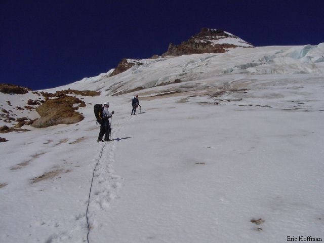
At 3:30 AM we stepped onto the Park Glacier and began the ascent toward the bottom of Boulder-Park Cleaver (c. 6800'), negotiating a few crevasses along the way. Good camp sites where noted on the cleaver near 7200'. The route generally stays on the north side of the cleaver then crosses a short rock section near 7,800'. Now the route becomes a bit steeper to climb a snow to a short snow finger with a rock scramble near the top of the cleaver. The route continues on the Park Glacier to the top of the cleaver where the most difficult portion of the route begins. The climbing is not difficult, but was sometimes steep, icy, exposed to rock fall and has crevasses close below. We used ice screws and pickets to protect much of the section between the top of the cleaver and a buttress at c.9,500'.
|
Climbing above the Boulder-Park Cleaver |
|
|
Crossing beneath the buttress, we navigated a few crevasses and made our way to the final steep section of glacier between the steep vents and summit. A few more crevasses had to be negotiated before we reached the summit plateau, near the true summit. The descent was made via the route of ascent, again protecting the portion between the buttress and the top of the cleaver. A 60' rappel was made down the rock section below the crest of Boulder Ridge (a 37 meter rope was just long enough to reach the bottom).
|
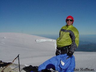
Andy (Left) and John (Right) on the summit of Mt. Baker |
|
|
|
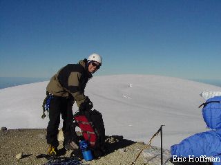
Andy and John descending near the top of the cleaver |
|
|
|
Andy rappelling off Boulder Ridge with Sherman Peak and the Boulder Glacier in the background |
|
|
References:
Cascade Alpine Guide Volume 3, Second Edition; Fred Beckey; Pages 35-36
100 Hikes in Washington's North Cascades N.P. Region, Third Edition;
Spring/Manning; Pages 80-81