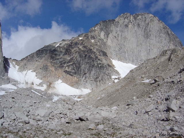
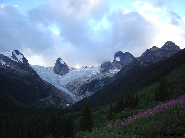
The Bugaboo Glacier, but this is just the view from the road...
The forecast for the Washington Cascades wasn't pretty so Sergio Verdina and I decided to take a gamble on a trip to the Bugaboos and Glacier National Park in British Columbia. It was a spur of the moment plan but we managed to get the time off work and gather enough information about the area to be reasonably educated. We departed on August 5th for the long drive to the Bugaboo area. The fastest way there seems to be to take I-90 to Coeur d'Alane Idaho then highway 95 to the boarder crossing. Once across the boarder (apparently, I was a threat to Canada's national security) Highway 95 takes on two names, 95 and 93. Once through Cranbrook we took 95/93 through Invermere and Radium Hot Springs. Now the highway was once again only called Highway 95. After another 27Km we arrived in Brisco, which appears to be a town on the map but really isn't, we turned left onto a gravel road marked with a sign for Bugaboo Provincial Park. From here we followed signs toward the Bugaboo Glacier... 46Km later we arrived at the trailhead.
|
The Bugaboo Glacier, but this is just the view from the road... |
|
|
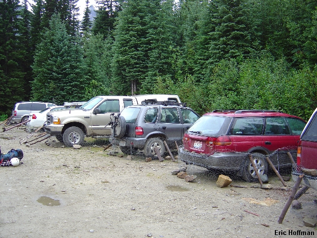
We arrived at the trailhead later than we had hoped and decided to stay at the trailhead and hike up to Kain Hut in the morning. All of the vehicles in the parking lot were wrapped with chicken wire held in place with sticks and rocks. Finally we ask an elder who arrived at the trailhead before us what the deal was. He tells the tale of a porcupine chewing through someone's breaklines while their vehicle was parked at the trailhead and the subsequent ride down the road. We were a bit skeptical that the rodents were any worse here than elsewhere but fortify the Kia anyhow.
Not long after our first attempt to go to sleep it began raining and end up staying the night in the none to spacious Kia hoping to keep our gear dry for at least the first day. We awake briefly at around 5:30am and it is still raining lightly. Finally, we left the cramped quarters of the Kia at 7:00, quickly ate breakfast, drank coffee and began hiking. Along the way we run into another elderly climber who is talking non-stop about their late return from Bugaboo Spire's NE ridge and the hassle he had getting his social security check. Sergio and I don't take the two elderly climbers too seriously, but as we would later realize these two senior citizens from Colorado were a force to be reckoned with.
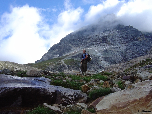
We arrived at Kain Hut in under two hours where we dropped our overnight gear, paid the $15(US) per person for the following night and grabbed a bite to eat before heading up the moraine towards Bugaboo Spire's South Ridge. Our plan was to climb the Kain Route, a route pioneered in 1916. A path leads from the hut to the moraine below a short 30-40 degree headwall between Snowpatch Spire and Bugaboo Spire. The bergshrund crossing could be a problem but didn't pose much of one on our ascent. The two elderly climbers are right there with us and plan to climb the SW ridge of Snowpatch Spire.
|
Bugaboo Spire from above Kain Hut |
|
|
Once above the burgshrund we continued to the saddle between Bugaboo and Snowpatch Spires. We met two climbers at the saddle who had a different objective in mind. We left our ice axes and crampons here as the patches of snow that remained on Bugaboo Spire were small and easily avoided. We began up on rubble ascending and traversing east on or below the ridge crest. When it looked like things were going to get more difficult we decided to rope up. As it turned out it did get a bit more difficult but the rope was unecessary. When the ridge crest became difficult at c.10,000' we located a wide ledge below a steep gully system on the east side of the crest. Sergio made quick work of the short 5th class pitch (30 to 40 meters) to return to the ridge crest.
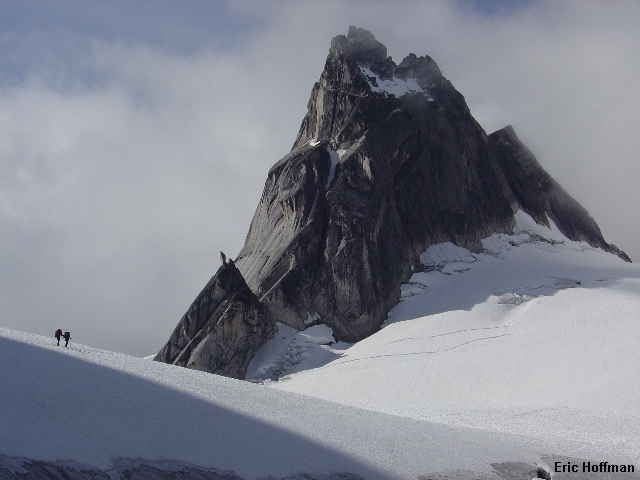
|
Climbers heading for Pigeon Spire |
|
|
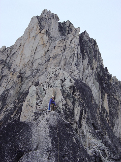
|
Sergio on the South Ridge of Bugaboo Spire |
|
|
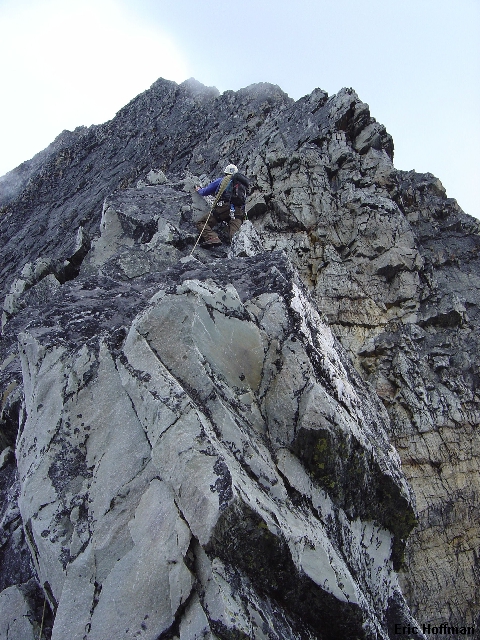
The ridge crest is exposed but was largely 3rd and easy 4th class scrambling until we reached a large block on the ridge where it seems we made things more difficult than necessary. Sergio did a layback on the right side after aiding from a sling to gain the top of the block. I removed his sling and ended up going to the left side which at first seemed would be easier but now I am not so sure. It appears that the best way to handle this section is to drop slightly on the right side then briefly follow a ledge system before climbing back to the crest beyond the block. In about a pitch from the large block we arrived at the gendarme pitch. Sergio led out as a brief snow flurry set in.
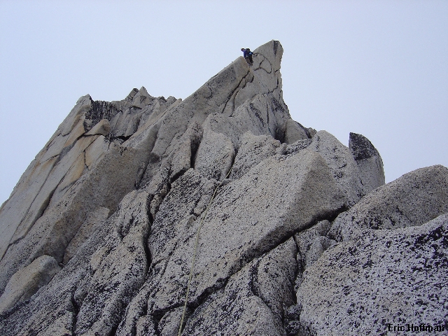
|
Sergio leading the gendarme pitch |
|
|
The gendarme was a nice challenge for a modest rock climber such as myself (5.6 with a wide variety of moves). The pitch begins in a short gully on the right side of the ridge then between a large flake and the gendarme where there were a couple of old pitons. A few steep moves led left to the ridge crest where there is a short friction slab. Once across the slab (about 3 steps) there is an awkward move to a 2" wide lip. After a downclimbing mantle move from the small lip I struggled to retrieve one of Sergio's cams but eventually joined him at the top of the pitch with his cam (he owes me for that one). From here the summit was a short pitch of class 4-5 that we elected to climb unroped.
|
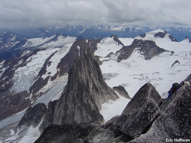
Snow Patch Spire and much more from the summit of Bugaboo Spire |
|
|
|
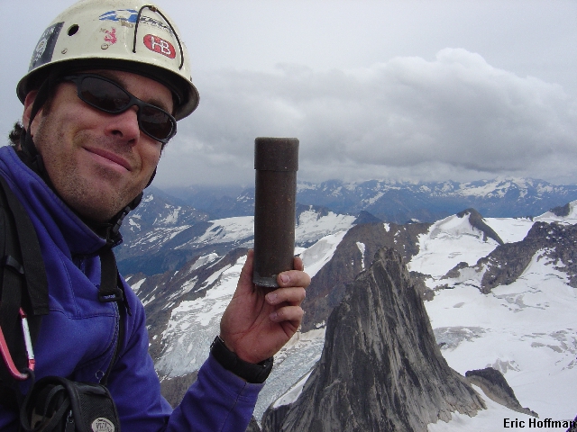
Sergio on the summit |
|
|
We made 5 rappels on the descent from excellent bolted anchors with some downclimbing in between. There was another anchor near the summit and two more on the class 4 slabs below the ridge crest that we did not use as the rock was dry and the downclimbing straight forward. It began raining on the descent and we saw the two elders on the final pitch of Snowpatch. We reached the hut at about 8:00pm (10-11 hours round trip from the hut). The term "hut" may not be an accurate description for this alpine palace that features electricity (small hydro generator), hot and cold running water and sleeps up to 50. We ate our freeze dried meals as the real chefs prepared savory dishes on the electric and gas stoves. Somewhere around 11:30pm the two elders arrived after rappeling down the west face of Snowpatch Spire in the rain.
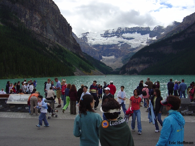
The following morning we waited for a pause in the rain then made our escape and return to the trailhead. After removing the porcupine barrier surrounding the Kia we decided to drive to Lake Louis to check out the scene there. There wasn't much else to do in the rain. Oh yeah, you could eat Pizza in Golden... but there was still had time to drive to Lake Louis.
|
Local legend? Cars at the trailhead fortified against brake fluid drinking porcupines |
|
|
|
Doing the tourist thing at Lake Louise |
|
|
After checking out Lake Louis and Moraine Lake we headed back to Golden then on to Rodger's Pass. We still had hopes of climbing Mount Sir Donald. The weather appeared to be improving as we forked out the cash to stay at Wheeler hut ($25 Canadian per person per night) but once again it rains during the night. We awake at 5:00am and everything is wet and the sky gloomy. At 6:30 we decided to go get breakfast at the Rodger's Pass Best Western. As we ate breakfast we started getting glimpes of blue sky and high summits. We quickly ate as much as we could eat at the buffet breakfast and raced back to the hut.
|
On the approach to Mount Sir Donald |
|
|
In about 2 hours we arrive at the Uto-Sir Donald Col. Just after 11:00 we started up the NW ridge. While this route is technically not that difficult (up to 5.4) it is a long demanding route with about 2500 feet of exposed climbing. The rock was reasonably dry near the col but for whatever reason I was not feeling altogether on my game. In the interest of moving rapidly, we rope up but are placing no protection. I felt I was a liability. Finally, I pulled the plug on the climb knowing this was the end of the climb for both of us. This was something I had never done and it was not an easy decision to make. I was comforted only by the fact that two climbers who both had far better skills than I had failed to reach the summit and were descending. They stated that the rock was quite wet and very slick above. We retreated back to the col then continued in silence back to the hut.
|
Sergio low on Mount Sir Donald's NW Ridge |
|
|
After a second night at Wheeler Hut we began the the long drive back to Seattle. The return was through Revelstoke and Kamloops which seems to be the fastest way there (allow 10 hours). If attempting to climb Sir Donald it would be prudent to stop at the Rodger's Pass Information Center for details on the descent route which now consists of 12 bolted rappel stations. Also note that a permit is required to park in Glacier National Park. Permits can be obtained at the information center... it closes pretty early.
References:
Bugaboo Rock-A Climbing Guide, 2nd Edition; Randall Green and Joe Bensen; Pages 67-72; 79
Selkirks South; David P. Jones; Pages 74-77, 98, 102-104, 105, 106-107