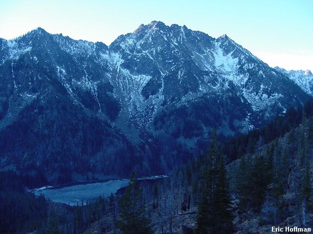
Cashmere Mountain from Argonaut Peak (11/2/02)
Cashmere Mountain is a high mountain near the Enchantments. I was lured to this peak by the promise of good views and a route that seemed reasonable for a late November day. This has, of course been a dry start to the winter. Cashmere can be climbed just about anywhere but the approach makes the south slope/west ridge the most appealing.
|
Cashmere Mountain from Argonaut Peak (11/2/02) |
|
|
I started hiking the Eightmile Creek Trail (FST 1552, c.3300') around 6:00am. The trail follows the creek through sometimes burned forest for 2.8 miles to Little Eightmile Lake (4404'). On the north side of the small lake is the junction with the Caroline Lake Trail (FST 1554). This trail climbs NW through mostly burned forest to a saddle (+6320') then descends to Lake Caroline (6190'). The lake is about 5.5 miles from the trailhead and was mostly frozen despite the unseasonably warm temperatures. There was also more snow than I had been expecting. In the basins it was 6-10 inches deep and it was always with a breakable crust.
|
Eightmile Lake from the Lake Caroline Trail |
|
|
|
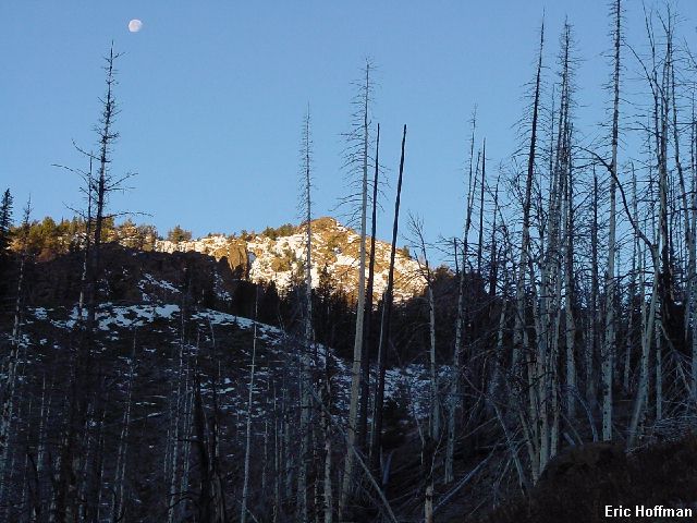
Hiking through the charred forest-was it day or night? |
|
|
The trail circles to the north side of Caroline Lake then gains a bit of elevation to reach Little Lake Caroline (c.6 miles, c.6300'). The trail turns north, traverses a slope then turns a corner formed by the east ridge of point 7380' (c.6.8 miles) where I left the trail to ascend a south trending ridge that merges with the west ridge of Cashmere just west of the summit. There was another option, continue on the trail to reach Windy Pass (c.7200' ) and then ascend a ridge that first climbs north then curves NE to merge with the west ridge of Cashmere. That route would seem to be considerably longer and would probably require some traversing and/or ups and downs to then meet up with the route that I took. The advantage of going to Windy Pass is probably the view. There may be some environmental concerns crossing the meadow area and reaching the ridge.
From the corner, I descended less than a hundred feet to a snow filled meadow area. I crossed it and started up a tree and snow slope to reach the south trending ridge. Once on the ridge I found a path on the easy crest (uncertain where it starts due to snow). I hiked up the ridge until it became a jumble of talus. Presumably, this is where the route from Windy Pass would meet this route. I turned right and traversed on talus and snow to reach a saddle just west of the final craggy summit of Cashmere.
|
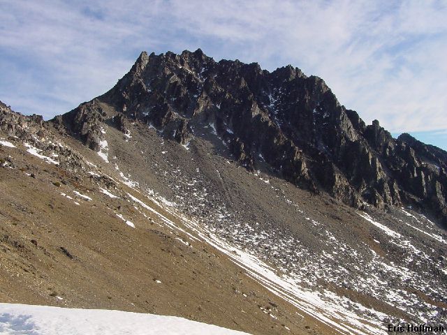
Cashmere from the south trending ridge |
|
|
From the saddle, a path heads up the ridge until just below then traverses toward the north side of the summit rocks a bit and vanishes a couple of hundred yards from the summit into a rock gullies and ribs with snow in most of the gullies. There are many different ways to complete the scramble to the summit. After traversing only a short distance , I climbed back to the ridge crest. I tried climbing the ridge crest directly which seems possible but harder than class 3. I finished the climb on ledges on the south side. Like the north side, the south side has numerous gullies that would offer some variation if there is snow and conditions are good. At 10:30am, I arrived on the summit and found that there is little in the way to obstruct the view.
|
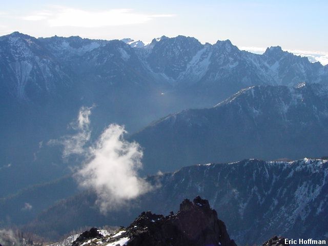
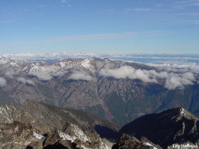
Cannon Mountain to Argonaut Peak from the top of Cashmere Mountain, |
|
|
|
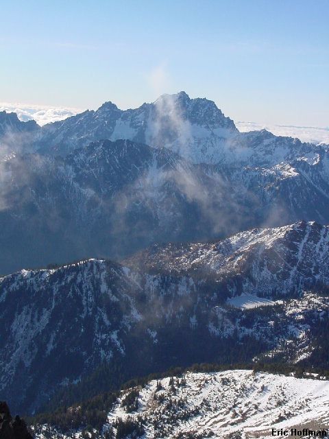
the view to the north, |
|
|
|
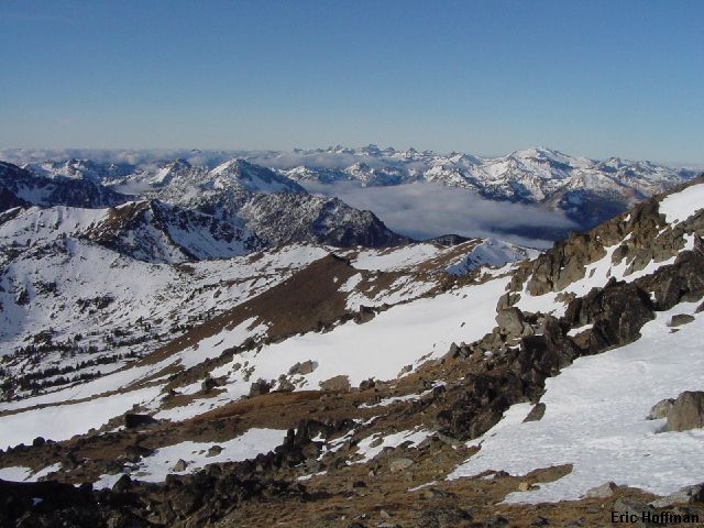
the view to the south, |
|
|
|
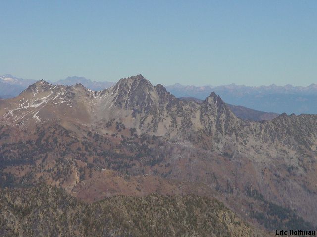
and finally, the view to the west |
|
|
I descended to the saddle in an almost entirely different way, then followed the path down the ridge until I lost it in snow before reaching the Caroline Lake Trail. It was all down hill from there...well almost. It was just before 3:00pm (9 hours total).
References:
Cascade Alpine Guide, Volume 1, 2nd Edition; Fred Beckey; Pages 221-222
Climbing Washington's Mountains; Jeff Smoot; Pages 208-211