The Castle from the south
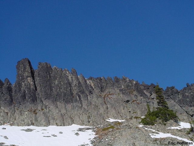
This climbing venture was all about taking advantage of a sunny, warm, November day in a high place. I was accompanied by Chris Mattson, and Andy Johnson. It was a cold and sometimes foggy drive in the lowlands. Cold enough that a vehicle skidded on ice and into the trees.. before our very eyes. We were obligated to stop and happy to find the driver was only bruised and shaken. After waiting for help to arrive we continued into the park and then to Stevens Canyon Road. Stevens Canyon Road was closed. Aside from the two foot high pile of snow pushed up by a snowplow, there was little snow on the road. In a little over a mile we reached Reflection Lake and the Pinnacle Peak Trail. There was considerable hard snow below the Pinnacle-Plummer Saddle and we ended up wearing crampons the last 200 yards. We crossed through the saddle and began traversing the sunny south side of Pinnacle Peak. We traversed to a rocky crest, then scrambled up and over (class 3, you can easily traverse around the crest) to the small basin just south of The Castle.
|
The Castle from the south |
|
|
If you are looking for great rock, a multi-pitch route or difficult climbing, The Castle probably isn't the place to go. There are many possible routes to the SW to NE trending summit ridge. There is a good ledge for belaying along the entire south side but it lacks belay anchors. From the ledge it is at best a half pitch to the ridge crest. We set up day camp at a gully at the NE end of the ridge.
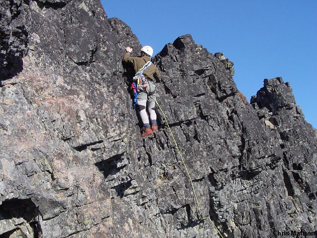
Our first route was an easy class 4. There are many short (30 feet) class 4 routes to the ridge crest, take your pick. There is loose rock but there are still plenty of solid holds.
|
Me leading an easy class 4 route on the NE end of the summit ridge |
|
|
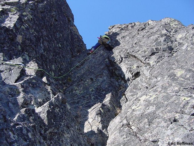
Once on the summit ridge we headed for the top. The top is on the SW end of the ridge where there are two points nearly equal in height. There is a good rappel horn with slings near the center of the summit ridge. We rappelled down and Andy led a low 5th class route to the notch between the two high points. After scrambling up the first 15 feet (as with most routes) he climbed an open book to a more difficult section where he stemmed to an off-width then climbed the last 10 feet to the top. I was able to climb the open book all the way up by using a fist jam in a very small hole.
|
Andy jams his leg into an off-width leading the hardest climb of the day |
|
|
I tried to lead the arete that rose to the rappel horn. It proved to be difficult to climb and protect and I bailed to the left. After an unpleasant class 4 finish, Andy gave it a try while I belayed from above. He ended up bailing off the arete but he went to the right (and got a bit higher on the arete than I did before bailing). The right side was fun and easy or at least that was how Chris made it look.
|
Chris near the top of a fun and easy route |
|
|
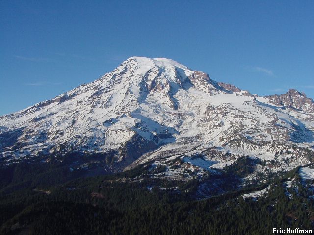
I rappelled down and climbed the right side to verify that it was in fact fun and easy. It was fun and easy (this is the rappel route so most of the loose rock is long gone). The one thing we could count on every time we got to the top was a nice view of Mount Rainier. The rest of the day we were stuck with views of Adams, the Goat Rocks and Mt. St. Helens.
|
The reward for getting to the top |
|
|
|
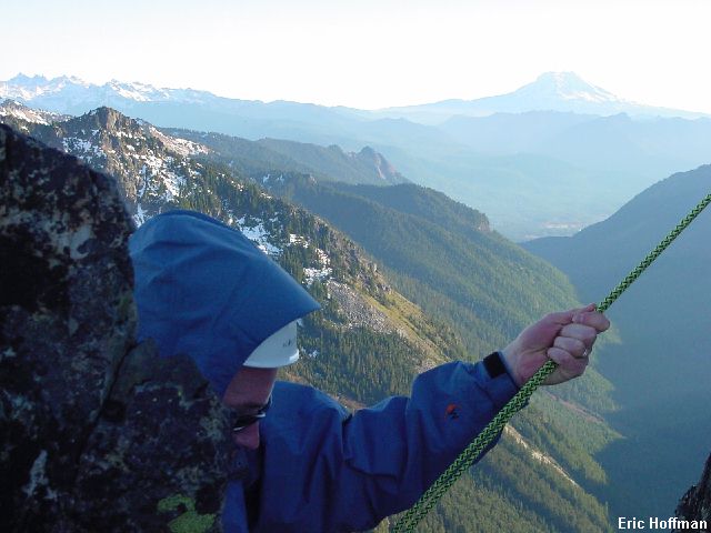
Chris prepared to make his final rappel from The Castle |
|
|
References:
Cascade Alpine Guide, Volume 1, 2nd Edition; Fred Beckey; pages 123
Selected Climbs in the Cascades, Volume 2; Jim Nelson and Peter Potterfield;
pages 28-32