Chair Peak - NE
Buttress Route
- Destination: Chair Peak (6238')
- Date: January 18, 2003
- Difficulty: 6
- Payoff: 7
- Starting Point: Upper Alpental
Parking Lot, c.3300')
- High Point: Chair Peak Summit (6238')
- Round Trip Distance: c.6 miles
- Equipment: The ten essentials; crampons; ice
tools; helmet; rock, snow and ice protection
- Mountain Skills: Route finding, class 4 rock
climbing, steep snow and ice, avalanche hazard assessment
|
 |
I was invited on this climb by Tom Sjolseth and Sergio
Verdina, both of whom I had met on Dome Peak in August of 2002. I had been
on a few trips with Tom since then, but this was my first trip with Sergio. The
original topic of discussion was the North Face of Chair Peak, but this would
end up changing up arriving at the base of the NE Buttress and the North
Face.
We met in North Bend around 6:15am then drove to the upper parking lot at the
Alpental ski area. We divided up the load of climbing gear (2 ropes, a lot of
runners, and a rack consisting of rock, ice and snow protection). We started up
the cat track towards Source Lake in the fog. We were all wearing snowshoes but
we probably could have done without them under the conditions. We arrived at
Source Lake (c.3740') in the fog and continued NW on moderate snow to
c.4200 feet. Here we began a rising traverse to the north crossing a gully and
then reaching a bench. Continuing north on the bench we reached an open snow
slope (talus in summer). We ascended the slope on avalanche debris to about 4800
feet then began traversing left below cliffs then ascending to reach the
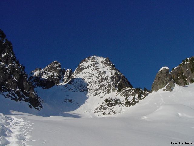
"Thumbtack" in the basin below the east face. As we reached the
basin, we also reached the top of the dense fog layer that we had been in since
leaving the car. We got our first look at Chair Peak, but could not yet see the
North Face.
|
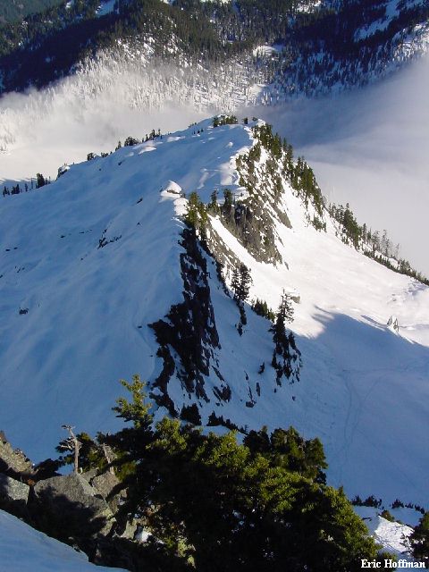
Chair Peak from Chair Peak Basin
|
|
|
|
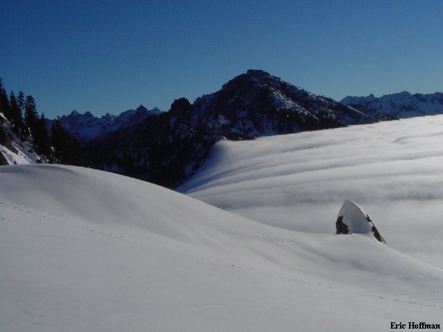
Snoqualmie Mountain and the Snow Lake Vortex from Chair Peak Basin
|
|
|
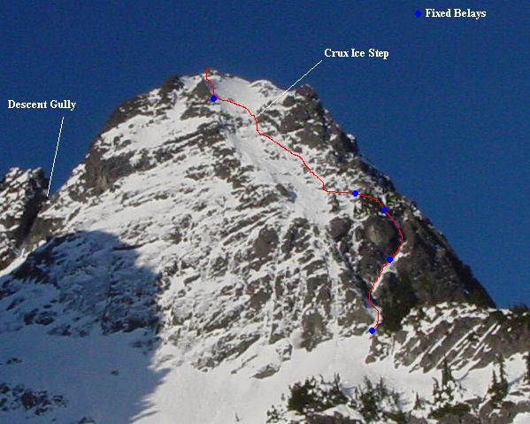
We left our snowshoes in the basin then climbed moderate snow and a bit of
rock to the Snow Lake Divide just below the base of the NE Buttress. Now we
could see the North Face and it looked like the ice was thin and the climbing
was going to be difficult. We weighed our options and decided that the NE
buttress looked like a better option.
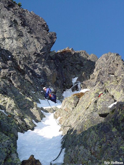
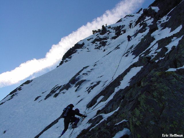
Sergio took the lead, Tom was second and I was last. Since we were going to
be climbing in crampons and with ice tools we used a twin rope to climb. With
three of us climbing and one of our two ropes being only a 50 meter rope, we
were limited to 25 meter "pitches". Sergio used a couple slings and a
cam on the first pitch that ended about half way up the gully. Sergio belayed
Tom then it was my turn. The trickiest section of the first "pitch"
was at the bottom (class 4, some ice) beyond that it was fairly easy but thin
snow.
|
Sergio leading the first pitch of the NE Buttress
|
|
|
The second lead was a lot like the first with a couple trickier moves on rock
(class 4) then thin but easy snow to the next belay station, this one in the
trees. Slings and cams were used for protection. From the tree belay, Sergio
headed through the trees then disappeared over the crest to our left. This part
was easy with deeper snow. Once again Sergio belayed Tom then Tom belayed me.
Slings on trees were used for protection.
|
Snow Lake from the NE Buttress
|
|
|
The belaying 25 meters at a time was getting old and taking a lot of time. We
decided to use a running belay to reach a short ice step. Sergio took the lead
trying to protect in the rock, then using a couple of pickets before reaching
and clipping into a bonus anchor. Two Abalakov V-threads in good ice were equalized
with runners and ready for the using. Above this the angle increased to about 60
degrees to reach the bottom of an ice step about 10 feet high. Though it was
short, it was easily the most difficult climbing of the day. Sergio placed two
screws then climbed up and over the step, making it look fairly easy. By the
time Sergio and Tom had climbed the step there was no ice left at the bottom of
the step, just smooth wet rock. I was comforted by the fact that I was being
belay from a tree anchor above. An awkward move to the left with little to no
footing then a mantle reached the top of the step. A final 40 degree slope
reached the summit area.
|
Sergio and Tom nearing the crux of the climb
|
|
|
|
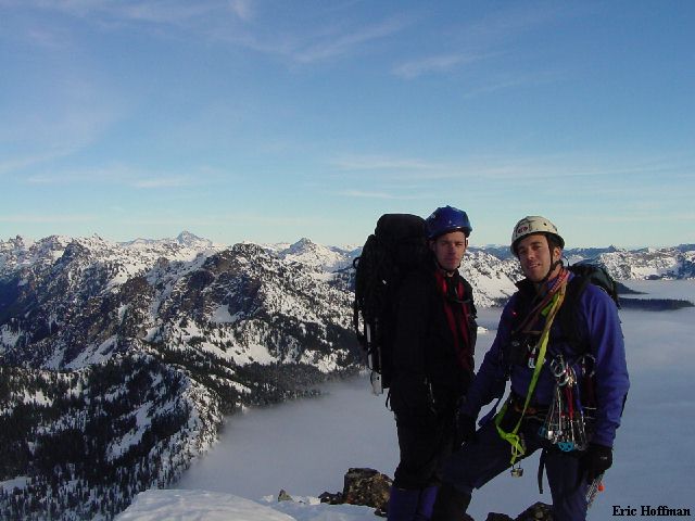
Tom and Sergio on the summit
|
|
|
It was getting late in the day and I was happy to have just climbed Chair
Peak in November 2002 and was familiar with the descent route. We started
down . It is easiest to descend east from the summit to the top and locate a not
so obvious gully (the gully runs south and is not the broad and obvious gully
just east of the summit. This gully is near the top of the NE buttress route
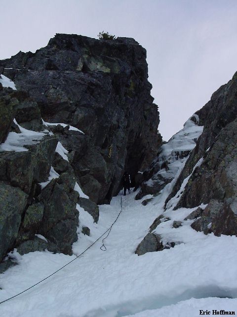
and leads 200 feet to reach a notch SE of the summit. We made a double
rope rappel down the chimney passing one overhang but ending just above what
appeared to be the second overhang mentioned in the CAG description of the SE
route.
|
Tom rappelling the chimney
|
|
|
After rappelling the chimney we postholed down to our snowshoes. The day was
almost gone by the time we left the basin and headed for Source Lake. We reached
Source Lake and switched on our headlamps for the hike out on the cat
track.
|
An alpenglow view from Chair Peak Basin
|
|
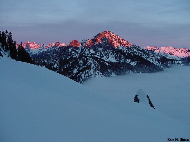
|
References:
Cascade Alpine Guide, Volume 1, 2nd Edition; Fred Beckey; Pages 146-147, 150-152,
153
Climbing Washington's Mountains; Jeff Smoot; Pages 246-250