![]() Click
Here for map
Click
Here for map
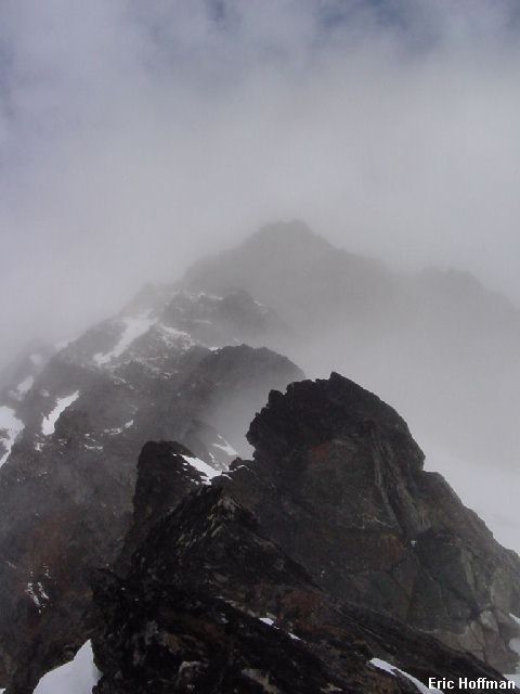
This was not my first attempt to reach the summit of Clark or Luahna. In the spring of 2001 I attempted to reach Clark Mountain via Boulder Creek. I camped at about 5000' along Boulder Creek. From camp I followed an old sheepherder's path then found my way through the clouds to the South Spur of the SE Peak of Clark. At 7200' I found the class 2 gully that provides access to the south slopes of Clark Mountain. This was my high point as poor weather and questionable snow conditions prompted a retreat.
|
First Try: Looking Up the South Spur of the SE Peak |
|
|
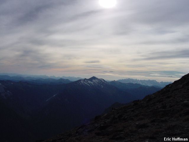
A second attempt was made in September 2002 when Tom Sjolseth persuaded me to attempt to climb Clark Mountain and Luahna Peak (the unofficial name of the +8400' peak about 1 mile NW of Clark) by following the same sheepherders path I had followed on the first attempt but beginning at its other end. The plan was to hike in, set up camp in the White River Valley then climb the peaks the same day in order to beat the rain that was being forecast. Difficulties finding the sheepherders trail near Thunder Creek and following the trail higher up consumed too much time. We turned back near 8000' on Luahna Peak with two hours of daylight left. Fortunately, we had learned enough about the old trail to follow it most of the way down and arrived at our camp at the confluence of Thunder Creek and White River just before dark. We continued the retreated the following day after a night of rain.
|
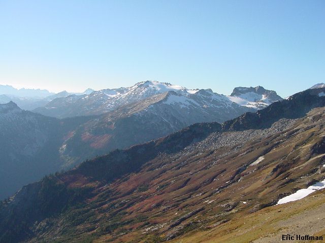
Second Try: The SW view from near Luahna Peak |
|
|
On this attempt Chris Mattson and I planned on doing in a single day what I had been unable to accomplish in two days on the previous attempts. Using what I had learned on the two previous attempts, we planned to climb Clark first, approaching from Boulder Creek. This route is the easiest to locate on the ascent and descent. From Clark we would descend SW, then traverse and climb Luahna. The descent from Luahna would be via the route of the second attempt. Though I don't recommend climbing this route unless you have first hand knowledge of the route, it is easier to find on the descent and is probably the fastest way off the mountain. The trip would be more than 20 miles and have nearly 7500 feet of gain.
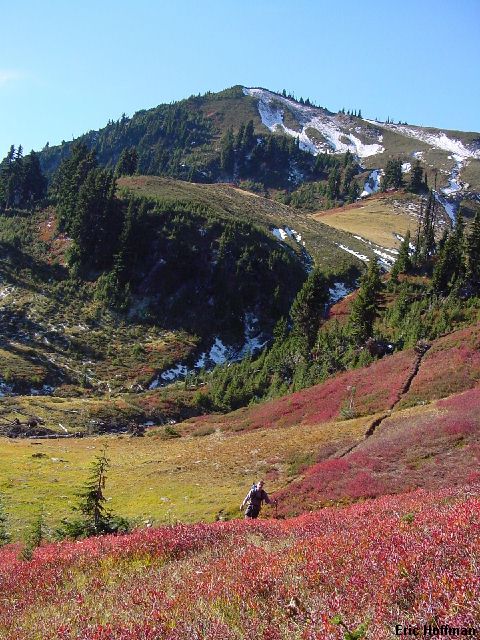
We met at 3:30AM and headed for Stevens Pass. After crossing through the pass we continued another 20 miles to Highway 207. After following 207 past about 10 miles, we turned right onto White River Road. In about 9 miles we reached the road's end and the White River Trailhead. We started hiking the White River Trail (FST 1507) around 6:30AM and reached the junction with the Boulder Pass Trail (FST 1562) at 4 miles in a little over an hour. We had gained a whopping 300 feet in elevation. From the 2500' junction we started up the trail toward Boulder Pass, finally gaining a bit of elevation we were distracted by the autumn colors and a bear high in a gully above the trail. We reached the basin at 5000' and began following a faint path that contoured then crossed the creek and began ascending the slope on the west side of Boulder Creek. The faint path turned to good trail as we started up the slope. At around 5700' we left the trail in a basin above Boulder Creek.
|
Chris in the basin above Boulder Creek |
|
|
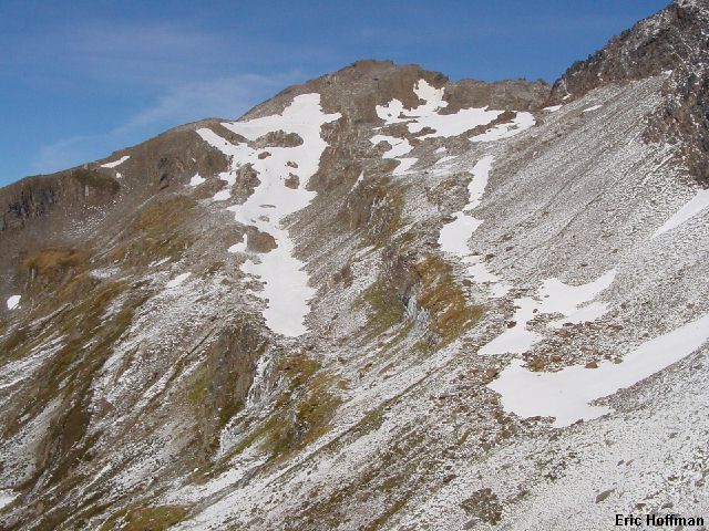
We traveled through brilliant red huckleberry bushes and climbed toward the south spur of Clark's SE Peak. There is a flattish section of the spur at 7200' that can be reached easily on scree and grass slopes. From the spur we could see the south slope of Clark Mountain which looked easy but getting down to the slope wasn't as all that easy.
|
The south slope of Clark Mountain |
|
|
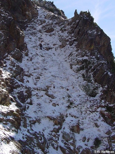
The class 2 "gully" feels more like a sloping ledge then a face. There was fresh snow and the scree and rock were frozen solid. We put on crampons and carefully descended to the easier slopes below.
|
Chris descending the class 2 gully |
|
|
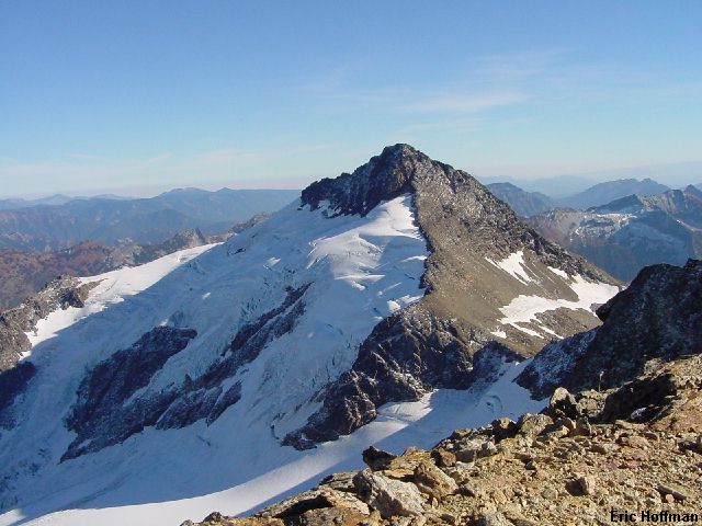
The south slope of Clark can be climbed in a number of ways. We decided to make a rising traverse on a broad bench with snow. This led to the south spur of Clark. Hiking and easy scrambling (class 2) up the spur reaches the summit. At this point I was a few hundred feet above Chris, who was only planning on climbing Clark. After signing the summit register and taking some photos I started down.
|
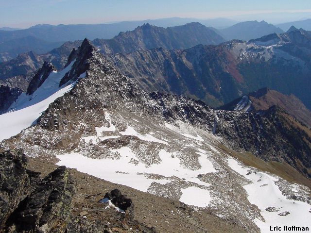
The SE Peak of Clark from Clark Mountain |
|
|
|
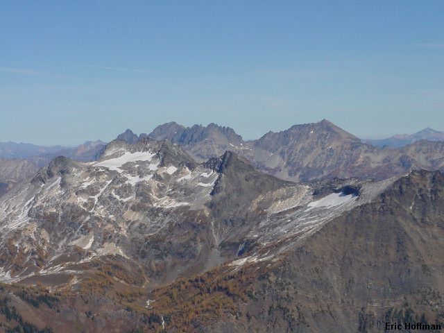
The NE view from Clark Mountain |
|
|
|
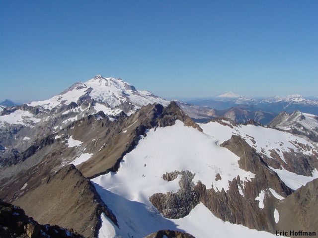
Luahna Peak and Glacier Peak in the background |
|
|
I descended the South Spur for a few hundred feet then descended the gully between the South Spur and a SW trending spur. At 7600 feet I crossed the SW spur and traversed to the 7600 foot col just west of Clark. Rather than climbing up and over point 7970', I made a rising traverse to reach the col on it's west side where the Richardson Glacier can be reached (class 3 to reach glacier, considerable moat in places). I began a rising traverse across the upper Richardson Glacier to reach the East Ridge of Luahna near 8000'. I started up the ridge and quickly reached a short class 4ish step that was going to be difficult to climb in crampons . I traversed right on ledges then into a gully running parallel to the ridge crest (class 3). The gully was frozen and had new snow then water ice and old snow at the top. Easy scrambling brought me back to the ridge crest then on to the summit.
|
Clark Mountain from Luahna Peak |
|
|
On the descent I made a short rappel down the steep step rather than descending the gully or trying to down climb it. After traversing back across the glacier, I began descending into the basin south of Luahna where I met up with Chris around 7200'.
|
The fifth and last basin we traveled through on the trip |
|
|
We descended the left side of the basin then into the trees. Descending directly toward the lowest level of the basin would be difficult due to rock bands and brush. After reaching the trees we continued down, eventually picking up the old sheepherders path. We where able to follow the path most of the way to Thunder Creek, where is crosses to the west side of the stream near 3750'. Once across the stream we again located the trail and followed it nearly to the White River Trail before losing it in downed trees (the sheepherder's trail is difficult to find when you are on the White River Trail). About 6.8 miles later, around 8:15PM, we reached the trailhead.
References:
Cascade Alpine Guide, Volume 2, Second Edition; Fred Beckey; Pages 149-150
Climbing Washington's Mountains; Jeff Smoot; Pages 173-176