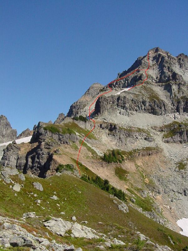
The West Spur Route on Columbia Peak
This was a fun climb despite the long approach and the low quality rock. Probably the most unpleasant part is getting to Monte Cristo. Four miles of road must be hiked or biked by most while the fortunate few drive the road to the old mining town. Once there, the new trail to Poodle Dog Pass and Silver Lake can be located by continuing through town. The old trail is still negotiable (FST 708), but the new trail is better unless you like hiking in a stream. The new trail is perhaps slightly longer than the 1.7 mile long old trail. The 0.3 miles to Silver Lake is probably worth the time, but I had my sights set on something else.
From the pass follow the Twin Lakes Trail (FST 708A) for about 2.5 miles, before reaching the Twin Peaks saddle. From here, a faint path traversed east, avoiding the eastern Twin Peak. After a bit of traversing, the path leads to the ridge crest. The way is reasonably obvious with the path continuing high up the West Spur on Columbia Peak. The route becomes more difficult at a snow/talus basin. I ascended on climbers right and found a few steep short sections that would not have been at all difficult if the rock was trust worthy. I descended on the left and found one steep section before dropping into the basin. Personally, I think going left is better. Once beyond the basin and back on the crest, the route stays on the south side working its way up even worse rock. Finally, I arrived at the summit block. The route up is on its northeast side which can be reached by traversing either way around the summit. There is a short exposed gully crossing if you choose to go to the left. A short scramble leads to the summit.
|
The West Spur Route on Columbia Peak |
|
|
|
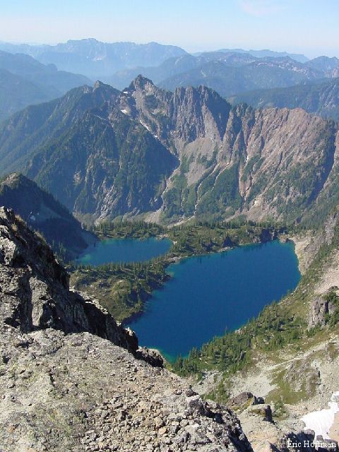
Twin Lakes from the West Spur |
|
|
|
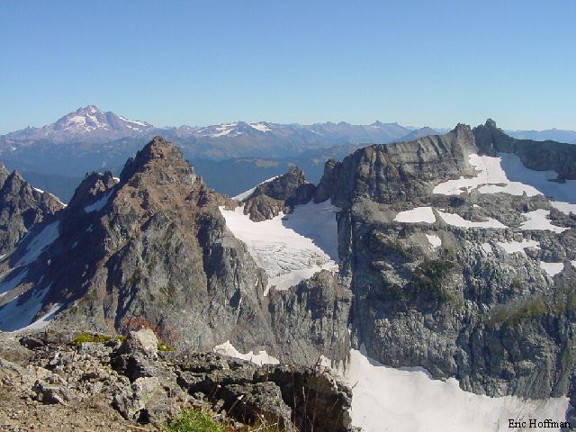
Glacier Peak from the summit with Monte Cristo and Kyes Peak in the foreground |
|
|
|
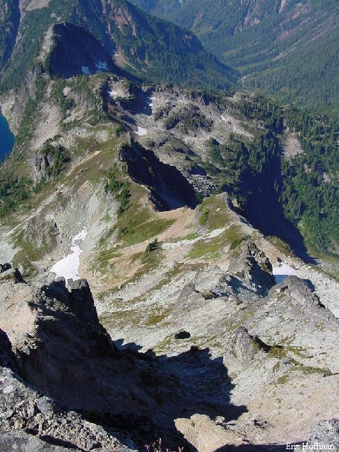
The West Spur from the summit of Columbia Peak |
|
|
References:
Cascade Alpine Guide Volume 2, Second Edition; Fred Beckey; Pages 67-69