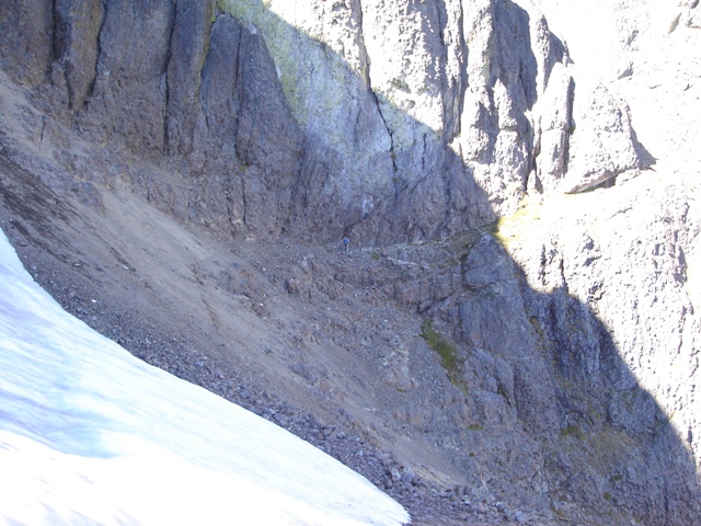
Crystal Pass and the West Arete (on right) from Avalanche Canyon
I had climbed Mount Constance in August of 2001 via the south chute route/finger traverse variation after a failed attempt a week prior. With its twisting gullies, precipitous towers and steep faces it is as complex as any mountain I have scaled. The complexities render the map nearly useless so you never really feel like you know where you are, only how you got there and hopefully, with the use of a guide book, where to go next. I didn’t really think I would every come back to climb it again… and that was before the washout on the road some four miles before the Lake Constance “Trailhead.” Sergio, however, sold his soul and convinced me to climb it once again, this time by the West Arête route. I hope he knows that I am going to hold him to his word to join me on an even more remote peak in the Olympics next year.
We arrived at the washout on the Dosewallip River in the early afternoon. We were expecting a warm bike ride up the road and an even warmer hike up the Lake Constance Trail. I had road my bike up the road earlier in the spring when the only option was to bypass the washout by going above it which would be a pain in the butt with a bike and a backpack. I was happy to see that with low water you could drop down a few feet and follow a path that contours through it. The ride/push up the road took me about an hour, but Sergio peddled the distance in less.
I had tried to describe the trail to Lake Constance to Sergio prior to the trip, but I think it is something you have to experience first hand to fully appreciate. It’s a short 2.2 mile hike with a crushing 3250 vertical feet of elevation gain and some steep rooted class 2-3 scrambling before reaching the lake. We arrived at the lake (‘) exhausted and located the camp sites on the opposite side.
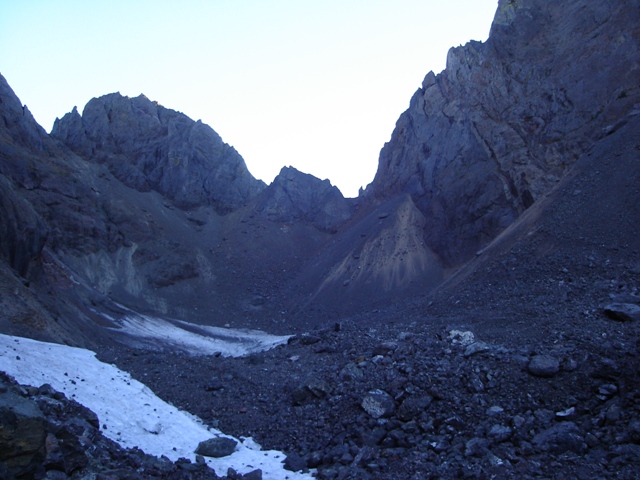
I awoke the following morning to Sergio grumbling about a rodent that kept him up all night and eventually stole one of his flip-flops. We would later locate the missing flip-flop a few feet away with only minor damage. With the search and rescue mission behind us we were able to focus on other thing and departed camp a little after 7:00AM. It is hard to say when the sun has risen when you are inside the steep walls of Avalanche Canyon.
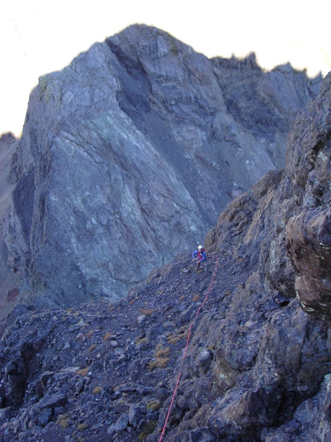
Once you pass the kings thrown overlooking camp you can locate a path into Avalanche Canyon through the scree and talus. The path makes travel in the canyon much easier until it disappears below the south chute (although hard to follow at times the path bears up the right side of the canyon towards the Cat Ears). At the head of the canyon there was a remnant of ice below the scree fan leading to Crystal Pass.
|
Crystal Pass and the West Arete (on right) from Avalanche Canyon |
|
|
When we finally reached Crystal Pass (‘) we were greeted by a cold wind and hunkered down on the lee side for a snack and the ritual of preparing to enter the unknown. At about 10:30 I started over the small step above Crystal Pass then began a rising traverse on the right side of the crest. There are a lot of ways to go we tried to stay close to the crest of the arête but were not on it again until just below the crux step. The traverse is fairly broken class 2 and 3 with an occasional 4th or low 5th step to deal with. Continuing on this rising traverse on the right of the crest we reached an area with a couple of towers. There is a ledge on the right side of the right tower that easily bypasses them. Above this was rubble leading to a short, flat but exposed section of scree on the ridge crest that ended abruptly at the crux step on the arête.
|
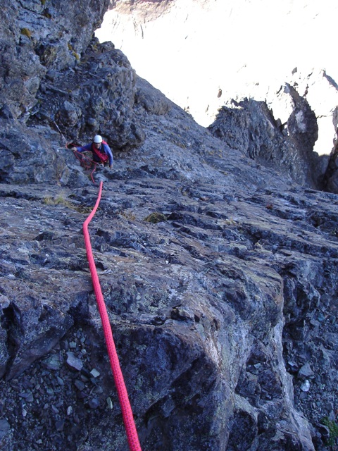
Sergio Low on the West Arete |
|
|
Traversing up and right on a groove I clipped into the existing pitons before moving straight up (5.4) then back left to a small alcove below a chimney. There were two pitons and a chock stone here for belay anchors in the alcove. Sergio followed and joined me at the belay anchors.
From here I climbed directly up just left of the chimney then along side of it to a sloping ledge that I followed left around a corner. I was running short on rope without a good belay opportunity available. Finally, I manage to sling a solid horn and place a questionable chock. My feet rejoiced on the sloping slab I have been belaying from when Sergio came into sight. From here easier climbing and traversing to the left brings us to a crest and a few hundred feet of talus above. On the map it looks like the summit should be straight up, but no, it is across from us and there are two climbers on it.
|
Sergio Above the Crux Step |
|
|
|
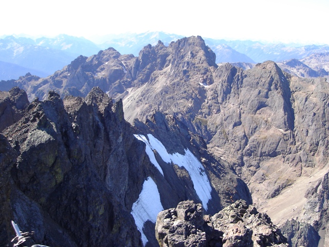
Inner Constance from the top of the West Arete |
|
|
After ascending the talus you can traverse left until able to cross over the ridge to the east side of the mountain. Following close to the ridge we traversed near the crest (class 3) until we came reached the standard route where we dropped the rope and continued to the summit horn (class 3). The summit horn is climbed by circling to the back side then making a short class 3 scramble to the top.
With good visibility and pleasant temperature we relaxed on the summit. I had seen Mount Constance from Seattle all too many times but I had never seen Seattle from any Olympic peak until this climb.
|
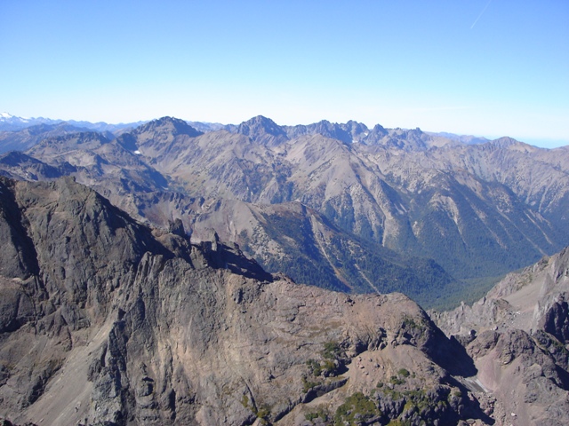
Mount Mystery, Deception and the Needles from Mount Constance |
|
|
We had planned on descending via the Finger Traverse but took the Terrible Traverse instead. The ledges were entirely melted out and the only remaining patch of snow was easily avoided. Scree, scree and more scree on the standard South Chute route brought us back to Avalanche Canyon and Lake Constance. See my report from my previous trip for more details on the South Chute route.
|
Sergio on the Terrible Traverse... not so terrible today |
|
|
We packed up our gear and heading down to the road and our stashed bikes. It took me about an hour and a half. Sergio was a little behind. My bike was locked to a tree just off the road but Sergio had hid his in a spot that no one would ever find. Since I was ahead of him I decided to recover it… turned out to be the most strenuous part of the climb!
References: