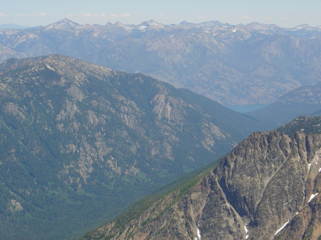
The East Face of Copper Peak from Cardinal Peak
On my last trip to Holden Village Sergio and I hurried back from the summit of Bonanza to reach the village and its highly anticipated ice cream shop. We were greeted by the sounds of singing which I initially mistook as rejoicing my arrival. This, however, was not the case and the singing was due to the fact that it was Sunday, regardless of the fact that the ice cream shop was not open on Sunday. On that day Holden most resembled Whoville on a day when the Grinch had stole ice cream instead of Christmas.
If Holden is the Whoville of the Cascades then Copper Peak is the mountain upon which the Grinch lives. Although you can’t see the true summit of Copper Peak from Holden the Grinch could probably hear the Whos singing about having no ice cream on Sundays.
|
The East Face of Copper Peak from Cardinal Peak |
|
|
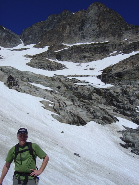
I met Chris Shultz, my boss, to climb Copper and perhaps the corporate ladder… He had been in Holden since the previous weekend and had obtained some inside information about the climb, albeit a bit incomplete, from the Whoville baker. The baker had signed the summit register 3 times in 2005, his 3rd with an ascent time of 3 hour from Holden. Not expecting to reach the summit in 3 hours, Chris and I agreed to meet at 5:30AM at the “Hike Haus”.
I had camped at the campground about 1/2 mile west of Whoville and had about a 10-15 minute walk to the village and arrived at the “Hike Haus” a little early so I could fill my water bladder and take advantage of the amenities. Chris arrived on schedule and we departed post haste.
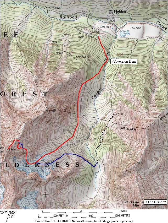
Arriving at the water tower (see the USGS 7.5 minute quadrangle) we located a spur road on the right that leads to a diversion dam at c.3900’ (neither the road nor the dam is shown on maps). Once at the diversion dam we headed cross country, uphill along the right side of the creek then to the right of the dense slide alder that clogs the valley floor. The going is mostly moderate to steep forest with downed trees but not too much brush. We followed this until we started to hit cliffy terrain then began traversing left above the alder (c.4800).
|
Traversing below the cliffs |
|
|
We traversed above the brush but below the steep cliffs above on ledges. Arriving at the only significant gully on the traverse we were faced with the decision to go up 50 feet or down 50 feet. At the time going up seemed like the right thing to do… About 30 minute later we found ourselves going below. After more traversing including one of the crazier moats I have gone through we found ourselves in open terrain and on snow below the glacier on the east face at c.5500’ (3 hours).
|
Chris on the glacier at c.6900' |
|
|
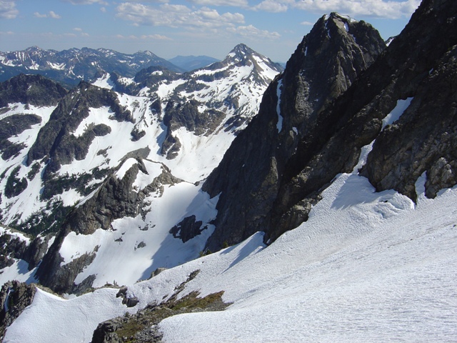
The glacier is moderate with a few crevasses on the southern lobe. At c.7400 feet we traversed right then climbed to an obvious flat section on the east buttress at c.7700 where there was a small cairn. A short snow traverse led to the lower of two largely snow covered benches on the east face where we could evaluate our options.
|
Looking back at the buttress crossing and glacier |
|
|
The most obvious option was to the go left on snow (35 degrees) to reach the upper bench. From there it is easy to traverse north on the second bench to reach an area of broken rock which can be climbed to reach the NE ridge at c.8500’. The rock leading to the ridge is loose and covered with debris (class 3).
|
Chris reaching the NE Ridge |
|
|
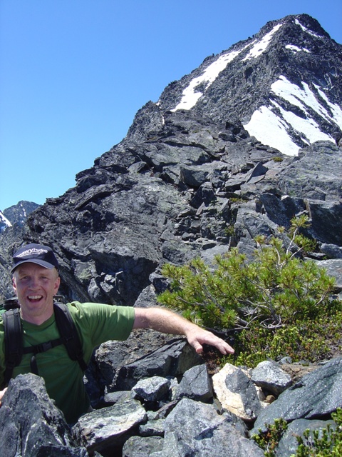
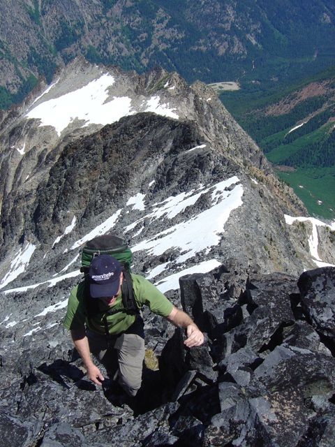
Once on the NE ridge we quickly encountered a small notch with loose rock and somewhat exposed (class 3-4). Beyond that the ridge was an easy, somewhat airy ridge scramble until about 150 feet below the summit where the ridge steepened. We went right where there are many variations possible then worked our way back to the ridge crest (class 3, blocky and reasonably solid). We reached the summit at about 12:50PM. There are excellent views in all directions except to the south where Mount Fernow blocks the view of pretty much everything including Maude and 7 Fingered Jack.
|
Chris scrambling just below the summit on the NE Ridge |
|
|
|
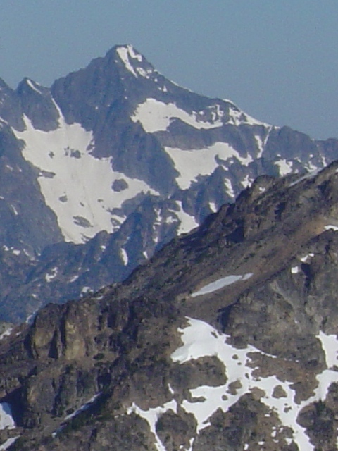
The Chelan Sawtooth Ridge from Copper Peak |
|
|
I didn’t count but I would estimate that there were 50-75 names in the summit register since it was placed there in 1982. The summit register and the 1 cairn on the east buttress where the only signs that anyone had been on this mountain before. There was also no evidence that the Grinch had ever been here. Maybe on Buckskin…
We had decided hours before that we would traverse into Copper Basin and return to Holden via the Copper Basin Trail rather than the ledges. When we were on the ledges we thought we should have taken the route from Copper Basin. It may prove to be faster but expect some brush and possibly short rock bands to contend with before reaching the terminal moraine of the glacier. After Chris fell into Copper Creek we began looking for the trail in the snow eventually intersecting it in a series of switchbacks. We reached Whoville a few minutes past 6:00PM.
|
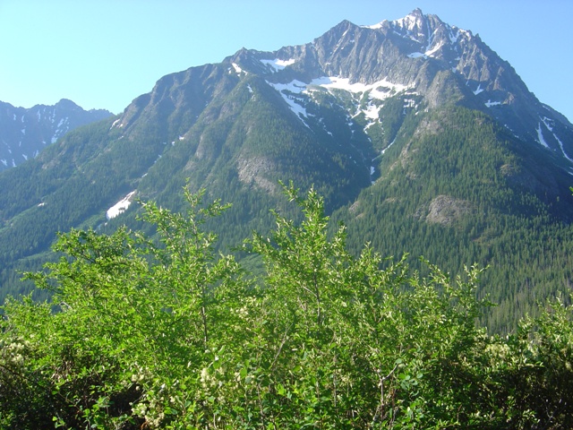
Copper Peak from the Holden Lake Trail |
|
|
|
|
References:
Cascade Alpine Guide, Volume 2, 2nd Edition; Fred Beckey; Pages 179-180
Washington's Highest Mountains; Peggy Goldman; Pages 162-165