This trip began at the Phelps Creek Trailhead near Trinity. See the Entiat Excursion for driving directions if you are unfamiliar with how to get there. From the trailhead I followed the Phelps Creek Trail (FST 1511) for a couple hundred yards to the junction with the Carne Mountain Trail (FST 1508) and started up it. This trail climbs through forest and then open sub-alpine slopes before reaching Carne Basin (6100') between the summit of Carne Mountain (7085') and the south summit (old lookout site, 6991'). The trail continues east and climbs above the basin to the junction with the Old Gib Mountain Trail (FST 1528) just below a saddle. Keep on the Carne Mountain and continue to the gap on the ridge crest. The main trail now becomes the Rock Creek Trail (FST 1509). A side trail leads to the summit of Carne Mountain which offers excellent views to the west but the view to the east is limited to the west slope of Ice Creek Ridge.
|
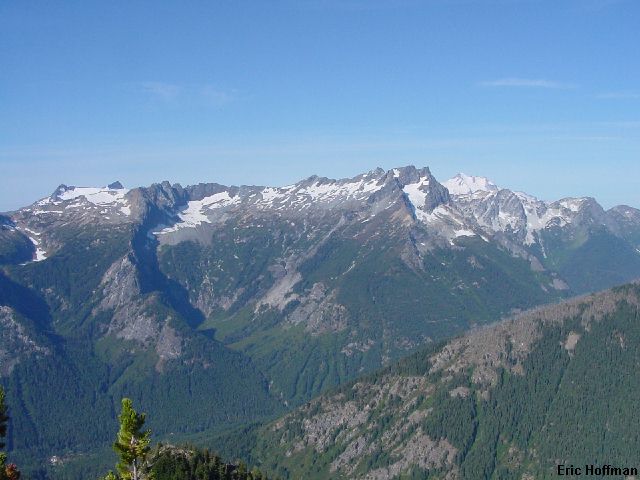
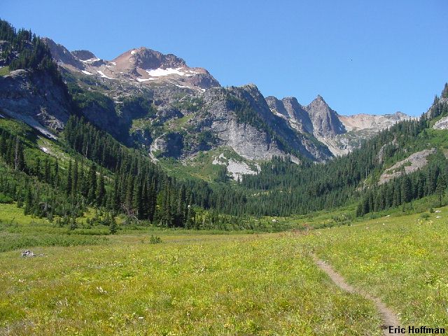
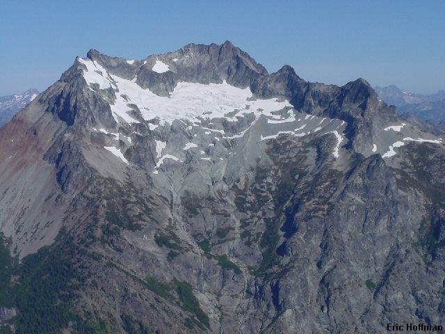
Clark Mountain to Glacier Peak from Carne Mountain |
|
|
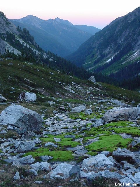
From the summit I descended NE and located the Carne Mountain High Route at the low point in the NE ridge of Carne Mountain. The route is a good path for the most part that traverses the west slope of Ice Creek Ridge from Carne Mountain all the way to Mount Maude. The route stays above 6000' for about 3 miles before reaching Leroy Creek Basin, the last of many basins on the high route. I followed the path up and down from one small basin to the next until I could make a rising traverse to the 7700 foot low point in the ridge between Mount Maude and point 8033'. This seems to be the only reasonable place to cross the ridge to Ice Lakes. I hiked to a gap further south and found that while the view was great, getting to Ice Lakes from here would be difficult. From the 7700 low point I descended snow and scree to upper Ice Lake (7188') then descend just west of the upper lakes outlet to the lower Lake (6822'). The lakes are an excellent place to camp at and explore.
|
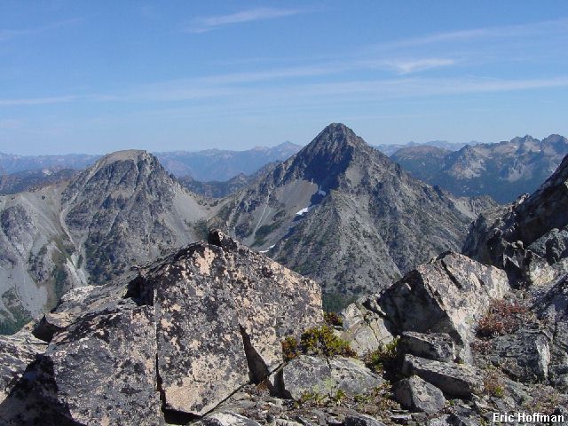
The Spectacle Buttes from a gap in Ice Creek Ridge |
|
|
|
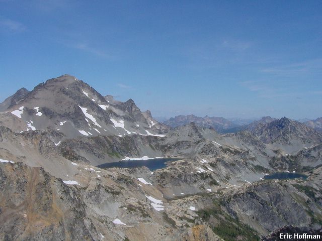
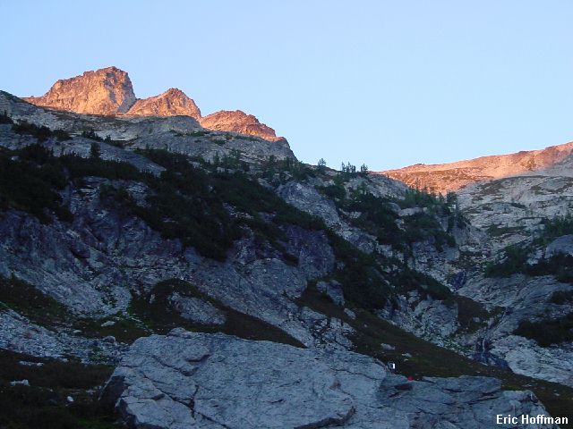
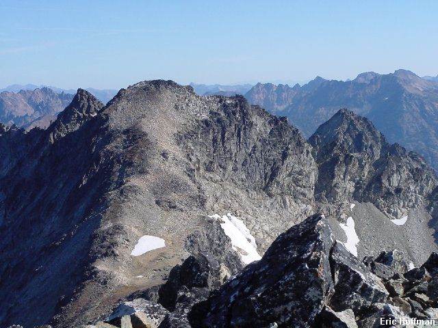
Mount Maude and the Ice Lakes from the above mentioned notch |
|
|
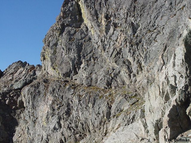
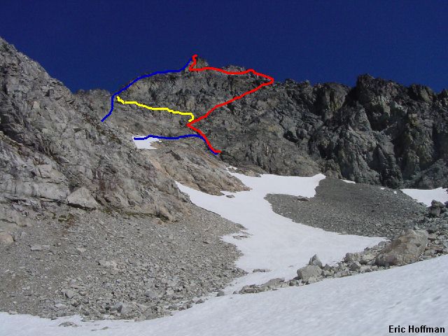
I dropped most of my gear at camp and headed for South Spectacle Butte. After crossing the outlet of lower Ice Lake, I located the trail leading to the lakes from the Ice Creek Valley. I descended about three hundred feet to get below some cliffs then traversed. I reached a rather unpleasant gully. It is probably easiest and safest to go up and over the top of the gully but I found a spot to cross it without having to go up or down too much. Once across the gully I continued traversing and reached the talus basin below the Spectacle Buttes Saddle. I continued toward the west ridge of the south butte then climbed a short talus gully to the ridge. The ridge is broad at first and I scrambled upward and traversed south around the first gendarme then followed continued to the second Gendarme. A steep gully on the south seemed to be a problem at first. I climbed out onto a ledge that got hard after a few feet. Looking down I saw that there was another ledge about 10 feet below that looked like it would provide a route around the gendarme. I followed the ledge (class 3) past a small cave then into a gully. From there I could climb to the ridge crest and the remainder of the climb was a fun scramble (class 2-3) on the crest or just to the south.
|
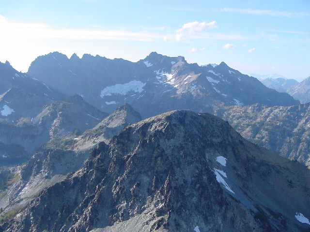
The North Butte, Seven Fingered Jack, Fernow and Copper from the Summit of South Spectacle Butte |
|
|
After a brief stay on the summit I descended the route and returned to camp around 7:00pm. The lower lake was a nice place to spend the night. In the morning I made a short excursion to the north then packed up camp and headed back though the gap and back down to the Carne Mountain High Route. I followed the path to Leroy Creek Basin then continued down to the Phelps Creek Trail. I had been hiking for over a day and way now less than three miles from the trailhead, but I wasn't heading there just yet. I followed the Phelps Creek Trail north to Spider Meadows.
|
Welcome to Spider Meadow |
|
|
From Spider Meadows I continued on reaching a junction with FST 1511A, a short trail to Phelps Basin. I followed this trail which ends in about 0.3 miles in the lower basin. I continued on passing the best bivy site I saw at about 5700'. At 6000' I reached the upper basin where I found no bivy sites other than on the remaining patches of snow. I made due with that and relaxed for the rest of the afternoon and evening. By 5:00pm the sun no longer shined in the basin.
|
The Phelps Creek Valley from upper Phelps Basin |
|
|
|
The false summit of Dumbell Mountain from upper Phelps Basin |
|
|
I left camp at about 7:00am and headed east along a steam to reach the broad talus gully on the south side of Dumbell Mountain. The going was easy and in less than an hour and a half I arrived at the ledge crossing the east face of Dumbell. The ledge is long, narrow, exposed and a natural wonder. If the ledge was not there, climbing Greenwood Mountain, the unofficial name of the NE peak of Dumbell Mountain, would be far more complicated. The ledge is fairly easy (class 2-3) and straight forward, ending at a snow patch on the north side of Dumbell. I put on crampons to make travel across the hard snow to the Dumbell/Greenwood saddle faster and easier. From the saddle, the remainder of the climb is on talus.
|
The ledge across the East Face of Dumbell Mountain |
|
|
|
Bonanza the way it really is...BIG |
|
|
After reaching the top of Greenwood, I signed the summit register that is kept in a Boy Scouts of America can. Oddly, the first person to sign the register (1930 something) seems to think that they are on top of Mount Fernow. Hmmm...a peak about 200 feet NW looks suspiciously close in elevation but would be much harder to get to. I descended the route and returned to the broad gully south of Dumbell. I climbed up directly under the summit then took a right sloping ledge (class 3) with a fair amount of loose hold and debris. I followed the ledge to the summit ridge east of the summit. I scrambled (class 3-4) on the crest until nearly at the summit then I traversed below it (still on the south face) until I could climb to the top.
|
Greenwood Mountain from Dumbell |
|
|
After a snack on the summit I started down. I was hoping to find a better way down. I descended easily to the notch between the true summit and the false summit to the SW. From there I traversed and descended ledges until under the false summit where a class 3-4 gully could be down climbed. While I was descending I got a better look at the south face and there appears to be a good slanting ledge starting directly below the summit leading almost to the notch between the summit and false summit. This is the way I would try if I climbed it again.
|
The South Face of Dumbell |
|
|
References:
Cascade Alpine Guide, Volume 2, Second Edition; Fred Beckey; Pages 166-168, 172,
174-176, 359