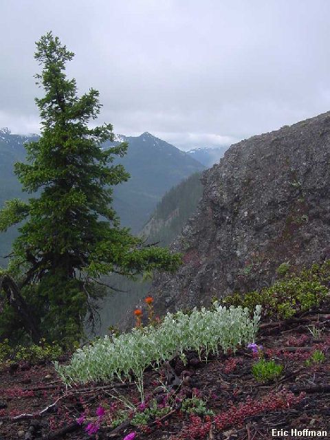
A view to the west from Crow Lake Way
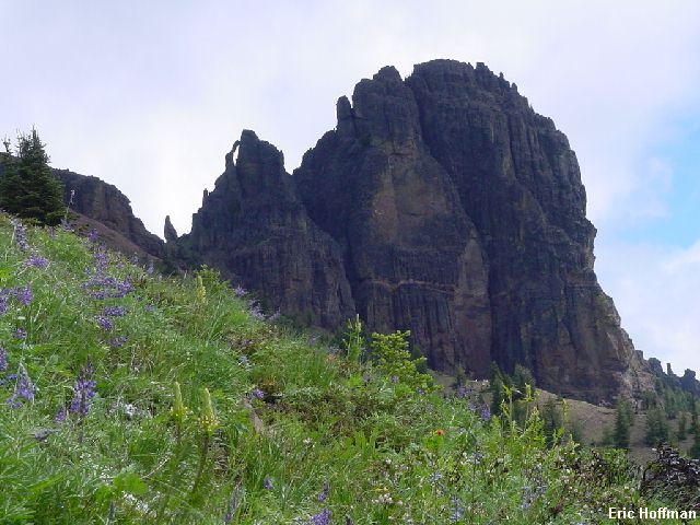
The forecast for just about everywhere was mostly cloudy with the possibility of showers. The possibility was a reality as I crossed Chinook Pass on Highway 410. I was heading for the Fifes Peaks. About the only thing I knew about the Fifes Peaks was that I would find a trailhead at c.12.5 miles , between mile posts 81 and 82. Actually, I knew a bit more. The "Crow Lake Way" Trailhead/View Point has a display about Fife Peak with a good view of the East Peak. The display using the singular form of the word "peak", seems to acknowledge only the East Peak (6793'), the most prominent from this this point and most other viewpoints. Beckey also includes The West (6880'+), NW(6917') and Far East Peaks (c.6320') in his description of the area, all of which deserve recognition on their own merits. He also describes a few of the many pinnacles between the peaks including Cannonhole Pinnacle, located between the East and West Peaks and the Masthead (I believe this is the same pinnacle refered to as Mainmast), located between East and Far East Peaks. The guide also describes three approach routes: one circling to the north side from the east, one from the west and one up the middle. The craggy peaks are the remnants of a caldera that was active 25 million years ago. The rock is andesite and breccia, so I wasn't expecting to find too much that was solid.
The morning drizzle had stopped by the time I started the hike up "Crow Lake Way" (FST 953). This trail is popular with the cowboys, so watch your step. The trail is an easy hike (2400 ft in 3.5 miles) to a very small grassy saddle at c.3.5 miles, following an interesting spur much of the way. The views from the spur are best to the south and west but there are also views of the Fifes Peaks. Even with the clouds, the views of Chinook Pass and the American River Valley got my attention. Summer has arrived here, the flowers were blooming and the snow is all but gone.
|
A view to the west from Crow Lake Way |
|
|
From the small grassy saddle (c.5800'), the west approach to the peaks continues. The route contours east and gains a bit of elevation on easy sub-alpine slopes that were alive with wildlife. I spotted three deer just after leaving the saddle and as the slopes below the East Peak came into view, I spotted a herd of mountain goats. I counted 18 goats in the herd that began moving uphill when they saw me coming. We were all heading for the gap between the West and East Peaks, directly below Cannonhole pinnacle.
|
Cannonhole Pinnacle and East Fifes Peak, the white specs on the slope directly below the East Peak are the mountain goats |
|
|
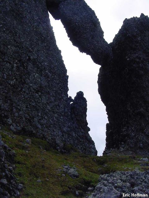
The route reaches the gap with little difficulty. From here it looks easy to scramble to the West Peak, but nothing to the east looks easy. I followed ledges to the North side of Cannonhole Pinnacle and scrambled (class 2) up to the hole. As with most of the rock near the gap, the rock was breccia. The pinnacle was first climbed by Fred Beckey and Rudy Miller in 1950 with the use of one bolt. I could not see climbing it with out at least one bolt even though it is rated class 4. I scrambled up a pinnacle adjacent to the hole (class 3-4) to get the view from there. I was hoping to find a route to the north side of the east peak but I didn't see anything that I was interested in attempting. Separating the East Peak and Cannonhole Pinnacle are steep walls. While the north side of the gap is interesting, it was no place I wanted to descend into insearch of route around the wall of the East Peak.
|
A closer look at the cannon hole |
|
|
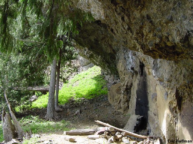
I descended from the gap and dropped to the slopes below the cliffs on the south side of the East Peak, eventually intersecting the middle approach to the peaks. This route continues up to a notch between the East Peak and Masthead, but I continued traversing and found an interesting 15 to 20 foot overhang. It was obvious that I was not the first to find this overhang. Aside from a small amount of rubbish, names and dates as far back as the 60's had been carved into the rock. There was water running in a stream near the overhang but it will likely be dry in the hot summer months.
|
Bivy Deluxe! |
|
|
I began descending the middle approach route but then decided to traverse east to the crest of a spur. The spur offers a good view of the East Peak and the Masthead. I followed the spur to a low point north of point 4925', then descended toward the trailhead via forested slopes. The upper slopes had a network of game trails that sometimes made it easier. Lower it was easiest to travel in a mostly dry stream bed to avoid brush. I reached "Crow Lake Way" less than a mile from the trailhead.
|
East Fifes peak and the Mainhead |
|
|
References:
Cascade Alpine Guide, Volume 1, second edition; Fred Beckey; Pages 134-135
100 Hikes in Washington's South Cascades and Olympics; Ira Spring and Harvey
Manning; Pages 54-55