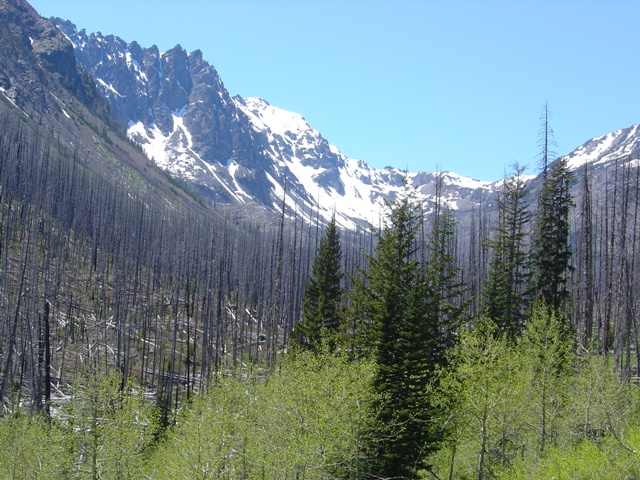
Entering the burn on the way to Gardner Meadows
Early season seemed like a good time to take a trip to the Chelan Sawtooth Wilderness Area as once summer arrives the temperatures are hot and the routes are largely scree. Early season must already be over…
Chris Mattson and I decided that a trip up the Wolf Creek Trail to Gardner Meadows was the right thing to do. We left the Seattle area a bit after 5:00 AM on (Friday) the 27th, getting an early start on the Memorial Day Weekend. By 11:00 AM we had departed the trailhead (c.2900’) and immediately dropped down a couple hundred feet… a typical valley trail with all of its enjoyable ups and downs.
After relatively short stops at 2.7 miles and 7 miles, we took a long break a Gardner Meadows (c.5600’) at 10.5 miles. The last 2-3 miles are through a burned area that offers little in the way of shade. Wolf Creek provided relief from the sun and the high temperatures we had endured on the hike in (near 100 F in Winthrop). By 4:00 PM we grew restless and decided to move up… After moving up once, then twice then three times we found a suitable camp site at c. 6700’ just east of Wolf Creek. It is better to travel up the grassy slope above Gardner Meadows then traverse to the area that we camped in than to try to follow Wolf Creek itself.
|
Entering the burn on the way to Gardner Meadows |
|
|
We settled in for the evening with a small fire on a gravel bench and a cigar. The alarms were set for 5:00 AM. We hoped to beat the heat that had beat us the day before. If there is one thing that can be said about Gardner and N Gardner Mountains, it is that there is scree O’ plenty. Based on this observation we decide it was best to hike up Gardner Mountain first since it had grassy slopes to about 8000’ and what we hope was good snow most of the way to the summit.
|
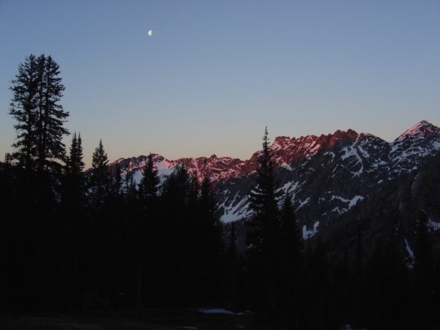
Abernathy Ridge at sunrise |
|
|
The snow turned out to be less than consistent. Sometimes it was quite hard and sometimes it was soft and deep enough that you ended up in it beyond your knee. We returned to the scree and sometimes slightly more solid rock on the sides of the gully. A final bit of snow on the NW ridge took us to the summit of Gardner Mountain where we took in the views and tried to get a look at what was ahead.
|
Chris suffers up the scree on Gardner Mountain |
|
|
|
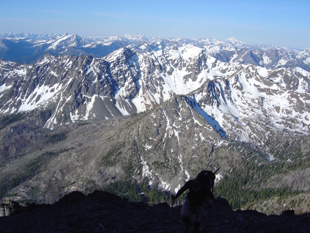
Reynolds Peak to Mount Maude from Gardner Mountain |
|
|
|
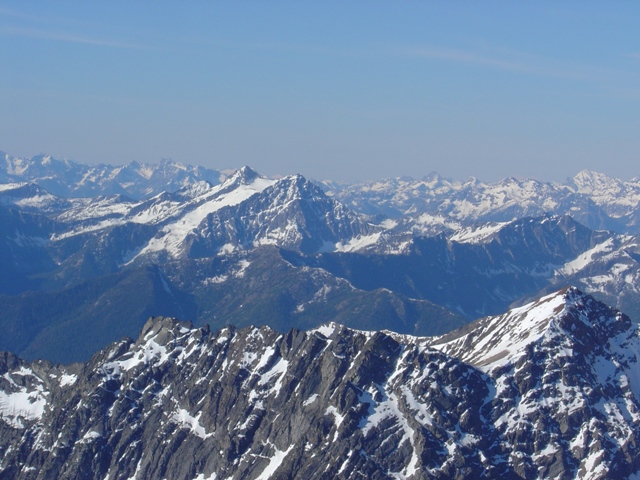
North Gardner Mountain from Gardner Mountain |
|
|
We headed down the NW ridge keeping on the west side. More scree, occasional class 2 and a few patches of snow gave way to the saddle (c.7900’) between Gardner Mountain and Point 8487’. From here we tried to lose as little elevation as possible by scrambling the loose rock on the ridge leading to Point 8487’. The last few hundred feet was on scree. From here we headed north toward North Gardner Mountain.
After descending a couple hundred feet we tried to avoid losing even more elevation by staying on the crest. We ended up on the East side of the ridge which did save some loss of elevation but was loose class 2/3 with some exposure and steep snow. It may be better to drop a bit and bypass this section on the west side… more scree. Beyond this it is straight forward to the summit… take your option of scree and loose rock west, on, or east of the crest.
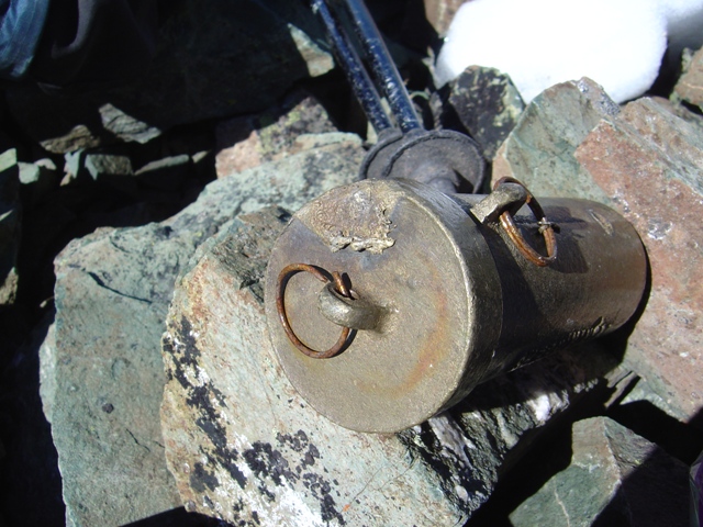
We spent a bit of time on the summit happy not to see the weather that had led to the melting of the brass Mountaineers Summit Register. The views from the summit of North Gardner are about the same as those from the summit of Gardner Mountain…
|
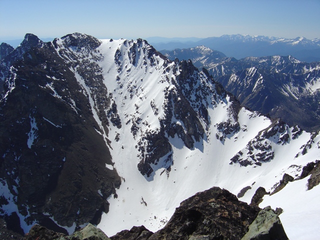
North Gardner Mountain from Gardner Mountain |
|
|
|
The Lightning struck summit register on North Gardner Mountain |
|
|
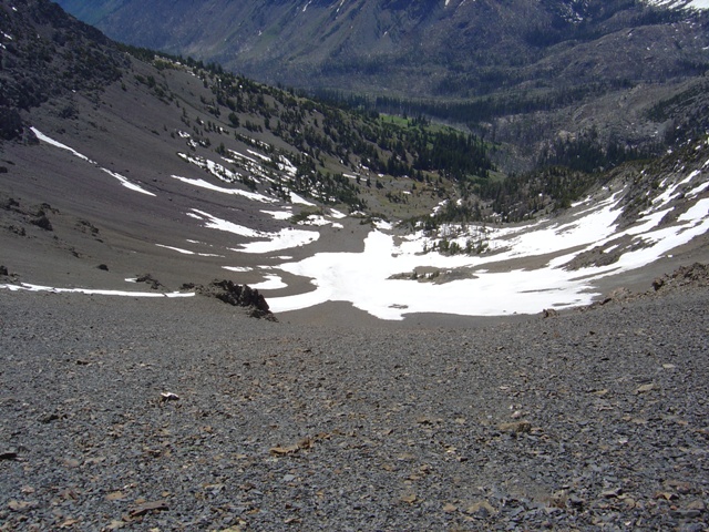
We headed back to point 8487’ and plunged our way down more than 1000’ of scree in minutes. After packing up camp and filtering water at Gardner Meadows we began the 10.5 miles of hiking back to the trailhead. Heat stroke seemed inevitable...
|
Gardner Meadows, camp and the scree bowl from point 8487' |
|
|
References:
Cascade Alpine Guide, Volume 3, 2nd Edition; Fred Beckey; Pages 283-284, 410
75 Scrambles in Washington; Peggy Goldman; Pages 56-58
Climbing Washinton's Mountains; Jeff Smoot; Pages 58-61