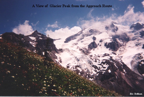
Glacier Peak is considered by most to be the only true wilderness volcano in Washington. It is situated on the Cascade Crest, and roughly 55 miles South of the Canadian border. There are no roads that lead to its slopes, only trails. The shortest climbing approach is roughly nine miles to the area known as Boulder Basin which is located at the foot of the Sitkum Glacier. Because of the short approach to Boulder Basin, the Sitkum Glacier Route is by far the most popular, but possibly least interesting, route to the summit.
Frostbite Ridge (a.k.a. The North Cleaver or Pumice Ridge) requires a twelve mile approach to the standard high camp, but is definitely worth the extra steps. The views are spectacular and the climbing interesting. We, Andy Johnson and myself, chose to combine the two routes by climbing Frostbite Ridge, then descending by the shorter, less challenging Sitkum Route.
The Whitechuck Trailhead is reached quickest by driving Highway 530 from I-5 to the town of Darrington. From Darrington, take the Mountain Loop Highway south to the White Chuck River Road (FSR 49), then FSR 49 to its end.
Hike the White Chuck River Trail (FST 643) for approximately 6 miles to the junction of the Kennedy Ridge Trail (FST 639), then follow 639 for 1.7 miles to the Pacific Crest Trail. Hike north on the PCT for approximately 3 miles, to a small, but obvious path that leads to the crest of an open ridge (~0.7 miles after crossing Kennedy Creek). The ridge provides a great view of Glacier peak from its flowered crest.
Continue up the ridge to about 7200' on snow and pumice(standard high camp), being sure to enjoy the views, then travel on the upper south west slopes of the Ptarmigan Glacier just below the ridge line to about 8000' ( no crevasses encountered), then traversing around Kennedy Peak to an 8000' sadde between the Vista and Kennedy Glaciers (bivy sites). From this saddle, ascend the Kennedy Glacier ( a few small crevasses) to an 8800' saddle between the Kennedy and Ermine Glaciers. From here, Frostbite Ridge becomes more prominent and the route is obvious for the next 1000'.
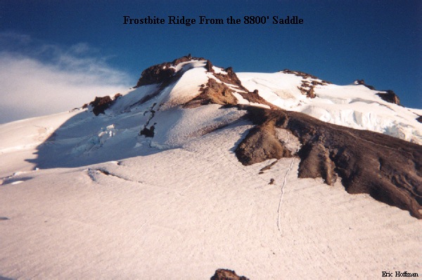
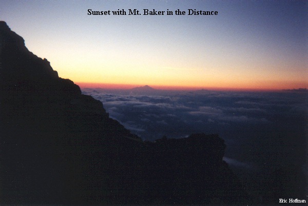
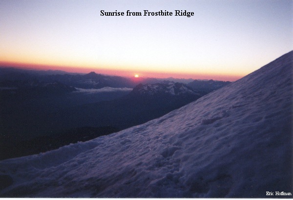
From the 8800' saddle (last definite bivy site before the summit crater), ascend on pumice and steep snow/ice to the "Rabbit Ears" which were not at all obvious until we went through them. We found a bivy site at about 9900' (wouldn't count on this site), before the difficult sections of the route. It was an incredible place to watch both the sunset and sunrise.
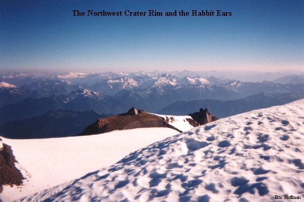
With the advantage of sunlight, we ascended the 50 degree ice slope to the "Rabbit Ears", which actually lie to the east of the prominent pinnacle, then descended class 3 rock to a small saddle. The next challenge was to climb a steep, snow slope (reported to be verticle some years) for about 100' before it rounded off. Continuing up the ridge, we quickly arrived at the crater rim, where we were forced to descend into the crater.
We were able to ascend the steep wall of the crater on the left in good snow, but this section could prove to be the hardest of the climb. Most of the lower section of the wall is hard glacial ice. We were able to avoid this, by staying to the left side, but crevasses are beginning to open in this area and an ascent up the steep ice may be necessary (est. 50-60 degrees). Once we were above the ice band, an easy traverse to a gap on the right, and a short ascent lead to the summit area.
The descent was straight forward, basically descend the gully east of the summit, then traverse and descend to the upper section of the Sitkum Glacier. Descend the upper Sitkum to a saddle at about 8000' and descend the lower section to Boulder Basin (some crevasses on the upper and lower sections). From there an easily spotted climbers path can be followed back to the PCT and the route back to civilization (eventually).
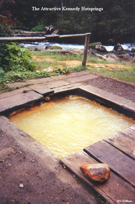
A popular stop on the hike out or as a hiking destination is Kennedy Hot Springs. Some of us are still trying to figure out why.