The first of many lakes - Lady of the Lake
This was my second attempt at the SW Couloir route on Granite Peak. In 2011 I ventured into Big Sky Country but a combination of a summer cold and a lot of snow stood in my way. I did get some valuable information about the area and concluded that the SW Couloir was better reached by following the fisherman's path up the Sky Top Creek drainage rather than the trail to the Aero Lakes. Either way you go this is a very scenic trip into the Absaroka-Beartooth Wilderness.
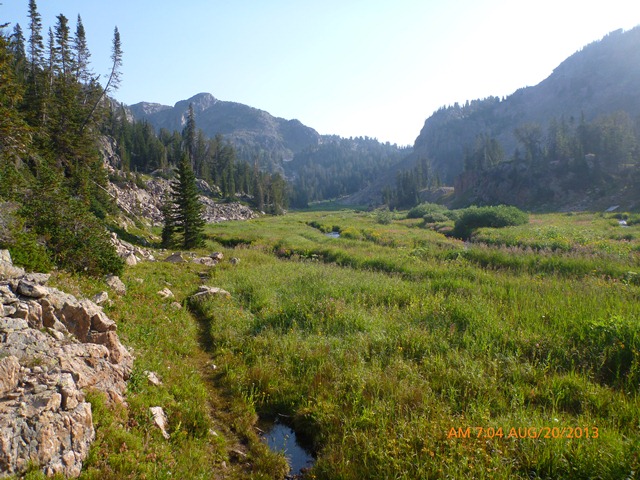
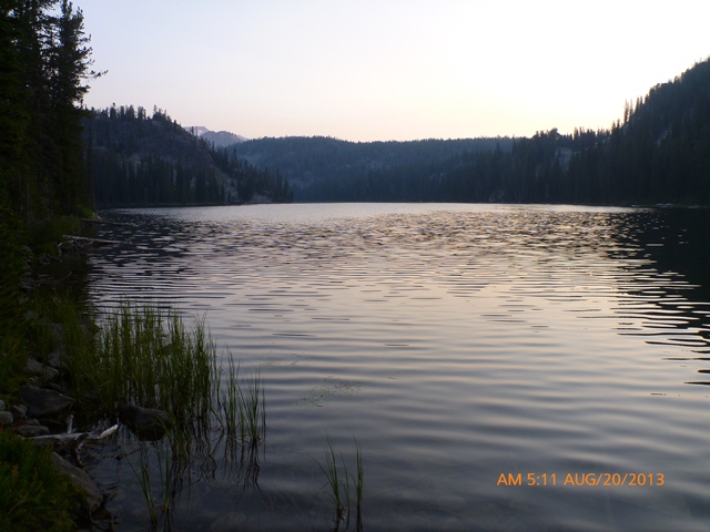
I got an early start on the day departing the new Lady of the Lake Trailhead around 5:30 (the time on the photos is PDT not MDT so the actual time was 1 hour later). It looks like you can drive closer to the old trailhead but it may involve a ford but I parked at the newer trailhead and hiked the extra quarter mile or so to the old trailhead where the sign claims it is 1 mile to Lady of the Lake. I arrived at the south end of the lake about 40 minutes from the car. Lady of the Lake is a nice subalpine lake but is nothing compared to what was coming.
|
The first of many lakes - Lady of the Lake |
|
|
Continuing about 2 miles I came to a spot where some logs and brush block what appears to be main trail and a less traveled option veers left into a meadow. The maintained trail actually does go to the left before heading up Zimmer Creek toward Aero Lakes. Stepping over the debris puts you on the fisherman's path toward Lone Elk and Rough Lakes. Just beyond this junction you must cross the Broadwater River which begins at the confluence of Star and Zimmer Creeks. The path follows Broadwater River maybe a quarter of a mile before turning NE and continuing up the Sky Top Creek Drainage.
A little over a mile later the path reaches a small opening where there is a fire ring. You must cross the creek on your right at this point as this is the fork coming down from the Aero Lakes and not the main fork of Sky Top Creek. There is also a path that leads up to the Aero Lakes from this location so it would be easy to get off route here. Continuing along Sky Top Creek I finally reached more open terrain.
|
Hiking up the Sky Top Creek Drainage |
|
|
I passed a party of 3 with helmets hanging from their packs and figured we were probably all heading for Granite. I was starting to think I was never going to reach Lone Elk Lake but I did and a mountain goat was there to greet me.
|
Lone Elk Lake |
|
|
Continuing on I made my way around Lone Elk Lake and up to the outlet of Rough Lake. By now the path has pretty much disappeared and navigating around Rough Lake is a bit trickier. There are a number of rocky peninsulas the stick out into the lake and you could waste a lot of time here. It was nice to have Rough Lake in the rearview mirror.
|
Looking back at Rough Lake |
|
|
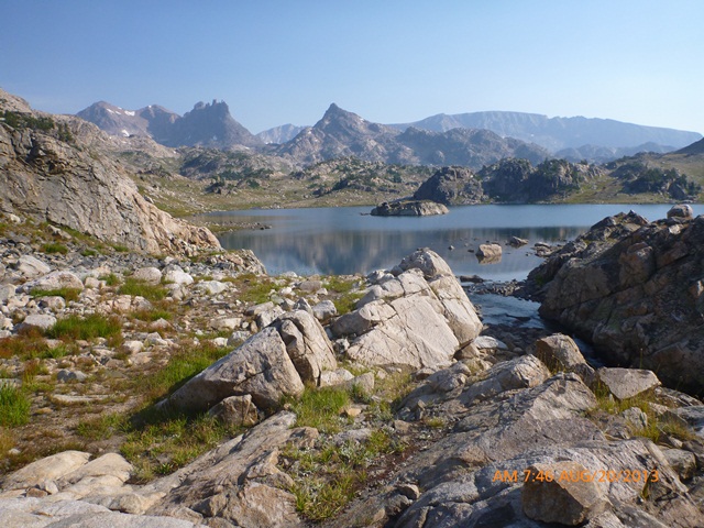
Now heading NNW I kept to the left of the first Sky Top Lake. Hiking up the valley I finally started to get a view of the prize. It seemed closer than it was. A little before 11 I was somewhere between 10 and 11 miles, the sky was showing no signs of thunder storms developing and I was going for the summit. I set up camp in a grassy area next to a giant boulder and was on my way. There were a lot of boulders to hop before I finally got to the base of Granite.
|
Finally, Granite Peak comes into view |
|
|
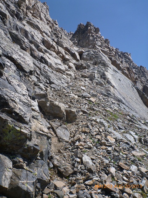
There is a bit of a path going up the steep loose debris if you go next to the cliffs but it wasn't helping me much. At the small snow patch the path heads left to avoid this potential difficulty altogether then disappears in the boulders before reappearing below the distinctive slab on the SW face. I was finally at the base of the couloir but it didn't look like the photos I had seen until I scrambled up a few feet.
|
Finally! Arriving at the base of Granite's SW Couloir |
|
|
The couloir has a couple of spots that seem to give people some concern; at least I assumed that was the explanation for the rappel slings. The first spot is a little steep but has good holds and it is probably the fact that you are right on the edge of the slab that causes the concern. Above that section there is a second spot that isn't at all exposed but is a little steep and awkward. Easy scrambling and loose rock is the best description of remaining section of the couloir.
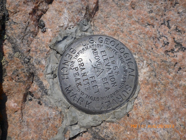
Once at the top of the Couloir the route follows the ridge up and to the left, generally keeping to the left side of the ridge. The ridge doesn't need to be any harder than class 2 with some class 3. Once on the main summit ridge it is pretty much a walk to the summit to the 4 inch plastic pipe summit register. I made it, 8 1/2 hours after leaving the car.
|
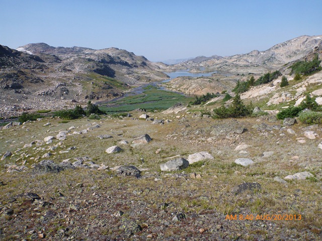
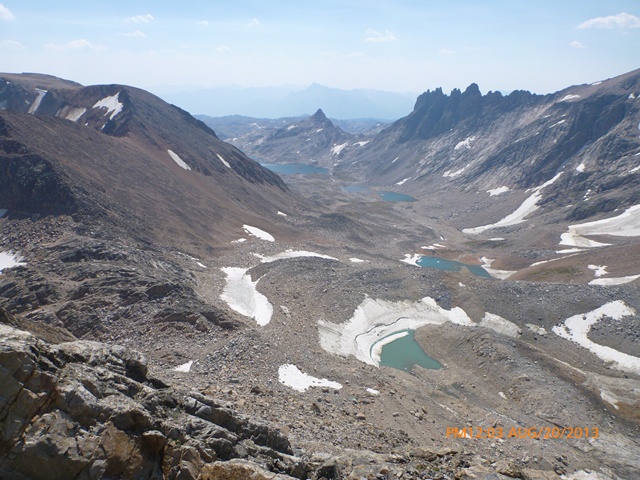
View down to Sky Top Lakes |
|
|
|
USGS monument on the summit of Granite Peak |
|
|
|
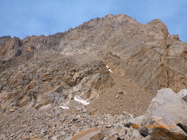
Looking back at the SW face of Granite Peak |
|
|
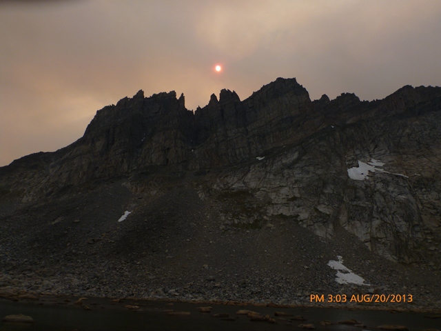
There were still no signs of thunder storms but the sky was filling with dark smoke as I headed down. That would seem to be the pattern - not too smoky in the morning then heavy smoke in the afternoon as the fires really got burning in the afternoon heat. In the morning there were mostly burned up pine needles and ashes on my tent...
|
Sun obscured by smoke and The Spires |
|
|
References: