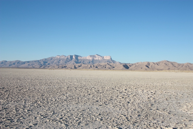
The Guadalupe Mountains from the South

Hoping to escape from the rain and check out a few of natures marvels I was heading for El Paso, Texas. As it turned out it was sunny in Western Washington the entire time I was gone so I didn't need to escape from the rain after all but there were still some other reasons to go...
First on my list of things to do was to go to Guadalupe Mountains National Park and hike to the summit of Guadalupe Peak, the highest peak in Texas. The Guadalupe Mountains are an ancient reef formed in the Permian Age, about 250 million years ago. The reef was eventually buried then uplifted to form the range you see today.
|
The Guadalupe Mountains from the South |
|
|
|
El Capitan and Guadalupe Peak from the West |
|
|
The hike to the top of Guadalupe Peak is not difficult but is notoriously windy, thunderstorms are somewhat common and it no doubt gets hot in mid summer. The weather was cooperative the day I hiked to the top with no wind and temperatures in the mid 70's at the 5730' trailhead/campground. There are several trails that begin here with at least the Guadalupe Peak Trail being well marked. It took about 1 hour 45 minutes to hike the 4.25 miles to the 8749'summit where the Texans have erected a shiny monument. The most noteworthy view is toward El Capitan.
|
Kamal Shamlou on top of the Loan Star State |
|
|
|
El Capitan and what the rest of Texas looks like in the background |
|
|
Next on my list of things to do was to go to New Mexico to get out of the sun. There are over 300 known caves in the Guadalupe Mountains with 113 of them within the boundaries of Carlsbad Caverns National Park. These caves were formed as sulfuric acid ate away the limestone leaving large caverns such as The Big Room which is 8.2 acres in size. Some might argue that these caverns are over developed. Access is either on foot via the Natural Entrance or via the elevator that takes you 750 feet below the surface to The Big Room. However you get into the caverns expect to see a lot of rangers. This place is more heavily guarded and regulated than the El Paso- Juarez border!
There are two self guided tours in the main cave system: The Natural Entrance and The Big Room. I elected to take the The Natural Entrance Trail and get a little exercise. The paved trail winds down to meet up with The Big Room Trail in about 1 mile. The Big Room Trail is a 1 mile loop trail around the perimeter of the largest room I saw. Now for the exercise part but NO! I would have to take the elevator. Too many people had to be "rescued" on the 700 vertical foot hike out to The Natural Entrance so the rangers will not let you go up it. Apparently, you can get a special permit at the visitor center to hike out The Natural Entrance ...like you can get a permit to solo climb up Mount Rainier.
|
Somewhere in Carlsbad Caverns |
|
|
|
Somewhere else in Carlsbad Caverns |
|
|
|
The snack bar in Carlsbad Caverns |
|
|
There are several other guided tours that can be done in the main cave system as well as at the Slaughter Canyon Cave but I didn't want to spend my day hanging around with an underground dwelling park range. One other spectacle that draws attention is The Flight of the Bats. As you might imagine, the caves are home to a large population of bats, possibly as many as there are rangers, but photographing the bats as they exit the bowels of the earth is not allowed. Oh well, off to the beach...
Note to self: Avoid Carlsbad Caverns during tourist season! Afte all it is open 364 days a year,is always 56 degrees and it never rains, [in the caves,] it only drips.
The beach at Lake Lucero is big but don't expect to find water there. Lake Lucero is a playa, a lake that is dry most of the time and the modern source of the gypsum sand found at White Sands National Monument. There are a couple other advertised hikes on the monuments offical map that can be done or you could wander aimlessly for days through the over 250 square miles of dunes. I hiked the 4.6 mile Alkali Flat loop and the 1 mile Dune Life Nature Trail. Bring sunblock, you will need it!
|
Hanging on for life at White Sands National Monument |
|
|
|
Gypsum sand dunes on the Alkali Flat Trail |
|
|
References: