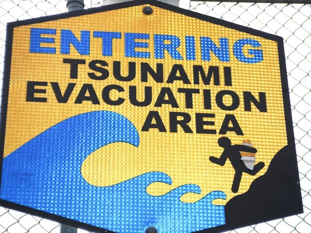
Ready for the big one dude?
In need of some warm sun and somewhere new to explore Lorri and I got on a plane on December 28th, the day before my 40th birthday, and headed for the island of Hawai'i. We had been looking forward to this trip for months and the time had finally arrived. Unfortunately, we couldn’t make arrangements for the dates we wanted so it was going to be a whirlwind tour of the Big Island. If you are planning a trip here around the holidays it pays to plan early.
|
Ready for the big one dude? |
|
|
It was 77 degrees at 10:30 PM when we started our Ford Focus rental car at the Kona Airport and that would be about average for the trip. We had tried to get a Jeep but the ones you can take off the pavement had been booked for weeks if not months. Over the next few days we appreciated that a 4x4 would have been useful but not having one wasn't stopping us from getting where we wanted to go.
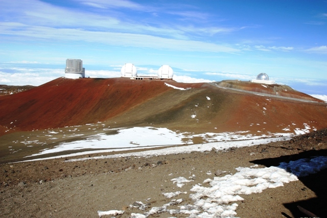
From our house of refuge near Captain Cook we go an early start on the 29th and headed for Mauna Kea, the highest point in the state of Hawaii. It is also the tallest mountain on the planet if you start from its base. After a couple hours of driving we arrived at the visitor's center on Mauna Kea Access Road. If we had more time we might have opted to hike the 6 miles each way but we weren't sure we wouldn’t have to until we got there. Most sources say a 4x4 is required beyond the visitor’s center but the sign there stated that a 4x4 was highly recommended so away we went. The road is fairly steep and unpaved for the first 4 mile beyond but the Focus got us to the highest point you can drive to with no problems. The hike from there isn't worth mentioning...
|
On the summit of Mauna Kea |
|
|
The summit area is home to a host of observatories include the Keck observatories which houses the world's largest optical and infrared telescopes. Inside the Keck Observatory there is a small visitor center with restrooms and a viewing room of the Keck 1 telescope.
|
The W. M. Keck Observatory on Mauna Kea (Center) |
|
|
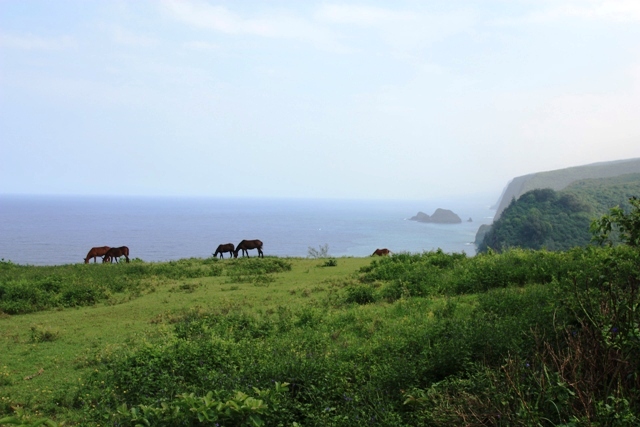
After checking out the summit area we headed back to the visitor's center. Going down was a bit more problematic because low gear in the Focus isn’t very low but we all survived (me, Lorri and the Focus). Once back to Saddle Road which goes from Hilo to Kona by crossing the saddle between Mauna Kea and Mauna Loa we headed for the North Kohala Region, one of the seven regions on the island. These seven regions illustrate the vast differences of the island caused largely by dramatic differences in rainfall and, of course, volcanic activity.
|
View from the Pololu Valley Lookout - North Kohala Region |
|
|
|
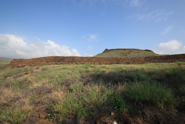
The temple at Pu'ukohala Heiau National Historical Site - Kohala Region |
|
|
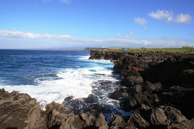
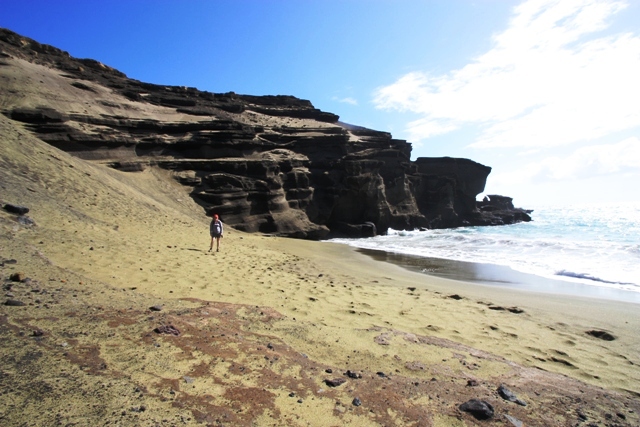
The next day we set out to explore the Kona region best known for its coffee but also found ourselves at Ka Lae, or South Point in the Kau district. South point is the southernmost point in the United States and like most areas of the big island rural with just enough tourists to remind you that you are still in Hawaii. After checking out South Point we took a 2.5 mile hike down a 4x4 trail to check out a green sand beach. The trail doesn't go all the way down to the beach but you can get to it by scrambing down to a ledge then following a path or you can take some sketchy looking stairs then down a steep hard sand slope. Although there were a lot of people around when we got there we had this small beach to ourselves because nobody else knew how or wasn't willing to get down to it.
|
The view from South Point - Kau Region |
|
|
|
The green sand beach near South Point - Kau Region |
|
|
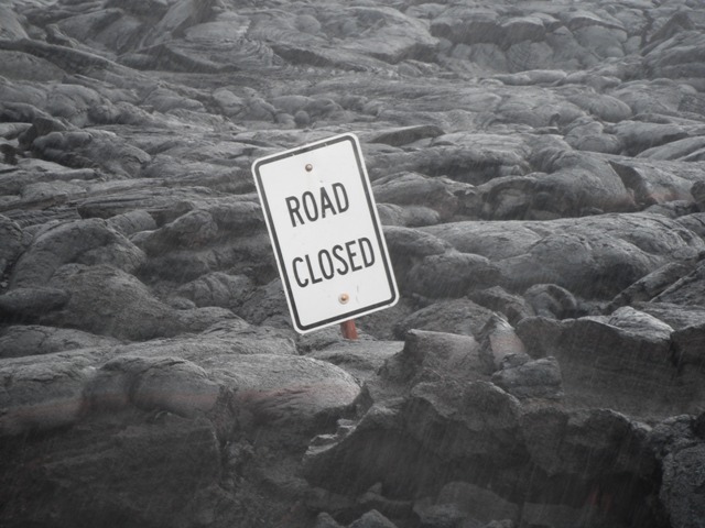
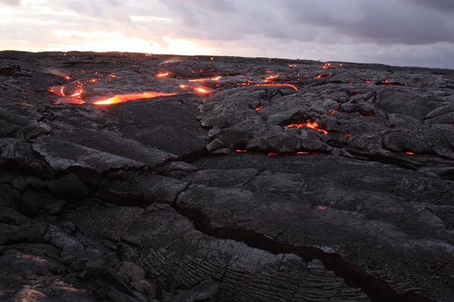
On the 31st we headed for Hawai'i Volcanoes National Park to see the Kilauea crater among other thing. We got soaked by heavy drizzle at the Holei Sea Arch in the morning and had to poor the water out of my boots before driving to Kalapana. Kalapana is only about 15 miles away but you’ll have to take the long way around even if you have a 4x4...
|
The end of the Chain of Craters Road in Hawaii Volcanoes National Park - Puna Region |
|
|
|
The other end of Chain of Craters Road near Kalapana - Puna Region |
|
|
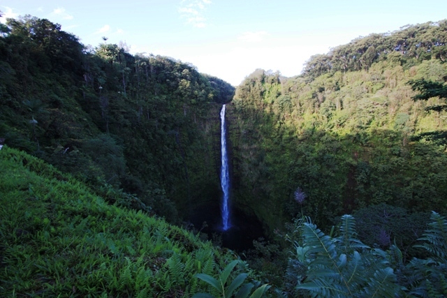
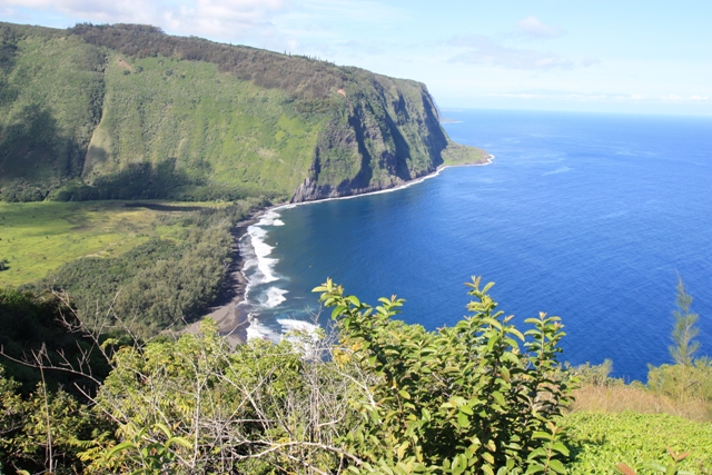
On New Year's Eve we stayed in downtown Hilo, the county seat of the island. Hilo is much more of an industrialized city than Kona because of its port. Unfortunately, it also gets more than 300 inches of rain a year compared to the 40 or so in Kona but we lucked out. The 1/1/11 was a beautiful morning to start the year in Hilo. We headed north to the Hamakua Region where there are a lot of waterfalls but my favorite spot was Waipio Valley where there is a great black sand beach. The road getting to the beach is a legitimate 4x4 road even if it is mostly paved.
|
420 Foot Tall Akaka Falls - Hamakua Region |
|
|
|
View from the Waipio Valley Lookout - Hamakua Region |
|
|
|
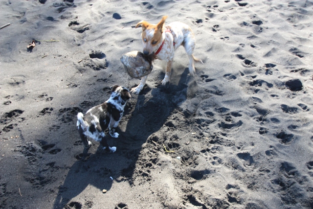
Going [coco]nuts on the Waipio Valley black sand beach - Hamakua Region |
|
|
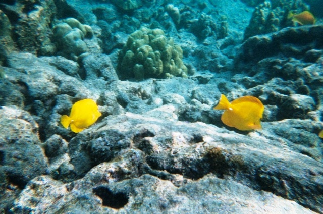
By early afternoon we were back in Captain Cook in the Kona District. From our house of refuge we could look down to Kealakekua Bay. We had been down there already but decided to return because we had been told it was the best snorkeling on the island. For $50 we rented a kayak and snorkel gear from a shady operation at the state park. It is a 1 mile paddle to the Captain Cook monument on the north side of the bay but you can also hike down to it by a trail that is not marked.
|
Snorkling near the Captain Cook Monument in Kealakekua Bay - Kona Region |
|
|
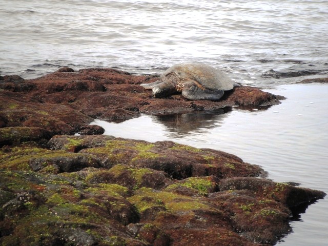
Our trip ended too soon after it had began but we still had the whole morning of the 2nd to check out a few more things. We headed for Kaloko-Honokohau National Historical Park where we found a great beach and saw a lot of green sea turtles in the area of the park just north of Honokohau Harbor. There are some hiking trails but you may just want to find yourself a spot to relax...
|
Relaxing by the ocean at Kaloko-Honokohau National Historical Park - Kona Region |
|
|
The best $7 I may have spent on this trip was for a map of the island printed by Environmental Designs and titled Hawai’i Island Atlas and Maps. It is up to date, accurate and packed full of information. I got mine at Metsker Maps in Seattle but can’t find a source on the web.