![]() Click Here for map
Click Here for map
Jack Mountain is the 15th highest peak in Washington and one I had had my eye on for at least a couple of years now. I was joined by Tom Sjolseth who I had met on Dome Peak a few weeks before. Tom had had his eye on Jack even longer than I had. We departed the Canyon Creek Trailhead on Highway 20 around 9:30am on Saturday. The weather was perfect and the forecast promised more good weather in the days to come. Everything was looking good for an ascent of Jack Mountain.
We crossed Granite Creek on the short trail leading from the trailhead then turned left at a junction and followed Granite Creek downstream for a couple hundred yards past an old cabin and across Canyon Creek to another junction. We turned right and started up FST 738 toward McMillan Park. The trail is moderate, gaining 3400 feet in about 4 miles where it reaches the Crater Mountain Trail (FST 746). We follwed FST 746 for less than a mile to Crater Lake, crossed the outlet and started up the old trail that leads nearly to the summit of 8128 foot high Crater Mountain. At about 6700 feet we left the trail and began a rising traverse to the pass between Crater Mountain's summit and the 7054 foot high east summit. We arrived at the pass (c.7200 feet) where the approach went from heather and rock to glacier.
After putting on crampons we began traversing the Jerry Glacier towards the cliffs of the North Ridge of Crater. We were looking for the ledge/scramble route to the ridge crest mentioned in the Beckey Guide. At about 6900 feet we found the ledge...on the other side of a four foot wide moat. Another party (the only other party we would see on Jack Mountain) had scrambled up just below the ledge and were preparing to belay about a half a pitch of rock. We decided to take the "easy" way out and descended to Jerry Lakes (c.5900'). We reached the area between the two large lakes and found that a few acres had been destroyed by a fire. It seems an unlikely spot for a fire to start by natural causes and we assumed the worst. It was probably started by someone's carelessness.
From between the two larger lakes we climbed a couple hundred feet up a water course and faint path then began a rising traverse to the left on a heather shelf to the pass ( +6520') between points 7001' and 6629'. From here a 600 foot descending traverse led to the 6000 foot basin WNW of point 7001. This would be our camp for the next two nights. Not far away were the two climbers we had met at the ledge on Jerry Glacier. They were planning to climb the east ridge and were happy to hear that we were not planning on climbing the same route. We were also happy to know that we would not be above or below another party as well.
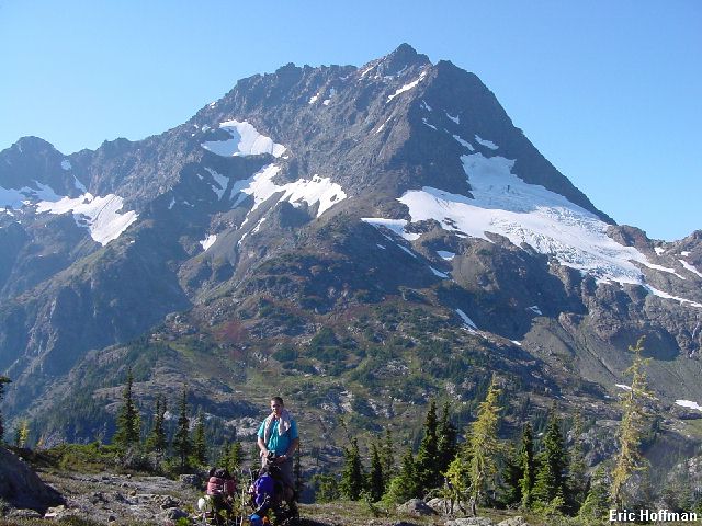
|
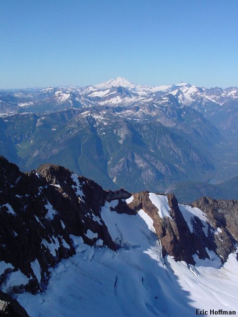
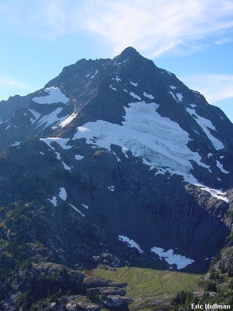
Jack Mountain from the pass above Jerry Lakes |
|
|
Prior to this trip I had an image of Jack Mountain as a steep, desolate massif. From the south it appears as a bulky, rocky mass and if Jack was not such a dominant peak, it would have had little appeal to me. My preconceived notions turned out to be completely wrong, however. The entire approach had been though beautiful sub-alpine and alpine terrain with the greatest reward being the amazing basin we were camping in. Jack Mountain stood before us with a large glacier draped on it SSE slopes contained by the East and Southeast Ridges. We could see the South Face but not very well. Personally, I thought it looked like it was going to be a difficult climb.
|
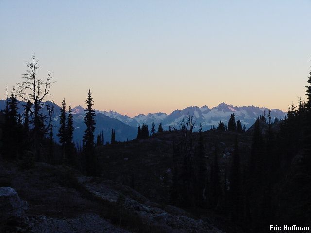
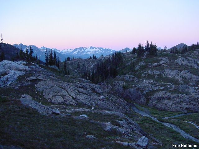
Sunset from camp |
|
|
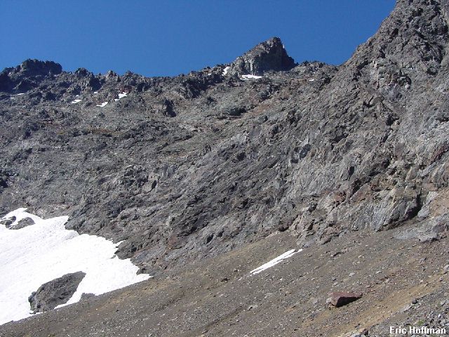
We left camp around 7:30am the next morning and climbed easily to a level area on the SE Ridge at c.7200'. From here we could see the face much better and we began looking for any obvious lines to the summit.
|
The South Face of Jack Mountain from the Southeast Ridge |
|
|
We made a rising traverse on scree to the snow patches below the major obstacle on the lower south face, steep cliffs. We continued in a shallow moat above the first large snow patch until we arrived at an area where we could climb a ramp. We climbed one ramp, then another, then another. I would describe the first 400-500 feet of the face as class 3 ramps and ledges connected by harder class 4 steps and traverses. Once above the steepest sections the terrain became easier. We continued upward and leftward on mostly class 3 rock then climbed about 200 feet of scree adjacent to a snow patch to reach the SE Ridge just above were the East and SE ridges merge (c.8600').
|
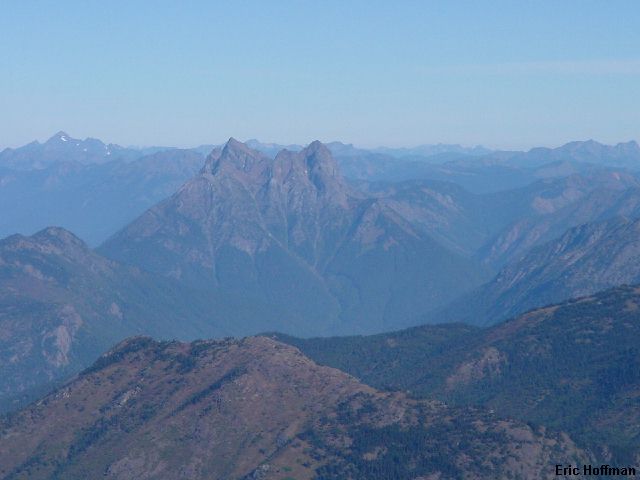
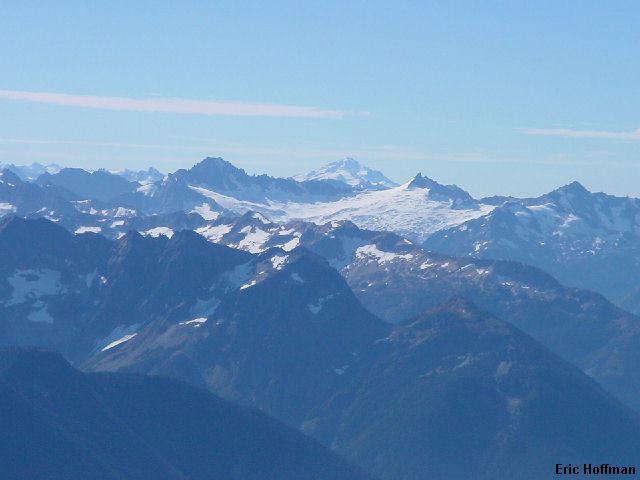
Hozomeen Mountain from 8600 feet on the SE Ridge |
|
|
From the ridge we began traversing and descended slightly to cross below the steep cliffs below the summit. Once around the steep cliff we started climbing a partially snow filled gully. Rather than putting on crampons, we continued up the somewhat loose gully along side the snow. Class 3 and 4 rock with one step that may have been low 5th class led to the summit ridge just west of the summit. After a short scramble up the ridge crest we reached the summit of Jack Mountain. The views were perhaps the best I had ever seen.
|
The view to the west from the summit of Jack |
|
|
|
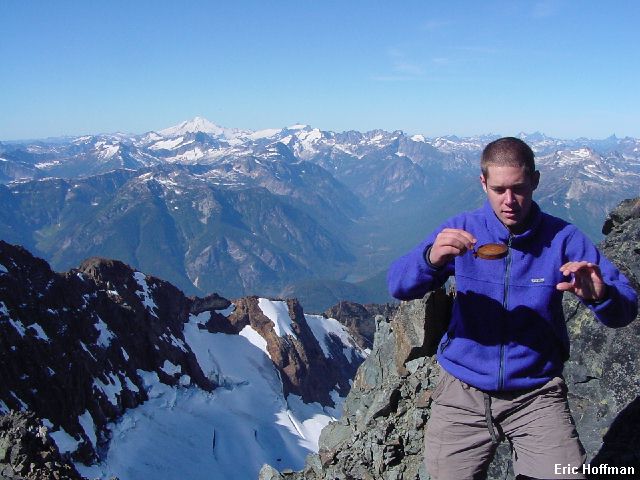
Tom finds a relic from a past ascent |
|
|
|
The view to the south from the summit |
|
|
We signed the summit register and counted only 25 entries recorded (the register dates to 1995). After nearly an hour on the summit we spot the East Ridge party at about 8600'. Not wanting to be part of a rock throwing contest, we decided to head down. We had had this rugged, rarely visited, summit to ourselves and they deserved the same sense of solitude we had enjoyed. We descended the route we had ascended until the ledges and ramps through the lower cliff bands. We down climbed whatever looked easiest and avoided rappelling due to loose debris and reached the snow below the cliffs with no significant difficulties. After traversing back to the SE ridge we began descending the last 1000 feet to camp. Tom noticed a white spot milling around our camp. It was a goat and we started running down the heather and scree slope. The goat was gone when we arrived and we were relieved to find that our camp had not been raided.
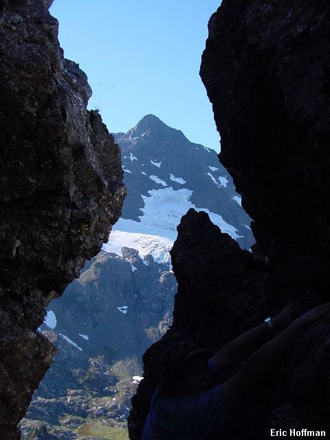
It was about 3:00pm when we arrived back at camp...hmmm, so much more to see. We hiked north to a small pond then started up the ridge toward point 7001'. The ridge was broad easy heather for several hundred feet and the views of Jack just kept getting better. The ridge narrowed and we followed a goat trail along the crest to a 10 foot vertical step that we dubbed the "goat ladder". We down climbed the step (class 3/4) then continued on the goat trail. A few hundred feet below point 7001, we scrambled up to an interesting chimney and climbed a couple of small pinnacles. Then we continued to the top where there were views of Jack Mountain, Jerry Lakes, Jerry Glacier and Crater Mountain. After enjoying the excellent views, we headed back down to camp and dropped in to see the East Ridge party. They reported that the east ridge was not the excellent rock that it has been described as.
|
The view of Jack Mountain from near point 7001 |
|
|
|
Jack Mountain from camp to summit (3000' vertical feet of relief) |
|
|
In the morning we left camp around 7:30am and returned the same way we had came in. It took 4 1/2 hours to reach the trailhead, 5 1/2 hours to reach a burger and fries.
|
Sunrise from camp |
|
|
Jack Mountain was an excellent trip filled with mountain scenery and challenges. The route had definite potential for disaster. There is plenty of steep rock with more than enough loose holds. Belaying would probably be more dangerous due to loose debris that would almost certainly be pulled down by a rope, but a rope could be useful for rappels.
References:
Cascade Alpine Guide, Volume 3, 2nd edition; Fred Beckey; Pages196-199
Climbing Washington's Mountains; Jeff Smoot; Pages 44-47