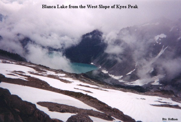
Blanca Lake is a relatively large mountain lake surrounded by the rugged peaks of the Monte Cristo group. The Lake is fed largely by the Columbia Glacier which results in the water being turquoise in color. The trail to this lake is shown to be 3.5 miles on the Green Trail map and reported to be 4 miles in the 100 Hikes book. Personally, I think it is longer, but whatever the length of the trail, Blanca Lake is a nice destination.
To get to the trailhead, follow Highway 2 to FSR 63 (the road leading to index) and follow it NW. At about 15 miles, the road turns left at the intersection with FSR 65. From the junction continue about 2.5 miles to the spur road signed "Blanca Lake Trail". Trail 1052 starts out in old growth forest and slowly gain altitude via many switchbacks until it reaches a high point of ~4600'. After a short descent, the trail passes a small lake called Virgin Lake (it really doesn't look that pure) then continues descending for the next mile to an elevation of 3972' and the south side of Blanca Lake.
An unmarked trail near the 4600' high point of the trail reportedly leads to Toil Peak (5128') which offers views of the Monte Cristo group and Blanca Lake. Another trail leads around the west side of Blanca Lake to its head.