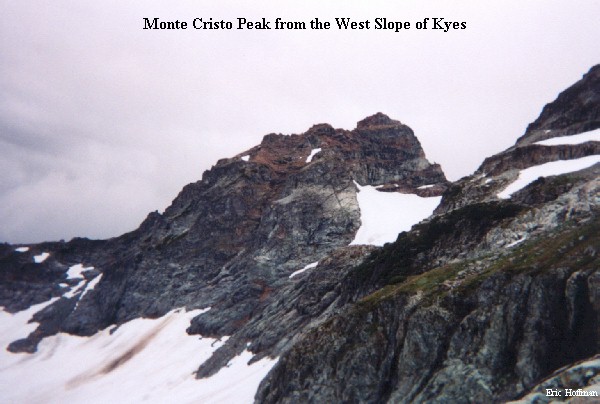
Located a half mile SE of Monte Cristo Peak, Kyes Peak is the highest of the compact Monte Cristo group. The one mile long South Ridge of Kyes offers the shortest and easiest route to the summit. The route is senic, interesting and isolated after the tedious hike to Blanca Lake.
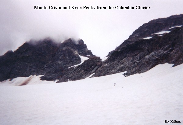
From Blanca Lake, cross the outlet however you can ( maze of logs near outfall provided a reasonable method) and skirt the west shore of the lake on an unmaintained path. The path follows the shoreline in most places but occasionally ascends into brush in others. Once at the head of the lake, travel towards the foot of the Columbia Glacier (4700') on rock and snow. The Columbia glacier is nestled in a large cirque and has only a few crevasse (we brought a rope but it was not needed). Ascend the glacier on its east side to about 5200' and a snow ramp that leads through a break in the lower cliffs. Ascend the snow ramp as high as possible, then continue ESE toward a west running spur of the South Ridge. Ascend on the north side of the spur to 6500' then cross to its south side. The standard route apparently leads back to the top of the spur then continues near its crest to point 7025' on the South ridge (reported as class 2). We traversed on snow to a gully just south of point 7025' that was easily ascended to the ridge crest (class 3, climb left around large boulder then back into gully). Other variations for gaining the South Ridge appear possible. Once on the ridge, follow the crest on its east side to the summit block then scramble to the summit (class 2-3 somewhat exposed near the top). Had the weather been more cooperative, the view would have been magnificent, but we only recieved short glimpes of the surrounding area.