Lundin Peak and Red Mountain are located less than three miles NNE of Snoqualmie Pass making them prime targets for a quick outing. Both are easily reached from Commonwealth Basin via the Pacific Crest Trail (FST 2000) then the Commonwealth Basin Trail (FST 1033 which is actually the old PCT).
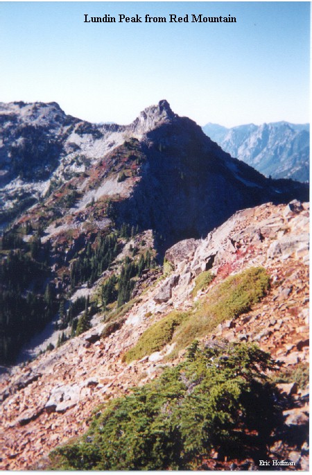
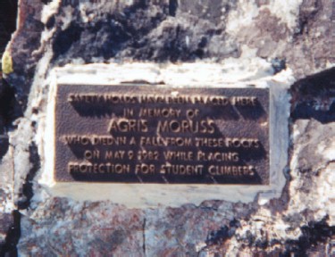
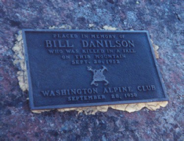
To reach Lundin Peak, follow the Pacific Crest Trail (or the shorter old section of the PCT) for 2.5 miles to the junction with the Commonwealth Basin Trail. Follow the Commonwealth Basin Trail an additional 2.5 miles to the saddle between Lundin Peak and Red Mountain. A path leads to the first false summit on the Southeast Ridge. From just below the false summit, descend SW to an obvious ledge then traverse to the notch beyond the false summit. From the notch, ascend and traverse aound the north side of the ridge to the second false summit. From here descend a gully to the saddle between the second false summit and the true summit. From this saddle climb the ridge on the SE side then onto the crest of the ridge. The last 25 feet of the climb is exposed and if that is not enough to scare you, a memorial plaque dedicated to someone who died here probably will. There are three bolted anchors on this final class 3 section of the ridge to help prevent another such incident. On the summit is yet another memorial plaque for another victim of Lundin Peak's summit rocks. It is typical to make a short rappel down the upper section of the ridge.
| The Memorial Plaques on Lundin Peak | |
 |
 |
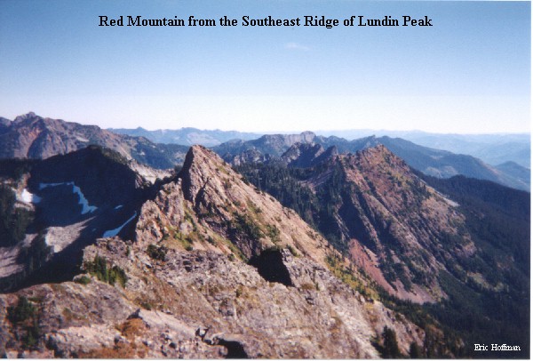
The Standard route to the summit of Red Mountain is from a small pond in upper Commonwealth Basin that ascends on or near the South Ridge, but since I was already at the saddle above the upper basin, I decided to climb the short couloir to the summit. From the saddle traverse southeast then ascend to the bottom of the couloir. The couloir is mostly loose rock with some class 2. Climb the couloir for 200-300 feet to the upper west ridge and then continue to the summit. It is easier to descend the South Ridge than the couloir. A path of sorts descends first near the ridge then onto the SW slopes toward the pond.