With rain turning to snow in the mountains and the subsequent closing of roads, I found myself of the slopes of Mt. Rainier taking advantage of some great fall weather. While all of these destinations can be reached during the dog days of winter, some have serious avalanche dangers and all require much more time and effort to reach.
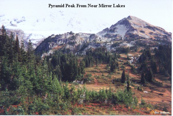
These destinations are reached most easily from the West Side Road which closes at the Paradise-Nisqually Road for the winter. From the barricade 2.5 miles from the Paradise Nisqually road, hike the road from approximately a mile and locate the Tahoma Creek Trail (at the first major westward bend). The trail is not signed and not maintained to the same standard as other trails in the park, but it is certainly passable. Follow this trail for about 2.5 miles to the junction with the Wonderland Trail. Cross the suspension bridge and continue south on the Wonderland Trail for 1.4 miles to Indian Henry's Hunting Ground and the junction with the Mirror Lakes Trail. Follow the Mirror Lakes Trail for 0.7 miles to the small mirror lakes and continue past the "End of Maintained Trail" sign. The path continues into a basin west of Pyramid Peak then climbs to Pyramids south Ridge and follows this to the summit.
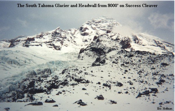
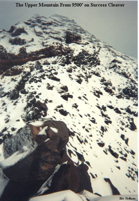
Success Cleaver offers the only route to the summit that does not include glacier travel, but it not necessarily easier or less dangerous than many other routes (snow and ice to 45 degrees, avalanche hazard, rockfall hazard and 3500' of exposure). The portion of this cleaver below 8500' is not steep and is generally broad. The next 1000'+ becomes somewhat steeper and exposed before the first of several traverses on the route marks the beginning of the serious climbing. From 6400' on the path to Pyramid Peak, traverse around Pyramid Peak's west side then make a short descent to the base of the cleaver. From the crest of the cleaver there are excellent views of the South Tahoma Glacier and its headwall along with many of Rainier's other south and west side features.
Perhaps some of Mount Rainiers most impressive features and hardest routes can be seen the area near Spray Park: The Mowich Face and Ptarmigan Ridge on the NW side; and Liberty Wall, Liberty Ridge, Willis Wall and Curtis Ridge on it's North side. This area is hard to beat.

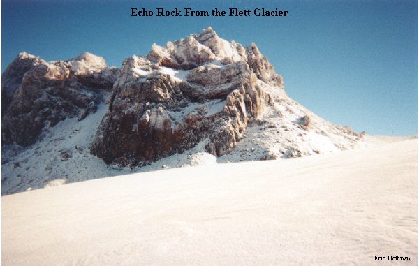
From Mowich Lake, take the Wonderland Trail south for 0.5 miles to the junction with the Spray Park Trail. Follow this trail to spray park (~4 miles to the 6400' high point). An alternate route to Spray Park is a non-maintained route that passes through Knapsack Pass (shorter and generally faster, but not necessarily easier; expect some route finding). From the high point in Spray Park, follow a path (vanishes after a short distance) along a minor rib to a small glacier remnant (one of the Flett Glaciers).
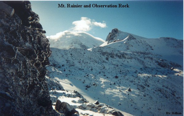
From the glacier, Echo Rock, Observation Rock and Ptarmigan Ridge can be gained. Echo Rock is climbed on loose rock and ledges on its SW side with a short class 2-3 section at the summit. Observation Rock is climbed on its east then completed on the SW slope. The most difficult part of this climb may be getting to the SW slope. Climb a moderately steep section of hard snow and ice or make a short ascent on the Russell Glacier (depending on the year, crevasses may make the Russell a this a less appealing option) From the top of the steep snow and ice slope, traverse to the SW slope and ascend to the summit.

Another good location in this area is an 8600'+ high point on Ptarmigan Ridge. From the top of the steep snow and ice slope on the Observation Rock Route, follow on or near the crest of the rib that connects with Ptarmigan ridge at 8600'. This spot offers a spectacular view of the North Mowich Glacier (no photo, out of film).