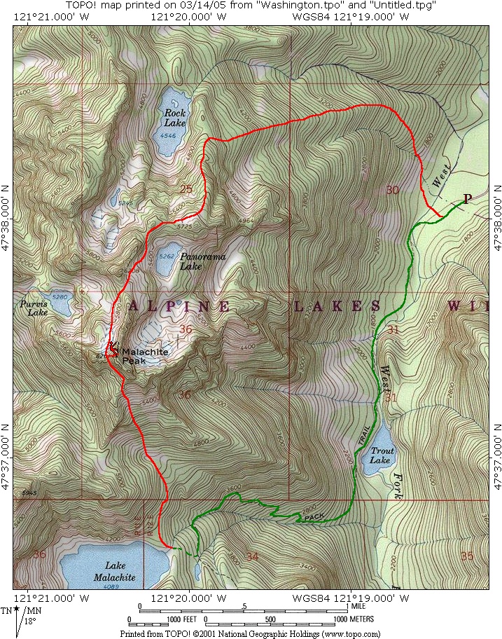
Map Courtesy of Topo.com
After our original plan was called off due to road closures Chris Mattson and I regrouped, finally settling on Malachite Peak for our Sunday destination. With a summit elevation of 6261’, Malachite is a modest but fairly rugged peak in the NW corner of the Alpine Lakes Wilderness. Malachite has a 6208’ north summit separated from the main summit by about a half mile and a +5840' saddle. Our plan was to ascend the south summit via a route up the south slope from Malachite Lake then traverse toward the north peak and descend the ridge east of Rock Lake where we would continue the descent via an undocumented route back to the trailhead on a minor spur on the east slope. If time permitted, we also hoped to scramble up the north peak. Here is a map of our route:
Information came primarily from the Beckey Guide which describes three routes to the summit area, a couple options for the summit block of the main summit and an extremely vague description of the traverse between the main and north summit. Route completions for the south and north summits are described as class 3, but were also very confusing. The guide also stated that a short rappel is necessary to complete the traverse between the summits. I received some second hand information that indicated that the terrain might be more difficult than described in the guide. We decided to take a rope and a selection of snow and rock protection.
Chris picked me up at about 5:00am and we headed for Skykomish. About two mile out of town we turned south onto Foss River Road NE which becomes FSR 68. We followed this for approximately 6 miles then turned left on spur road 6835. The spur ends in about 2 miles at the West Fork Foss River Trailhead, c.1600’. The roads are currently well marked.
By about 7:30am we were hiking the West Fork Foss River Trail (FST1064) passing Trout Lake at 1.5 miles and continued toward Copper Lake. Just before reaching Copper Lake we found an old sign on a tree (c.3.5 miles from the trailhead) with an arrow pointing right to get to Malachite Lake. We quickly lost the way trail but just as quickly relocated it after making a rising traverse to the right. The path headed up a short water course before reaching Malachite Lake (4089’). We took an extended break at the lake and took in the "winter views".
|
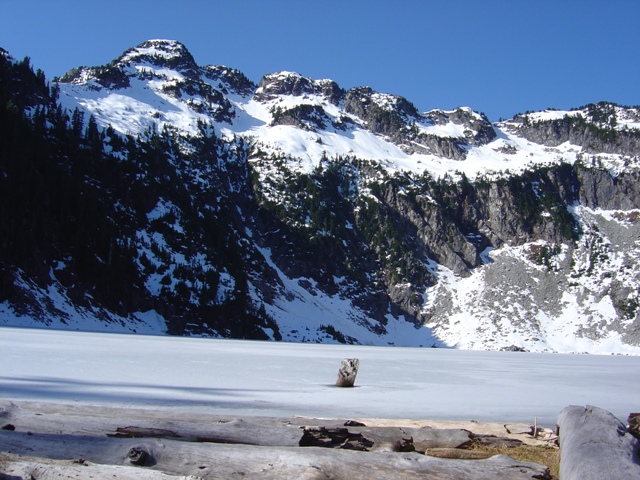
View From Malachite Lake... ok, so it's not much |
|
|
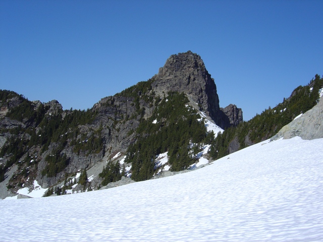
At about 9:30 we started traversing north and made the mistake of gaining too much elevation which led to steeper forest slopes with minor rock outcrops. The better route appears to be to make a level traverse between 4100’ and 4200’ for about a quarter of a mile then turn NW and ascend to a small talus basin at c.4400’. From here the minor gully on the left side of a "broad swath of Pygmy Evergreens" was obvious. I had been wondering what a "Pygmy Evergreen" was since I had first read the description.
|
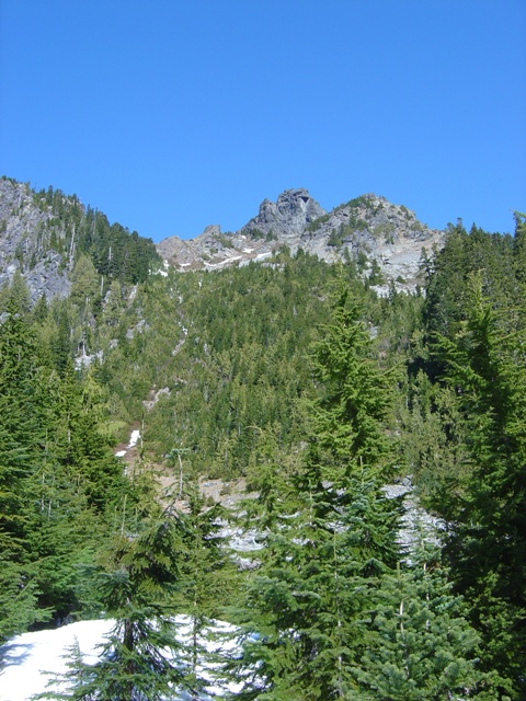
The south slope of Malachite. Note the minor gully on left |
|
|
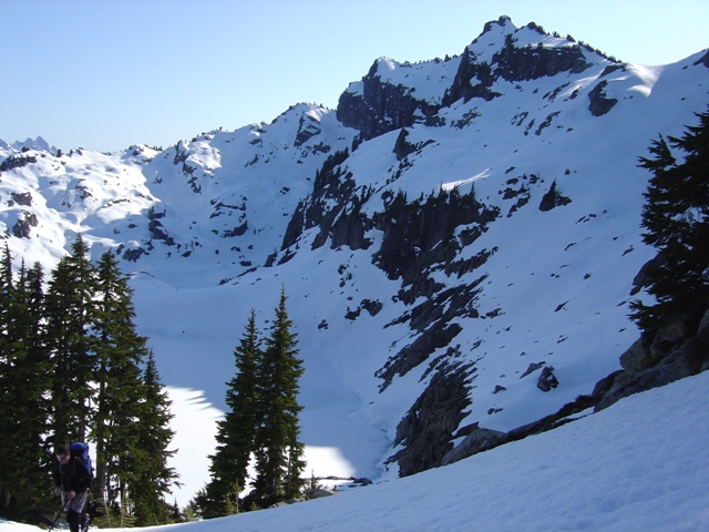
We hiked up to the base of the gully and found the going to be a reasonable mix of easy scrambling, moderate snow and some bushwhacking through scrub cedar trees (aka Pygmy Evergreen). After about 900’ we reached open heather and talus slopes above and headed for the ridge crest on our left, reaching it just below the cliffs of the summit. We crossed the ridge and traversed NW on scree just below the cliffs to the first notch. The summit was now to our right but a tower to the left made us question this. The completions described in CAG still didn’t make any sense to us.
|
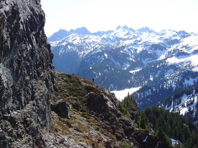
Traversing the SW slope below the Summit, Chimney Group in the background |
|
|
We started scrambling up mostly snow free rock but decided to retreat and get the rope. After tying in we climbed a pitch with a class 3/4 move to get into a gully on the SW side of the summit and a 4th class move to gain the loose debris above. Doable without a rope but it was nice to have one along for a rappel if nothing else. We climbed a second pitch (class 3 then moderate snow) to the summit area. The summit offers excellent views of the Snoqualmie Pass Peaks and the DaKobed Range but the views aren’t limited to just those areas.
|
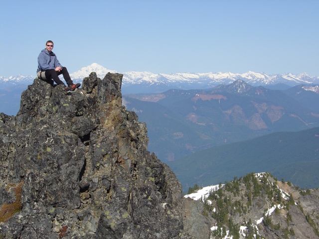
Chris on the summit of Malachite Peak with the DaKobed Range in the background |
|
|
We rappelled down the snow and 3rd class pitch since the snow was hard and we had left our axes at the notch then made a second rappel down the gully and back to the notch. It appears that there is an easier route on the NW face that would bypass the first pitch we climbed. Once back at the notch we made a short descent down moderate snow (used crampons from here) toward Purvis Lake then traversed to the saddle between the north and south summits. It was about 2:30 when we arrived there and while it appeared to be feasible to make a leftward rising traverse on talus to reach the W and NW sides of the north summit, we decided it was probably a better idea to continue descending since we still had 3000’ of uncharted territory to descend ahead of us.
|
The north summit of Malachite from near the saddle |
|
|
From the saddle we headed NE toward Panorama Lake then traversed to the minor saddle west of Point 5725'. From the saddle we continued NE to the ridge east of Rock Lake. Descending the ridge was not as easy as the map makes it appear but it was straight forward with an occasional obstacle to negotiate (this ridge is a portion of the North Route described in CAG).
|
Malachite Peak (south summit) from above Panorama Lake |
|
|
At c.4800’ we found our way to the top of the spur we would descend back to the trailhead. The spur ended up being much less prominent than the map had made it look but in the end did lead back to the West Fork Foss River with only minor difficulties. The river was easily crossed although I wouldn’t expect that on your average 65 degree day in March. After crossing the river we stumbled out on the trail only 100 yards from the trailhead. We still had an hour of daylight... Damn, should have scrambled up to the north summit after all.
References:
Cascade Alpine Guide, Volume 1, 2nd Edition; Fred Beckey; Pages 188, 189 and 190