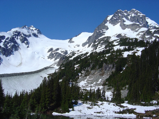
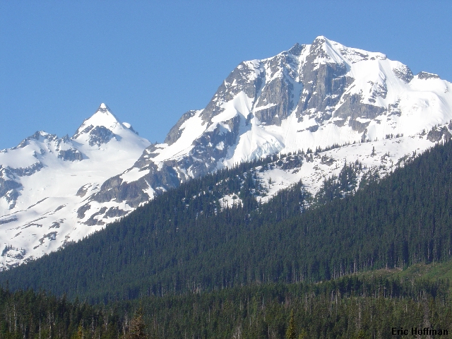
Mount Matier and Joffre Peak from Highway 99
Sergio and I headed for Vancouver Friday night where we could make a more reasonable start from the his mother inlaw's house. After 4 hours of sleep, at best, we began the 3 hour drive to the Cerise Creek Trailhead. A logging road leaves highway 99 12km past the Joffre Lakes Trailhead (cross a wood bridge then turn right at a concrete bridge just beyond). The road is described in Alpine Select as a good gravel road. The roadway is not bad but is overgrown. After about 4 miles on the road we passed the marked trailhead and continued across a bridge to a spur road. The road gets off to a rough start but then improves considerably. It ends in about a quarter of a mile at a logging platform where there is parking o'plenty.
|
Mount Matier and Joffre Peak from Highway 99 |
|
|
We began following the trail to Keith's Hut at about 8:15am. In about a mile and a half there is a signed junction: Hut to the right, Glacier to the left. We went right and in about a mile reached the hut. The last mile is steep in places and has a handline to help get up a steep rocky section of the trail. The hut (more like a cabin) is nice featuring a wood burning stove, stailess steel counters and a sink.
|
Matier, Joffre and the Anniversary Glacier from Kieth's Hut |
|
|
We gained the obvious lateral moraine of the Anniversary Glacier and started up it. After several hundred feet we passed a small tower on the left then climbed back to the crest of the moraine and continued until we could get onto the Anniversary Glacier. We followed the right side of the glacier to the Matier-Joffre Col without difficulty.
|
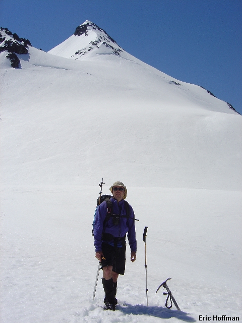
Sergio at Matier-Joffre Col, Matier NE Ridge in Background |
|
|
The snow was turning against us. Our original plan was to climb the NW Face. The snow was corn but had not frozen well the night before. We altered our plan and began postholing up the Matier Glacier toward the NE Ridge (Spur) of Matier. There is some confusion about the route name. Some call it the NE Face, while some call it the NE Ridge or Spur. Since most of the climbing was on the ridge, I chose to use that name. It appears that the NE Face route actually climbs the rock and steep snow directly from the flat on the Matier Glacier before merging with the NE Ridge route a few hundred feet below the summit.
|
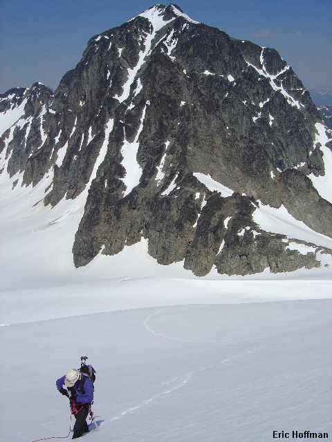
On the Matier Glacier, Joffre Peak is in the Background |
|
|
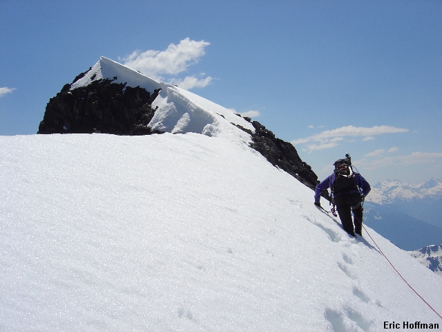
After ascending several hundred feet we reached a bergshrund that we were easily able to climb over (we also could have passed it on the right). Once across the shrund 40-45 degree snow on or right of the ridge crest turned into a mostly easy ridge traverse to the summit.
|
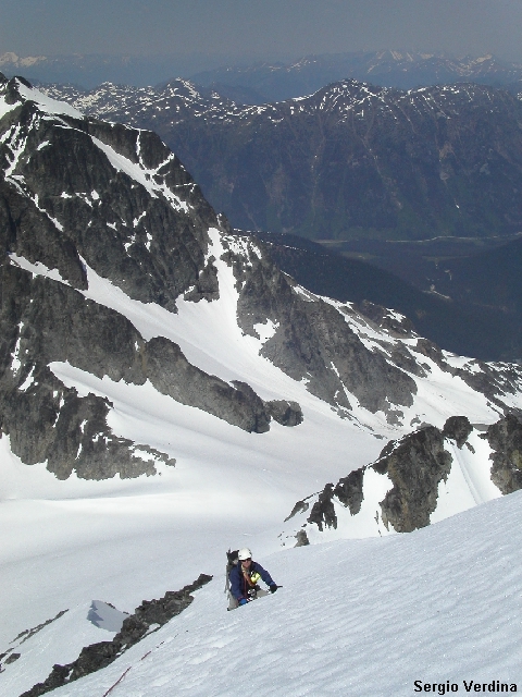
Me climbing above the Bergshrund |
|
|
|
Sergio near the summit of Mount Matier |
|
|
|
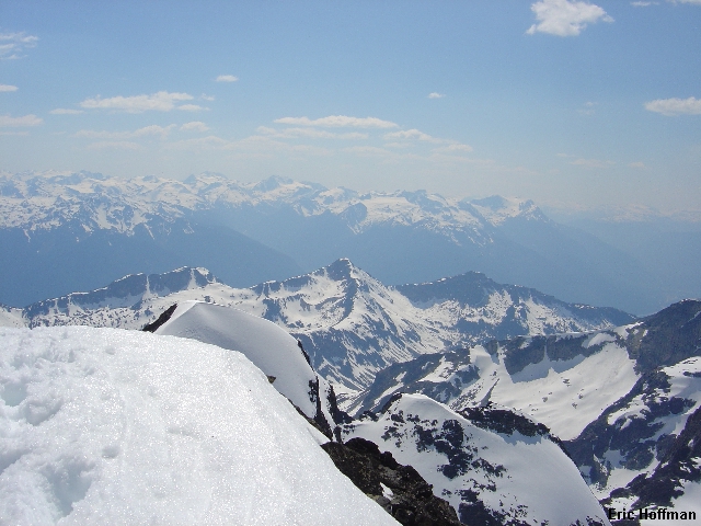
The View Towards Wedge Mountain and the Spearhead Range |
|
|
We descended via a slightly different route and returned to the col. We decided to take the trail from the terminus of the glacier rather than the trail from Keith's Hut which probably would have been faster. We descended the lateral moraine to the small pond at the bottom of the glacier where we began following a few cairns and shreds of flagging. The trail is hard to follow and was not well marked. We lost it at a boulder field were we should have switched back to the right. Instead we bushwhacked a few hundred yards until we reached the trail to the hut. We reached the trailhead at about 6:00pm.
|
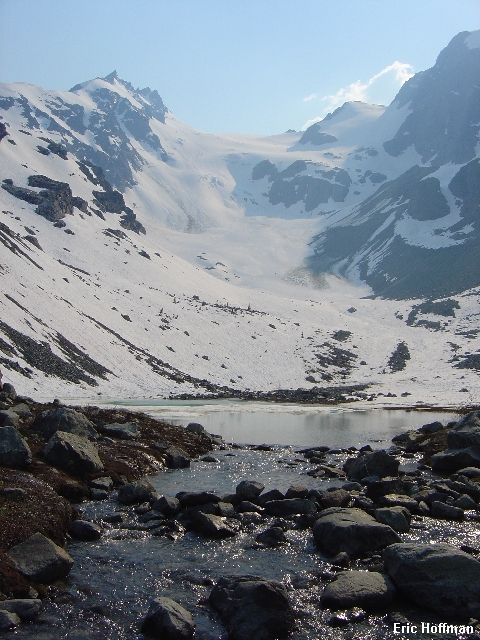
The Anniversary Glacier from its terminus |
|
|
References:
Alpine Select-Climbs in SW British Columbia and Northern Washington; Kevin McLane; Pages 60, 61, 225, 226, 227
A Guide to Climbing and Hiking in SW British Columbia; Bruce Fairley; Pages 185, 187-188
103 Hikes in Southwestern British Columbia; Jack Bryceland; Pages 32-33