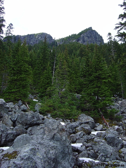
Mount Phelps from the South Basin
In search of something doable in less than perfect weather, Sergio and I agreed to meet in North Bend at 9:00am to give Mount Phelps a try. It wasn't a peak that I had really considered but apparently it is quite noticable from the Seattle area and had caught Sergio's eye and that was good enough for this mostly cloudy weekend.
The other somewhat interesting thing about Mount Phelps is it's name, or should I say its names. Maps show Mount Phelps at the 5162' point SW of the 5535' summit labeled Mclain Peaks. Apparently Mclain has also been spelled McClain and McLain. I received several emails from Paul Klenke regarding the name including a link to John Roper's trip report in which he called the peak "Schizophrenic". This would appear to be the case. My book of Washington Waypoints, primarily derived from the U.S. Department of Interior's "Geographic Names Information System", lists both summits at 5535 with coordinates differing by only 1 second in Latitude (101 feet) and 1 second in Longitude (about 68 feet) but the tolerance is plus or minus 5 seconds. Schizophenic it is.
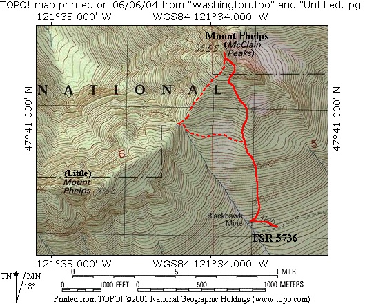
From downtown North Bend we headed north on Ballarat Street to a fork in 3.8 miles. Go left (road becomes FSR 57) for about 16 miles to the intersection of FSR 5730/5731. Follow FSR 5730 for about 2.5 miles to FSR 5736. Follow this road (a bit rough) to its end at a shooting gallery. Note a steep track on the right just before the end of the road.
Just after our arrival two camouflage clad sportsmen pulled up and were soon blasting away. We where happy to know that the route would not be in the line of fire. We hiked back down the road to the steep track mentioned above and followed it a few hundred yards to its end at the collapsed Black Hawk mine. We didn't notice a switchback just before the mine where the "trail" begins. The trail, which we eventually stumbled upon, closely follows a minor ridge crest through a clearcut and is not much of a trail at all. The clearcut ends at c.3800' but the trail continues into the basin south of Phelps (c.4000'). The normal route crosses the basin to the saddle between Mount Phelps (5535') and [Little] Mount Phelps (5162') then follows the ridge to the summit. We, however, were lured by flagging up a steep forested slope then up a ridge and into the gully that leads to the saddle between Mclain Peaks... yes, schizophrenic.
We climbed the gully then out on the left side to avoid a moat. Once above the moat we worked back into the gully for more snow then 10 feet of scrambling followed by more snow to the saddle between the 5535' summit and lesser summit to the east. From the saddle class 3 scrambling and hiking on the right of a gully reached the summit. The view was fairly limited due to the weather but we did get a look south to Mount Garfield and west to Bellevue.
|
Mount Phelps from the South Basin |
|
|
|
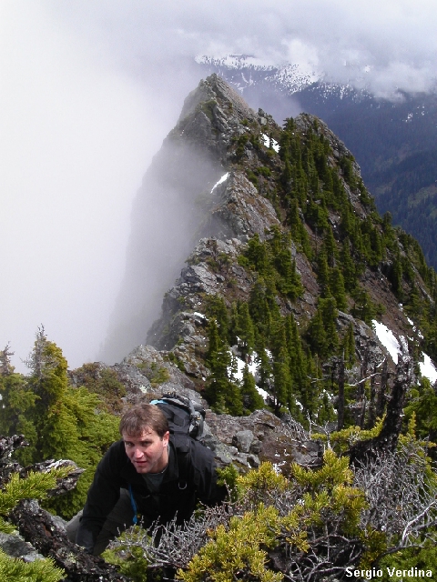
Me Nearing the Summit |
|
|
|
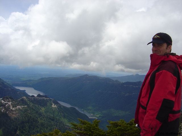
Sergio on the Summit with Tolt Reservoir in the Background |
|
|
We descended via the standard route which had some steeper snow but was reasonably straight forward. After an enjoyable hike back down the trail we reached the car where more sportsmen were hunting cans with an assalt rifle.
|
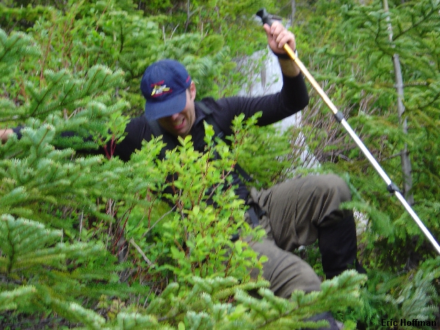
Sergio...back on the trail |
|
|
|
Map Courtesy of TOPO |
|
|
References:
Cascade Alpine Guide, Volume 1, Second Edition; Fred Beckey; Pages 201-202, 301
GPS Waypoints: Washington; Michael Ferguson; Pages 188, 191