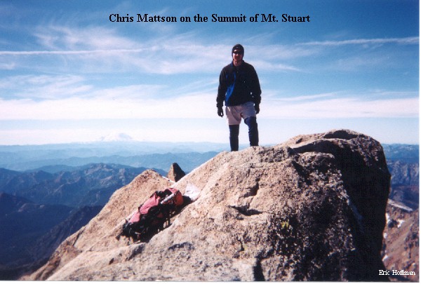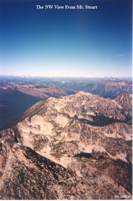
Standing watch over the central Cascades of Washington, Mt. Stuart is 9415' tall and is the largest mass of exposed granite in the United States. It was dubbed "The Mountain of Thrills" by early mountaineer Claude E. Rusk, and for good reason. Most of Mount Stuarts routes are long and complex and require technical mountaineering skills to climb.
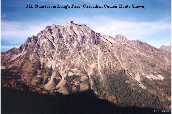
The least technical routes (if at all) are on the south and southeast slopes and include Ulrich's Couloir, Cascadian Couloir, and the SE route. The Cascadian Couloir has become a popular route to the summit of Stuart for the simple reason that it is among the easiest and is fairly direct. I attempted to climb the Cascadian Couloir route on September 21, but was turned back at ~9050' due to high winds, snow and poor visibility. Not being the type of person that takes defeat easily, I knew I would be returning soon.
To get to the Esmeralda Basin Trailhead, Take I-90 past Cle Elum to exit 85. Drive east on Highway 970 for just under 6 miles, then turn left onto Teanaway Road. Follow Teanaway Road for 13 miles to a fork then take the right fork (FSR 9737) until it ends at the trailhead in 9.5 miles.
From the Trailhead, follow the Esmeralda Basin Trail (FST 1394) for a short distance to the junction with the Ingalls Lake Way Trail (FST 1390). Follow this trail to the junction with the Long's Pass Trail (FST 1229) then proceed on this trail to Long's Pass at 6300' and descend to the 4800' junction of the Ingalls Creek Trail (FST 1215). The word "Trail" may not be appropriate for the section from the top of the pass to the Ingalls Creek Trail. Travel east on FST 1215 for about a quarter mile to a clearing and an obvious path at its western edge. (An Alternative is to take FST 1399 to the junction with FST 1391, then FST 1391 to the Ingalls Creek Trail. This approach reduces the total elevation gain from 8200' to 7100' but adds about 5 extra miles).
The route begins climbing through the clearing then reaches a large boulder field. Ascend the boulder field to the bottom of the obvious couloir above. The couloir provides a simple ascent (some easy class 2) to about 7700' where it merges with a larger gulley from the southeast (this is the SE route). Continue up to the base of a steep snow field and ascend it directly or skirt it on its left side (class 3) to the just left of the false summit (~9050'). Descend slightly and traverse on the south side of the East Ridge until the summit can be climbed to directly (class 3). While the SE route is rumored to be and appears to be the easier route, I have twice descended this route and have not found this to be accurate, therefore I recommend descending via the Cascadian Couloir.