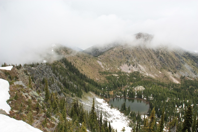
Approaching Pt. 6853' on the way to Gypsy PeakPeak
As usual the 4th of July forecast for western Washington wasn’t looking so hot so Lorri and I decided to try our luck east of the Cascades and explore the remote region in the NE corner of the state. First on our list was Gypsy Peak in the Selkirk Mountains. The Gypsy Peak area certainly doesn’t have the appeal of other areas of the Selkirk Range but that means you will probably have it all to yourself. All three of these peaks are county highpoints but don't get the impression I am planning on going to the top of all the county highpoints in Washington... Most of central and eastern Washington just aren't calling me.
To get to the Sullivan Mountain Trailhead from Metaline Falls we took Highway 31 a couple miles to Sullivan Lake Road where we took a right to Sullivan Creek Road (Signed FSR 22). In 4.8 miles we took a left onto FSR 2212 then in 1.5 miles a left onto spur road 200 which took us to Sullivan Mountain trailhead (ca.5550’) in 6.8 miles where thick fog limited visibility. There is a sign stating the 200 spur is closed from August 15th through November 30th but is probably closed by snow until spring most years.
We started hiking up the trail and before long arrived at Leola Creek where we were planning to leave the trail but we really couldn’t see where we were going because of the clouds and it looked kind of brushy. We decided to stay on the trail until we were just below Point 6617’ then hiked to the top and descended north down the ridge toward Point 6853’. The Hiking was relatively easy and the clouds were beginning to clear out some allowing us to get views down into the basins below. The nice thing about this route is you spend a lot of time on ridge crests connecting ridge humps but that of course means some up and down.
|
Approaching Pt. 6853' on the way to Gypsy PeakPeak |
|
|
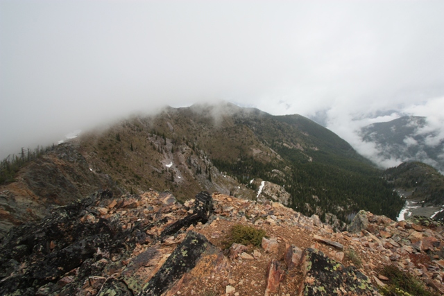
We arrived at Point 6853’ and made the short descent to a saddle before heading up toward Point 7177’. From the top of Point 7177’ we got our first view of Gypsy Peak. You can also look down to Watch Lake and over to Point 7033’, the next ridge hump...
|
Pt.7033', Gypsy Peak and Watch Lake from Pt. 7177' |
|
|
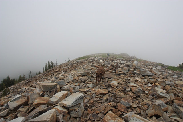
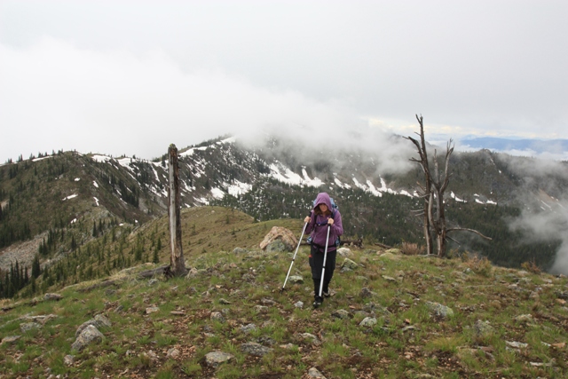
We began the 300’ descent to the saddle between Point 7177’ and Point 7033’ then hiked over Point 7033’ and descended another 300’ to the final saddle before Gypsy Peak. The hike up the ridge to summit is largely on scree and talus. The summit views were limited by cloud cover but we could look down the steeper north face to Gypsy Lakes.
|
View from the summit of Gypsy Peak on a cloudy day |
|
|
On the return to the trailhead we took a couple of variations. From the saddle between Point 7033’ and Point 7177’ we ascended slightly then made a near level traverse over to the saddle between Point 7177’ and Point 6853’. Since the clouds had lifted in the Leola Creek basin so we could see where we were going. From the saddle between Point 6853’ and Point 6617’ we kept right of a small boulder field then hiked toward the larger trees along the creek. After some light bushwhacking we stumbled upon a campsite where we picked up a faint path on a little rib just north of Leola Creek. This quickly took us back to the Sullivan Mountain trail.
The next peak on our list was Abercrombie Mountain which is also in the Selkirks. We headed north from Colville on Aladdin Road and followed this north for about 25 miles to Deep Lake Boundary Road. We took a right and followed this road about 7 miles to Silver Creek Road (turns into FSR 7078) where we took another right. Following Silver Creek Road for about 6 miles we reached a junction with FSR 300 and took a left. At the end of FSR 300, about 3.5 miles, there is a small trailhead for the Baldy Trail (FST 117).
The hike begins on an old road in dense forest. At about a mile and a half the Baldy Trail reaches a junction with FST 119. Still in the trees the views finally started to open up around 6500’. We were below the clouds so thought we would get some views but about the time we gained the broad south ridge the clouds enveloped the summit.
|
No view from the summit of Abercrombie Mountain |
|
|
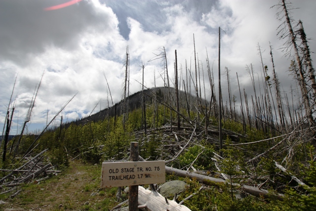
We had one more summit to hit before making the drive back, Copper Butte in the Kettle Mountains near the town of Republic. About 4 miles east of Sherman Pass we turned north onto NFS 2030 which we then followed for a little over 7 miles where we turned left at a sign saying “Old State Trailhead.” The trailhead is a short distance up this spur road.
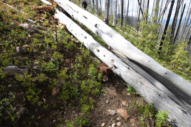
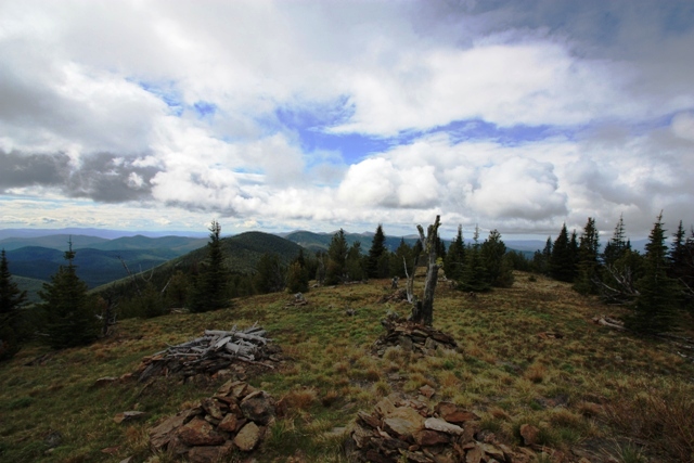
The hike begins on what was the first state highway in Washington but is now FST 75. In about 2 miles FST 75 reaches a 6040’ saddle and the junction with the Kettle Crest Trail (FST 13.1). Heading south on the Kettle Crest North we hiked through the devastation left behind by the White Mountain Fire. There are a lot of snags and of course some of them fall across the trail so you will probably need to crawl over or under a few. About a mile from the saddle you will reaches the site of the old lookout and the summit. The views from the summit are worth the small price you we paid to get there.
|
Charred remains on Copper Butte from the 1988 White Mountain Fire |
|
|
|
Negotiating fallen trees any way you can |
|
|
|
View from the summit of Copper Butte |
|
|
References:
USGS Gypsy Peak 7.5" Quadrangle
USGS LeadPoint 7.5" Quadgrangle
USGS Abercrombie Mountain 7.5"Quadrangle
USGS Copper Butte 7.5" Quadrangle