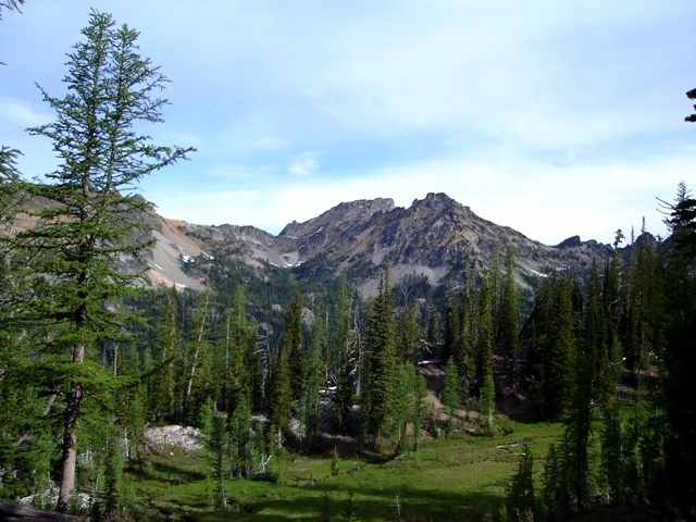
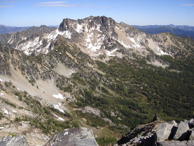
Saska and Emerald Peaks from the Pyramid Mountain Trail
The forecast was for a one day window of good weather. Hoping the window would last a little longer on the east side of the crest I headed to the North Fork of the Entiat River. I had four summits on my list but the weather window ended up being shorter than I had hoped.
After a 4 hour drive from the Seattle area I arrived at the North Fork Entiat River Trailhead (c.3900’). The trailhead is reached by driving the Entiat River Road for 33 paved miles then 4 miles on a well signed gravel road (FSR5606) to the right.
I started hiking around 4:30 PM under mostly clear skies but the temperature was nice for the 9.2 mile hike to camp. My plan was to hike to the small basin between Saska and Emerald Peaks. The following morning I would hike to Pinnacle Mountain then climb Saska Peak and return to camp. The next morning I planned to climb Emerald and Cardinal Peaks before returning to the trailhead.
The first several miles of the trail are rather flat and a bit boring. I reached the first junction with the Pyramid Mountain Trail in 1.2 miles and the junction with the Pugh Ridge Trail at 2.7 miles. At 6.1 miles there is a junction with the trail to Fern Lake. In about a mile the trail starts going up gaining about 1000’ of elevation before reaching the second junction with the Pyramid Mountain Trail at 8 miles. I turned left and began hiking the Pyramid Mountain trail. There is a good campsite after a couple hundred yards but I passed and continued on for another mile to the 6900’ basin between Emerald and Saska Peaks. There weren’t any obvious camp spots but there are a few good spots on the rock outcrops to the left of the trail after you cross the stream.
|
Saska and Emerald Peaks from the Pyramid Mountain Trail |
|
|
I awoke the following morning with clear skies… it was promising to be a hot day. I departed camp around 8:00 AM and hiked to Saska Pass (c.7400’) then the 2.2 miles and 1600 loss of elevation to the junction with the Emerald Park Trail at 5800’… arg. Taking a right on the trail I followed it north for 0.6 miles to the junction with the not too well traveled trail to Borealis Pass. I began following, or at least trying to follow the trail. There were a lot of hints along the way (blazes in the trees then cairns above) that kept me from getting too far off course as I found my way to 7600’ Borealis Pass.
|
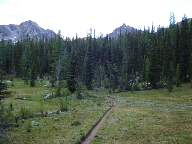
Pinnacle Mountain (Behind) from below Saska Pass |
|
|
I dropped down about 50 feet on the west side of the pass then began traversing north toward Pinnacle Mountain. From a small saddle (slightly lower than Borealis Pass) between Pinnacle Mountain and Borealis Pass scree, scree and more scree reached a final easy ridge to the summit (a little class 2 but mostly hiking, 3.5 hours from camp).
|
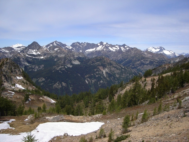
Glacier to Bonanza from above Borealis Pass |
|
|
|
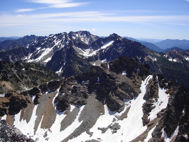
Emerald, Cardinal and Saska Peaks from Pinnacle Mountain |
|
|
After descending to the saddle I took a short gully followed by a short traverse to the right then down talus and meadows to intersect the trail around 7000’ (this saved quite a bit of time on the descent and could also be used on the ascent). By 2:00 PM I was back at Saska Pass.
|
Saska and Emerald Peaks from Saska Pass |
|
|
After descending to the first switchback east of Saska Pass I started up talus and heather to a basin between a SSW ridge and SSE ridge. At first the way was not obvious and I couldn’t decide which ridge the description was referring to… it seems like it contradicts itself. I continued up hoping things would become clearer… they did when I got high enough in the basin to see the broad gully reaching high on the SSW ridge. I went up the hard and somewhat steep scree gully to the ridge crest where things got a little more interesting.
The description said to go onto the west side of the crest but the east side looked better to me. I started out in sort of a chimney then on ledges and finally up another chimney back to the ridge crest. I followed the crest for a little bit then dropped briefly to the north side just below the summit. The rock on Saska is of poor quality and the ridge is exposed at times (class 2/3).
|
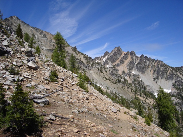
Cardinal Peak from Saska Peak |
|
|
I decided to go down the SSE ridge which I didn’t find to be a better option but it certainly can be done (class 3 with more routefinding problems and scrub trees. I returned to camp around 5:00 and called it a day. The weather looked like it was going to hold.
I poked my head out of the tent around 5:00 AM the next morning. The brightest stars were visible in the early dawn light. It looked like I was going to have another day of good weather. At 7:00 AM I got up to find all the summits now hidden in the quickly lowering clouds. I decided to pack up. By 7:30 the clouds had filled the basin and by 8:00 the scattered showers began. I reached the trailhead by 10:30 and drove 4 wet hours home.
References:
Cascade Alpine Guide, Volume 2, 2nd Edition; Fred Beckey; Pages 181-183, 184
75 Scrambles in Washington; Peggy Goldman; Pages 107-112