South Ingalls Peak-A Consolation Prize


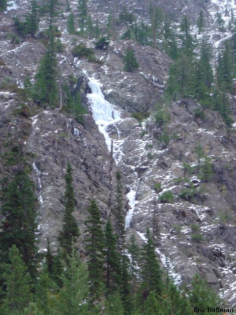
A Patch of Ice Hanging Above the Trailhead


Andy Johnson and I decided to travel to the Stuart area with the hope of climbing North Ingalls Peak. We knew that there was a possibility that this route would not go at this time of the year, but we wouldn't know for sure unless we tried. Ingalls Peak has appeal, too much, which made this time of the year an attractive time to try to climb it.

The standard route is the south ridge, which offers a few pitches of low 5th rock climbing with a couple of variations possible. We also entertained the idea of climbing the gully in the SW face. Unsure of the conditions on the route, we brought everything including a wired kitchen sink. I had been misled, again, by the guidebook without an index. The route is not 8 miles round trip. It is 4 miles to reach Ingalls Pass and roughly another 1.5 miles to reach the summit. Consult Greentrails Map #209, Mount Stuart.

Andy and I arrived at the Esmeralda Basin Trailhead later than we should have given the time of year and the conditions. Chunks of ice, some looking climbable but possibly difficult to access and get off, hung on the slopes above.


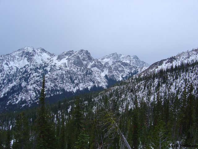
Esmeralda Basin and Hawkins Mountain From the Trail to Ingalls Pass


We started hiking the Esmeralda Basin Trail (FST 1394) a bit before 8:30am. In 0.4 miles we turned and followed Ingalls Way Trail (FST 1390). In another 2 miles we reached the junction with Long's Pass Trail (c.5600'). I was happy to not be going up and over Long's Pass this time. We followed Ingalls Way trail to Ingalls Pass (c.6500'), about 1.5 miles from the junction. On the way to the pass we passed two climbers heading down who had hoped to climb the North Ridge of Stuart...hmmm. Andy and I laughed at the thought, not knowing we too would return empty handed but at least we made it past the lake.


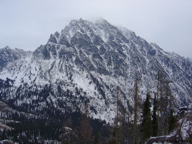
Mount Stuart from Ingalls Pass


There is a junction at the pass. The right fork descends to a camp and then ascends to Ingalls Lake. The left fork contours to the lake and is the better option if Ingalls Peak is your objective as it appears shorter and has less elevation loss. Note that the trail to the right is not shown on the Greentrails map but is shown on the Mount Stuart 7.5 minute USGS.

We left the pass and hiked toward the lake. Not sure what route would be best to reach the saddle between the North and South Peaks, we ended up hiking all the way to the lake. We stopped there briefly then back tracked a couple hundred feet where we started scrambling up icy slabs. Sometimes the slabs were bare and dry but more often they were covered with light fluffy snow and water ice. After a few hundred feet we dropped into a gully on our left where cairns indicated that we were on the route to the saddle. A few hundred feet higher we crossed a rib descending slightly into a gully on our right. This gully continued to the saddle. It was well after 12:00pm when we arrived.


North and East Ingalls Peaks


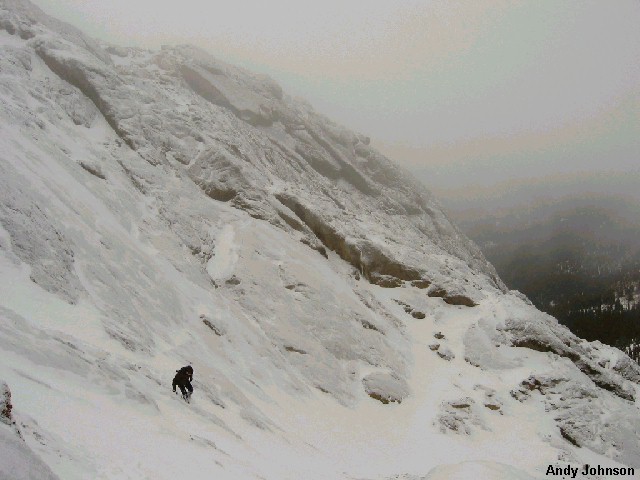
Andy nears "Dogtooth Crags", Ingalls Lake and Mount Stuart in Background


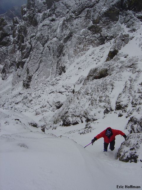
Andy in the Snow on South Ingalls Peak


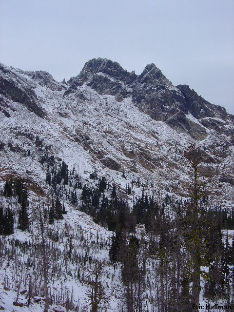
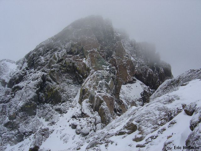
The South Side of North Ingalls Peak


The conditions on the North Peak were less than ideal. The cracks were largely filled with snow and ice and the slabs looked treacherous. There wasn't enough snow to turn it into a snow climb. It was going to be a scary mixed climb if we proceeded. We decided to take the consolation prize to the south.

We put on crampons and began traversing the west side of the north ridge of the south peak. After about 150 feet we turned and climbed up a gully (class 3, unconsolidated 45 degree snow and some ice) to gain the ridge crest. The remainder was hiking to the south summit where no views awaited due to the increasing cloud cover.

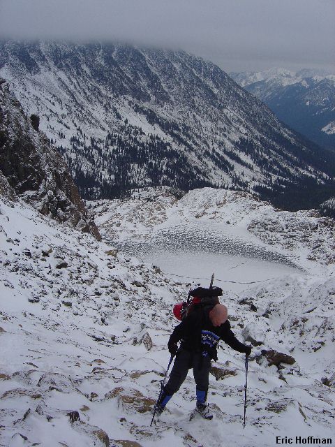
Me descending the South Peak


We descended back to the saddle where we took off our crampons and began descending toward the trail. We avoided the slabs by traversing right to a talus gully, which wasn't much better than the slabs. The remaining hike out was uneventful.

We stopped in Cle Elum where the family that breeds together goes to live...okay, some of them stay in Algona. Here we got a really bad burger before the trip over Snoqualmie Pass. Save your time, money and health by not stopping!

References:
Cascade Alpine Guide, Volume 1, 2nd Edition; Fred Beckey; Pages 286-289;
Climbing Washington's Mountains; Jeff Smoot; Pages 185-189