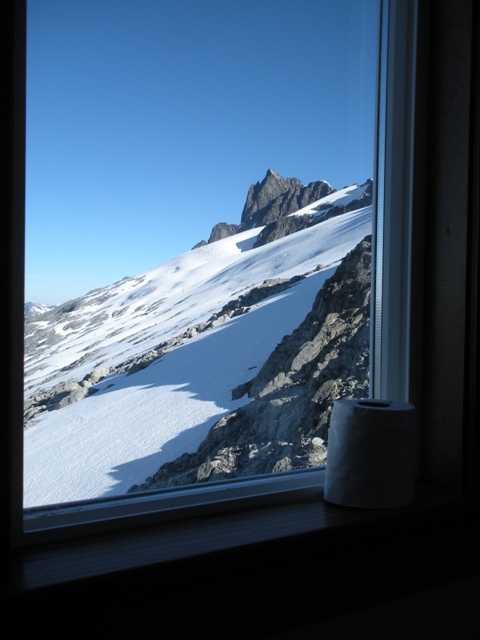
The North Face of Serratus Mountain on the flight in
The Tantalus group has to be the least remote, remote group of mountains in the BC Coast Range. A simple bridge in the right location would make access reasonable but instead there is a cable car that is not open to the public� some have crossed the cable which is illegal and from what I have heard fairly difficult. The Sigurd Creek route can be used to access some of the northern peaks in the group such as Pelion, Ossa, Zenith and even Tantalus but it is long with much elevation gain and and loss. It would be very difficult to get to the southern peaks in the group� such as Serratus and Alpha Mountains. An alternate means of transportation, namely a helicopter, might be considered. Having never been on a helicopter and having had my eye on the Tantalus group for a long time I definitely considered it.
With the Sea-to-Sky Highway temporarily closed due to a large rockslide, Sergio and I were forced to take the alternate route to Squamish. The lengthy detour through Hope, Lillooet and Pemberton took several hours longer than the Sea-to-Slide Highway but we eventually reached Squamish where we grabbed a room at the Squamish Hostel, after all, this trip was all about luxury.
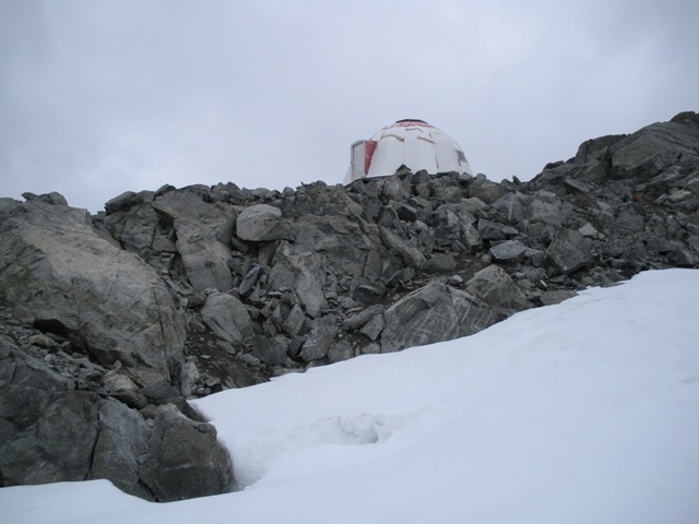
The following morning we arrive at the Squamish airport and headed into the Black Tusk Helicopter hanger (http://www.blacktuskhelicopter.com). The round trip flight cost us $300 each. The weather was not as good as we had hoped but the pilot was willing to fly and the forecast for the next few days was for sun. Our destination was �Red Tit Col.� Since this trip was all about luxury we had no intention of staying at the hut that the col was named after but the new Jim Haberl hut would suffice. We lifted off and quickly gained elevation as the pilot flew between clouds. In only a few minutes we were dropped off at the doorstep of the hut (ca.6800�). The hut was built in memory of Jim Haberl who was an accomplished mountaineer whose achievements include the first Canadian ascent of K2. Tragically, Jim was caught by an avalanche while climbing in Alaska.
|
The North Face of Serratus Mountain on the flight in |
|
|
|
The col's namesake |
|
|
|
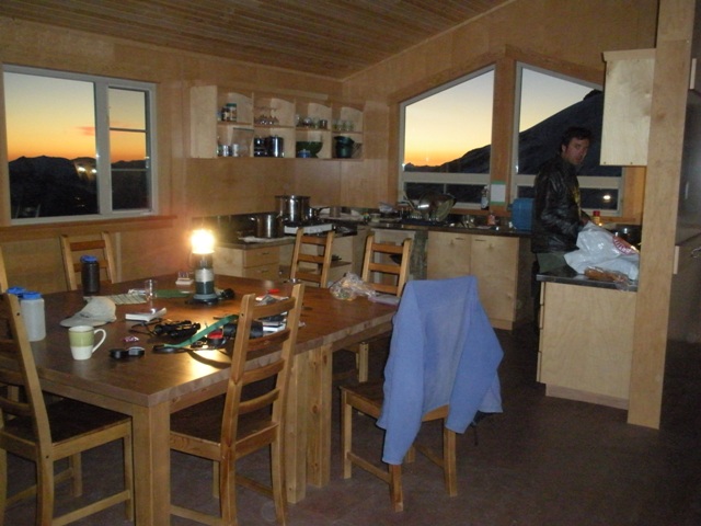
Inside the Jim Haberl Hut |
|
|
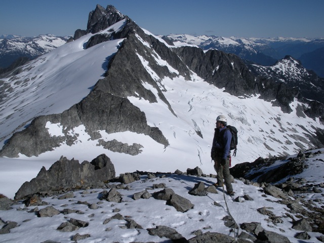
That day the weather deteriorated with increasing wind, occasional snow showers and thick clouds but as forecast the weather did a complete turn around and by early evening we were trying to scope out the West Face route on Serratus. The entire face looked loose with no distinct lines. With no debate we decided the North Face route is a far more attractive option and that would be the objective the next day.
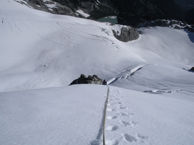
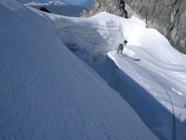
From the hut we descended ca.300 feet until we could traverse to the north face. Beginning up the face we negotiated a couple of crevasses then were forced onto a rock outcrop. After about 25 feet on the outcrop we were able to climb a short arete that took us to the bergshrund which was easily passed on the left. Above the bergshrund there was a short 45-50 degree pitch before arriving at the summit area.
|
Climbing the arete on the North Face of Serratus Mountain |
|
|
|
Passing the burgshrund |
|
|
|
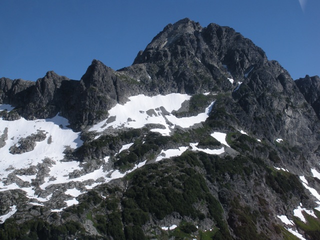
Tantalus and Dione from the summit of Serratus |
|
|
After enjoying the summit for a while we decided to descend the route recommended and trivialized in Alpine Select. We descended south down a class 3 gully with enough new snow to make it a pain. This gully ended at a notch and the main descent gully dropped steeply to the east. There were a number of steep steps in this gully that we had to rappel before we could descend 40 degree snow for a few hundred feet to the Serratus-Ionia col. I agree with Bruce Fairley that the north face is likely the quickest was up and down Serratus.
We had hoped to climb Alpha Mountain via the SW route after descending from Serratus. Between the descent of Serratus, the long traverse over to Alpha and the look of the SW route the idea lost appeal... or maybe heading back to the hut for beer, barbaqued brats and tring the East Ridge the following day was just more appealling. From the Serratus-Ionia col we crossed through the col, made a short descent then traversed and climbed back to Red Tit Col.
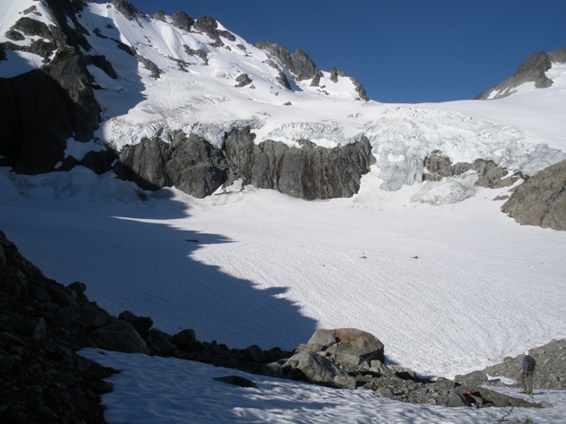
The following morning we descended the Serratus Glacier ca.1600 feet to the large flat area below the icefall. Other than a short narrow ice finger between the icefall and cliffs getting to the flat was straight forward. From the flat we gained the smaller glacier on the on the north side of Alpha. We traversed and ascended to an obvious notch in Alpha�s North Ridge (ca.6500'). Once through the notch we continued traversing and climbing to gain the East Ridge at ca.6800' where we changed travel modes from glacier to rock.
|
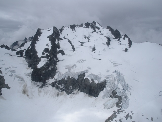
The North Face of Serratus on the way to Mount Alpha |
|
|
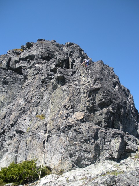
The first 100� of the ridge was class 3 or easy 4th and we quickly arrived at the crux of the route, a short overhang with a jam crack rated 5.7. Sergio was leading from a fixed belay and decided to take a look around the corner to see if there were other options. Eventually, Sergio called down to me that he was off belay� it was my turn. The alternate route that Sergio took was probably harder than the jam crack with some very awkward moves. The final move to the belay was a stemming move that vertically challenged people may find difficult� actually you will probably find it difficult even if you aren�t. Improvising, I finally make it to Sergio and join him on the ridge.
The remainder of the route was enjoyable climbing on mostly class 3 and 4 with a 5th class moment here and there. There is a false summit about 100 yards before the true summit that requires a short downclimb. Keeping right of a small tower between the false summit and the true summit allows you to gain a ledge that is a far better option than descending into the gully on the left. Easy scrambling leads to the summit from there.
|
Sergio on the East Ridge of Mount Alpha |
|
|
|
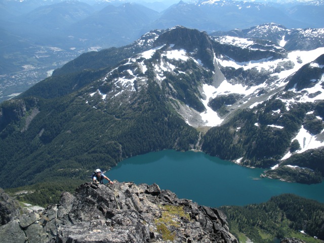
Lake Lovely Water from the East Ridge of Mount Alpha |
|
|
Like Serratus the descent route was a bit of a pain. The goal is to descend SW to a flat section of the ridge then drop down the south side on steep heather and brush to a rappel station. One rappel reached an undermined snow patch on the south side of Alpha. A long traverse (ca.1.2 miles) on snow and scree leads to the Serratus-Ionia col.
|
A final view of Tantalus before our pickup - even the pit toilet was luxurious |
|
|
|
Mount Alpha from the flight out - East Ridge and SW route are visible |
|
|
References:
A Guide to Hiking and Climbing in Southwestern British Columbia; Bruce Failey; Pages 99-102
Alpine Select; Kevin McLane; Pages 154-161