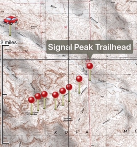
The route and where I parked
I was heading to Arizona to help my parents out and I don’t think they were too shocked to hear I was planning doing some hiking while I was in town. I had a couple of hikes on my list including Signal Peak in the Kofa Mountains and Castle Dome Peak in the Castle Dome Mountains. Both of these peaks are in the Kofa National Wildlife Refuge. KofA stands for "King of Arizona." The Kofa Queen Mine is an abandoned gold and silver mine in Kofa Canyon.
By all accounts getting to the "trailhead" for Signal Peak requires a high clearance vehicle. Although I don’t think the VW Tiguan I rented counts as high clearance it got me within about 2 miles of the trailhead. From Highway 95 I took a left onto Palm Canyon Road almost 20 miles south of Quartzsite. I followed this road for a little over 3 miles then turned left onto Kofa Queen Canyon Road. After about 5 bumpy miles I entered the canyon and the road got significantly worse. After about a mile I think I went right where I should have went left and not long after better judgement said it was time to park and hike the remaining distance to the trailhead. Had I gone left I think the Tiguan may have been able to to make it all the way to the trailhead with carefull driving.
|
The route and where I parked |
|
|
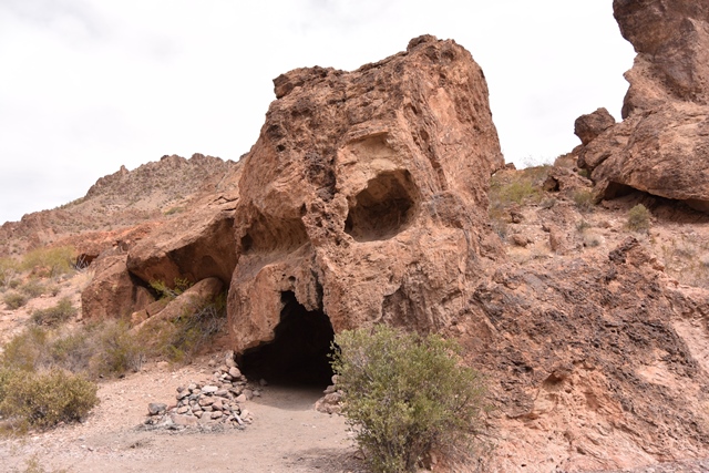
I stated Hiking up Kofa Queen Canyon and eventually the track I was on merged with the track to my left. After about a mile and a half I came upon Skull rock that is mentioned in many trip reports. It was a little over a half mile from Skull Rock to the unofficial trailhead at Ten-Ewe Canyon.
|
Skull Rock |
|
|
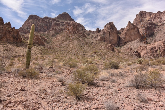
I started up the Ten-Ewe canyon and after a couple hundred yards left the wash and located a faint path on the right. As I continued the trail became more distinct and steep as it veered into Indian Canyon. Eventually I reached some short lived class 2 scrambling then up to what is sort of a notch although Indian Canyon continues toward Signal Peak.
|
Looking toward Indian Canyon from Ten-Ewe Canyon |
|
|
|
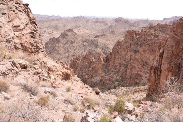
Looking down Indian Canyon from the notch |
|
|
From the notch the path descends slightly and continues up Indian Canyon. Eventually the path reaches a steeper headwall then continues to a ridge near the summit. Wow! The view from the ridge is impressive compared to the views in Indian Canyon. From here the summit is only a couple hundred yards or so. It had taken less than 3 hours from the car to get here. I returned by the same route.
|
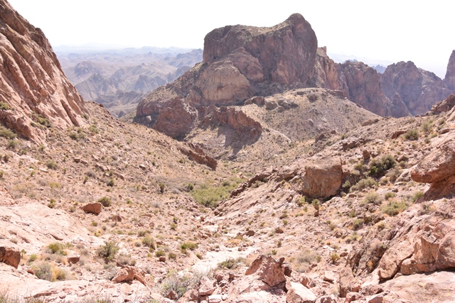
Looking down Indian Canyon towards Ten-Ewe Mountain |
|
|
|
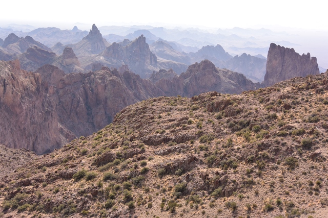
View of the Kofa Mountains from the summit of Signal Peak |
|
|
|
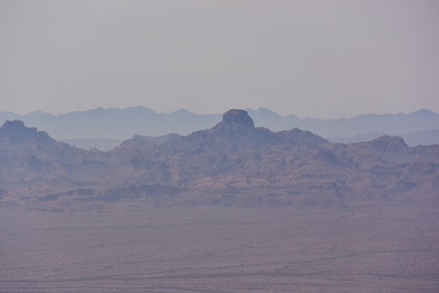
Castle Dome from Signal Peak |
|
|
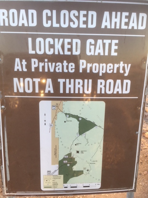
A few days later I planned on scrambling up Castle Dome Peak but found that Castle Dome road was now gated. Apparently this was a recent change that been in the local newspaper a week or so ago. The alternative route would be from Kings Road then several miles of rough road that will probably take a significant amount of time to negotiate and almost certainly a high clearance vehicle. Yuma Sun News Article
|
Castle Dome road closure sign |
|
|
References:
Summitpost Signal Peak Page
Summitpost Castle Dome Peak Page