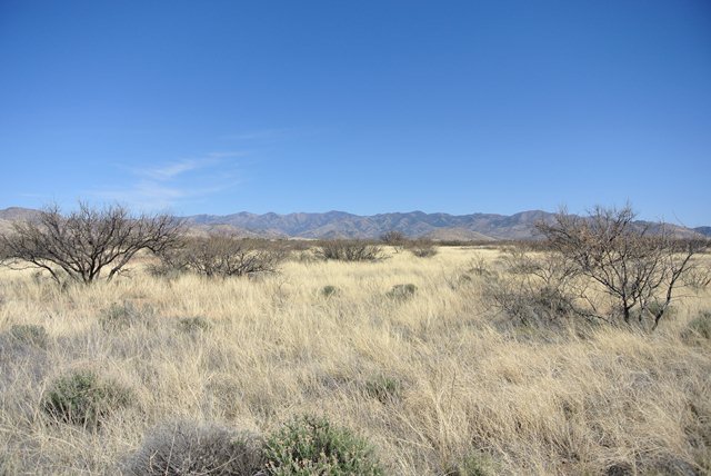
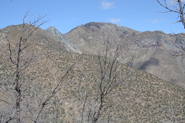
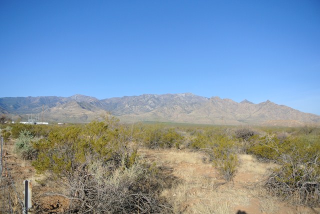
Mount Graham and the Pinaleno Mountains from the Northeast
I found myself in a use it or lose it situation with Southwest Airlines so I figured I might as well get out of the wet northwest and head someplace dryer and warm so I flew in to Sky Harbor in Phoenix and set sail for the Sky Islands...
My first destination was Mount Graham near the town of Safford. Allegedly, the summit area is closed to public travel without a permit in an effort to save the endangered Mount Graham red squirrel but there were no signs. I am not sure how a person walking up the forest service road would have any impact on the lives of the Mount Graham red squirrels but I am pretty sure the fire that scarred much of the area did.
Located in the Pinaleno Mountains Mount Graham has the most prominence of the Arizona Sky Islands. The most obvious route is via the access road to the Mount Graham International Observatory, forest service road 507. I was able to drive road 366, aka the Swift Trail, to the junction with 507 at an elevation of 9150 Feet. A gate here stopped further travel by car. From here it is about 5 miles to the summit. I found no real views and some soft patches of snow on the not dwell traveled road. Once in the general area of the summit you can see the observatory and a spur branches to the right. I followed this spur to the summit (10,724 Feet) where there was a wet summit register and no view.
|
Mount Graham and the Pinaleno Mountains from the Northeast |
|
|
The next day I was off to the Chiricahua Mountains to hike to the top of Chiricahua Peak (9,759 Feet). There are a few options available to hike to the summit. I chose the Mormon Canyon route primarily because it was shortest and easiest to get to. Near the town of Sunizona, if you want to call it a town, I located Turkey Creek Road. Following this road for a little over seven miles I located the Mormon Canyon Trailhead (ca.6400 Feet) not far beyond the Sycamore Campground.
|
The Chiricahua Mountains from the West |
|
|
|
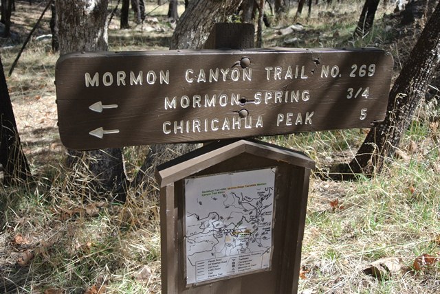
The sign at the trailhead for the Mormon Canyon Trail |
|
|
The map at the trailhead showed much of the route to be a 4 wheel drive road but this was far from true once you got past Mormon Spring at 0.75 miles. Beyond there much of the trail has washed out and becomes hard to follow in the burned up forest. Further up the trail the canyon turned into more of a basin where I lost the trail and consulted a map. Veering left I located the trail in a mess of burned and fallen trees and followed it to the junction with the Mormon Ridge Trail.
|
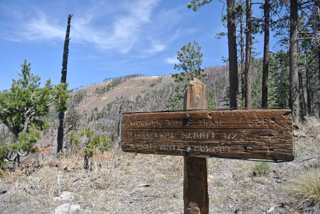
The sign at the Junction with the Mormon Ridge Trail |
|
|
From this junction the map indicates you can go a couple of different ways. I chose to go right to Chiricahua Saddle primarily because this was the only obvious trail. In a half mile I arrived at the saddle where the Mormon Ridge Trail meets the Crest Trail.
|
The sign at the junction with the Crest Trail at Chiricahua Saddle |
|
|
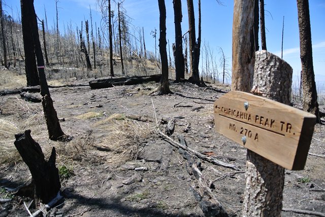
From the saddle I headed north on the Crest Trail, again the map showed other options but they seem to be long gone. The Crest Trail traverses below the summit and is rather overgrown with grass and some type of thorny bushes. By the time I reached the junction with the Chiricahua Peak Trail I was thoroughly scraped up.
|
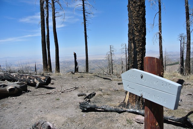
The sign at the junction with the Chiricahua Peak Trail |
|
|
Bring pants on this hike! From the junction I followed the faint trail to the wooded summit where there was once again a summit register but no view.
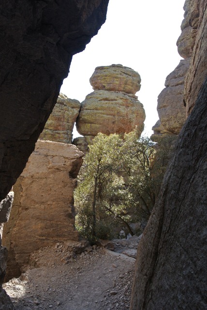
I got back to the trailhead and still had enough time and energy to hike through the Hoodoos on the 3.5 mile Echo Canyon Trail at Chiricahua National Monument before heading to the nearest civilization. The monument is a worthy destination if you are in the area and unlike Chiricahua Peak the trails on the map still exist.
|
Hiking among the Hoodoos at Chiricahua National Monument |
|
|
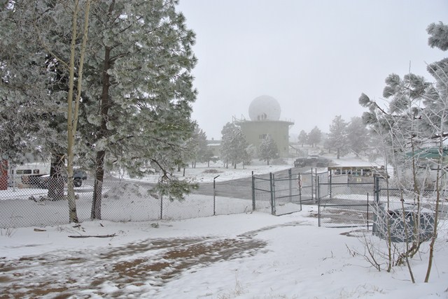
The next 2 days were windy with gusts up to 60 miles and a few showers rolled through but not enough to keep the sky from turning brown in the blowing dust. One day I drove to the summit of Mount Lemmon in the Santa Catalinas. The next day I found enough tourist traps to keep me occupied...
|
Sign on the road to Mount Lemmon |
|
|
|
The University of Arizona Observatory on the summit of Mount Lemmon |
|
|
|
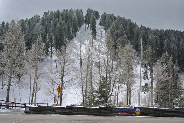
POWDER ALERT! Ski Valley Arizona |
|
|
|
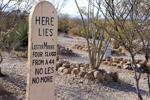
Lester Moore's headstone at Boot Hill Cemetary, Tombstone, AZ |
|
|
|
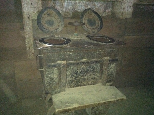
An "S" Car in the Copper Queen Mine... Use your imagination |
|
|
Once the dust settled it was back to get back to hiking on Sky Islands. Next on my list was Miller Peak in the Huachuca Mountains. Reports from far less than a decade ago described this area as a highway for illegal immigrants who left an abundance of trash behind. I was pleasantly surprise to find this to no longer be the case. With the exception of one item left behind on the summit that you could argue is trash I saw no trash and no illegal immigrants.
There are 3 obvious options to get to the 9466 Foot summit of Miller Peak. I decide that the route from Montezuma Pass in the Coronado National Monument looked like the best way to go. The terrain is much more open than on the previous Sky Island summits but it is forested in places. 5 miles later I arrived at the summit where there was a view down to the valley floor.
|
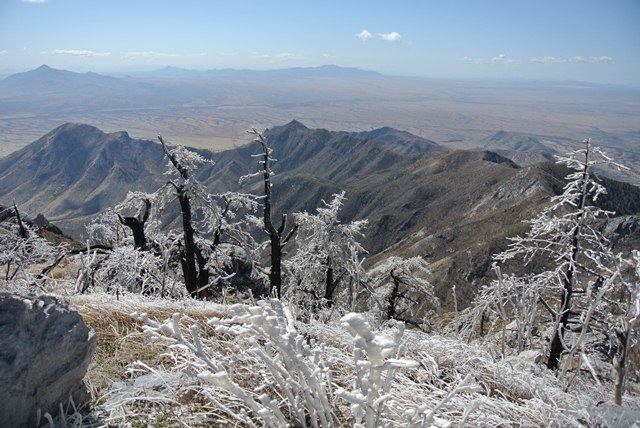
Rime Ice near the summit of Miller Peak |
|
|
|
No summit register, just this... |
|
|
|
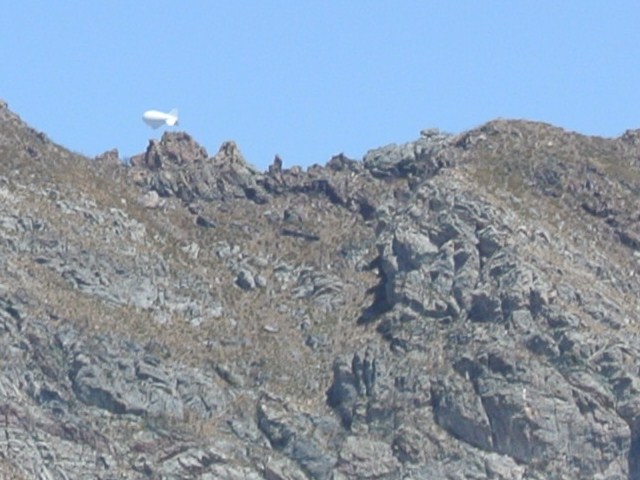
Looking back at Miller Peak. What's that? |
|
|
|
A UFO hovering near Miller Peak |
|
|
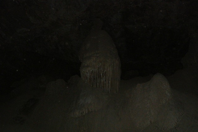
If you are into caves there is Coronado Cavern not far away. A half mile hike leads to the cave entrance where a short scramble gets you inside. There are no lights in this cave and there was no one else there. It was easy to become disoriented so it was good to know it was only 600 feet long. The more interesting cave in the area is at Kartchner Cavern State Park. This cave discovered by spelunkers in the �70s so unlike many caves that feature great formations it has not been abused. Unfortunately, photography is not allowed.
|
Formation in Coronado Cavern, Coronoda National Monument |
|
|
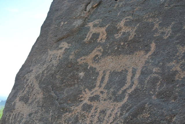
I still had a day left so I decided to check out the Superstition Mountains. The "Supes" are perhaps the most visited of the Sky Islands partly because of their location and partly because they are much more rugged than many of the others. I hiked up Hieroglyphic Canyon 1.5 miles to check out a route to a summit on Superstition ridge unofficially known as Carny but the route up looked like a desert bushwhack from hell.
|
Petroglyphs in Hieroglyphic Canyon |
|
|
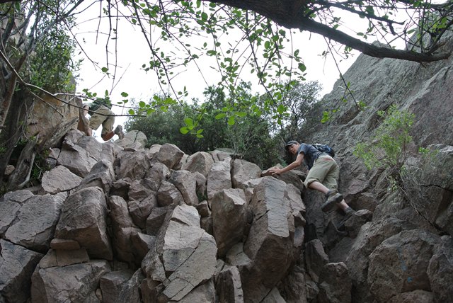
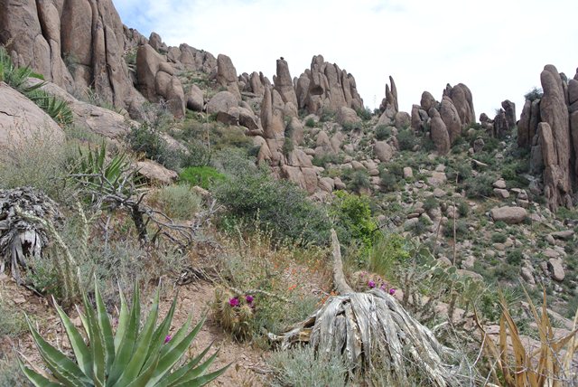
So Syphon Draw to The Flatiron it was. I paid my $7 day use fee at Lost Dutchman State Park and was on my way along with a lot of other people. From the parking area (ca.1900 Feet) the hike is flat for a ways then starts to steepen as it reaches the draw. Once in the draw proper the trail becomes a mix of hiking and scrambling for the next 2000 Feet until finally ending below a saddle. There are faint use trails going off in all directions from here but an obvious well used trail leads to the feature known as The Flatiron (4860 Feet). The rock formations and desert bloom made this a worthwhile destination.
|
Scrambling at the top of Syphon Draw |
|
|
|
Interesting rock formations on Superstition Ridge |
|
|
References:
Summitpost.com