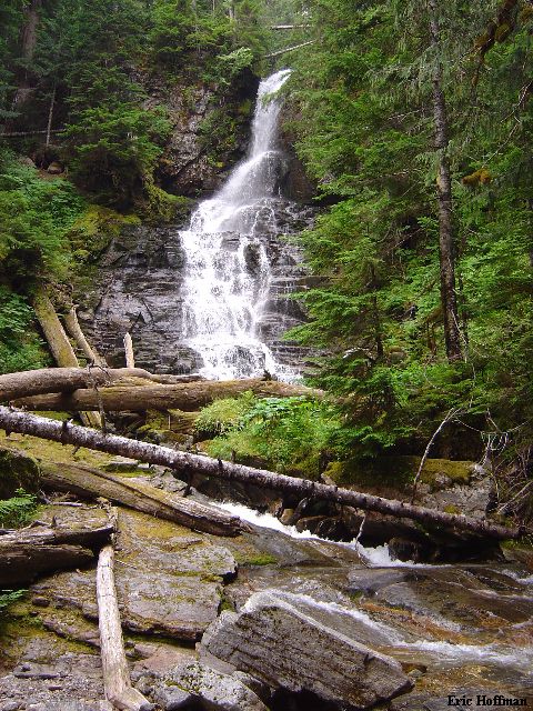
The Waterfall at c.1.5 Miles from the Trailhead

I met Chris Mattson and Chris Shultz (my boss) in Federal Way at 5:00pm then headed for Factoria where we picked up Max Emrick, (my boss's boss) who was standing at the on ramp to I405 looking homeless. We were headed for Starbucks and the Sloan Peak Climbers Trail Trailhead. The long name implies that a parking pass is required but the trail will keep you wondering why. The plan was to climb the Corkscrew route on Sloan Peak, a route that Chris Mattson and I had climbed on August 24, 2000.
We arrived at the above mention trailhead by 7:30am and started hiking in our Tevas around 7:40am. We hiked a few hundred yards where flagging on our right indicated it was time to head downstream. We followed more flagging, ignoring some, through brushy and mushy river valley. Eventually the flagging turned and headed back upstream and to the ford of the N. Fork Sauk River. At times I wished I was in boots. The water at the ford was neither deep nor swift, not unexpected given the time of year, the low snowpack and the recent cool temperatures.
Once across the N. Fork Sauk River, we all put on boots. We located the trail a short distance upstream where it headed into forest and brush for a few hundred yards then turned uphill to reach on old roadway. At the roadway we went in the direction the arrow constructed of rocks indicated, left. The trail followed the road for a few hundred yards then turned right...uphill. After about a mile from the river we reached a nice waterfall.
|
The Waterfall at c.1.5 Miles from the Trailhead |
|
|
We hopped across the stream below the waterfall and continued on the trail to reach a slide path at about 3 miles from the trailhead. Flagging helped keep us on track as we crossed to the left side. We continued up the trail and at near 4 miles crossed back to the right side of the same slide path we had crossed before. There were considerably more downed trees here, but once again, flagging showed the way. Once across this we soon reached a small basin and the end of the Sloan Peak Climbers Trail...
From the small basin we followed the steam bearing to the right. The trail leads up steeply to the right of a wide gully for several hundred feet then crosses a branch of the stream to the right to a rib in the middle of the wide gully (the gully was snow filled on the 2000 trip). We followed the spur up then took the path of least resistance (up and right) to a snow patch (icy in places) then a low point in the ridge separating us from the Sloan Glacier.
|
Glacier Peak and Red Mountain from below the Sloan Glacier |
|
|
Once across the ridge we could see the glacier and began evaluating our options. The best bet seemed to be staying far right. We did this passing minor crevasses to a rock band. In 2000, we passed this on the left, this time we were forced to a right slanting snow ramp in the upper right side of the glacier. At this point we really were not on glacier at all. We traversed the snow shelf then rock then back on snow to the moat. We stayed near the east face as we traversed across the upper glacier (some minor crevasses).
|
Sloan Peak and the Sloan Glacier on August 9, 2003 |
|
Same
View on August 24, 2000
|
|
Traversing Past a Moat on the Sloan Glacier |
|
|
Once across the glacier we dumped the rope and other glacier related items. An obvious goat/climbers path leads across the south face then swings across toward the west face to a short gully. We ascended the gully then class 3 rock on left for about 30 feet where cairns led into the broad gully SW of the summit.
|
Chris M. and Max Round a Corner on the Goat Trail |
|
|
|
Chris M. and Chris S. Scrambling in the Gully |
|
|
After crossing the gully we climbed a few feet then traversed back into into it and climbed until reaching the summit ridge. More class 2 and 3 led to the summit. It was about seven hours since we left the trailhead. Aside from some routefinding issues after fording the river, the descent was uneventful. Twelve hours round trip.
|
The Monte Cristo Group |
|
|
|
A Fire NW of Whitechuck Mountain fills the Sauk River Valley with Smoke |
|
|
|
The Summit Photo |
|
|
References:
Cascade Alpine Guide, Volume 2, 2nd Edition; Fred Beckey; Pages 80-85
Selected Climbs in the Cascades; Jim Nelson and Peter Potterfield; Pages 109-113
Climbing Washington's Mountains; Jeff Smoot; Pages 118-122