The Bottom of the "Unforgettable Waterfall"
The Approach: The Unforgettable Waterfall and Lake Ouzel
I met Sergio early, well before 4:00am, then we were on our way to border. We had every intention of climbing a peak or two in the US, but to get there in a reasonable amount of time, a border crossing or four were going to be necessary. Two of the border crossings would be the expected hassle, the other two even more so.
After reaching Highway 1, we headed east until a few Kilometers past Abbotsford where we began following signs to Chilliwack Lake (56KM from the highway). The road continues around the lake's east shore. We took the second left fork (the main road is barricaded just beyond the fork). This fork follows Depot Creek for about 2 miles to an intersection where we parked (the road leading from the right has a bridge across Depot Creek and there is a small clearing where one can park). We parked at this junction. The final 2 miles are very rough and overgrown. The main road became even more brushy beyond here.
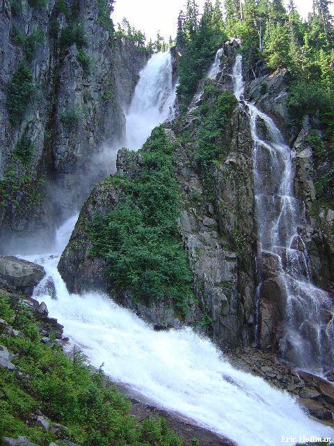
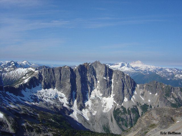
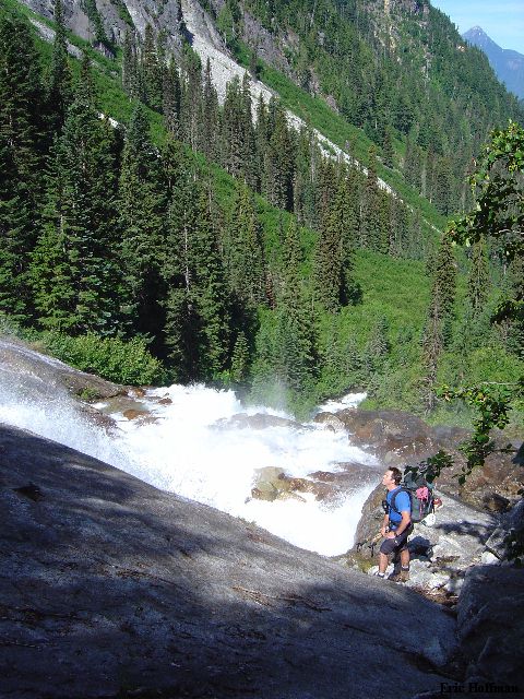
We hiked up the road (the road that you drove in on, not the one that crosses the creek) for a couple hundred yards then took a road to the left. This road reached another after a couple hundred more yards. We went right on this road, toward the boarder. After less than a mile the old road vanished entirely and the path quickly led to the border marker and a N Cascades National Park register. We signed into the register and continued on. For a good three miles the path wandered back and forth, and up and down through forest then through a few hundred yards of brush to the waterfall that Beckey describes as "unforgettable" (c.3800'). It does leave an impression.
|
The Bottom of the "Unforgettable Waterfall" |
|
|
After crossing a small steam at the base of the waterfall, we followed this small stream up a few feet to wet slabs and dangling handlines. After reaching easier (and dryer slabs above), we continued up until we arrived at yet another dangling handline on the left. We scrambled up to brush, talus and the continuing path. The path more or less parallels the waterfall to the top at c. 4800 feet.
|
The Top of the "Unforgettable Waterfall" |
|
|
Once above the waterfall the path drops a bit to a campsite near Depot Creek. A faint path leads left to forest and talus slopes. The faint path continues keeping on the north side of the large basin below Redoubt toward Ouzel Lake. The path eventually disappears altogether in brush and talus. After several hundred yards or in so in the talus and brush, it became just talus. We arrived at Ouzel Lake (+5640') around 12:30pm.
|
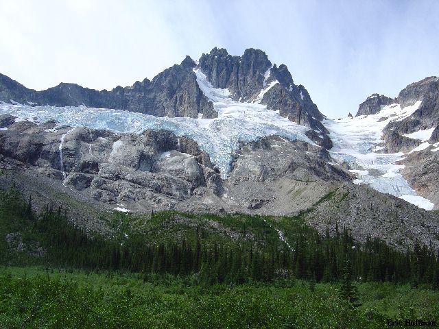
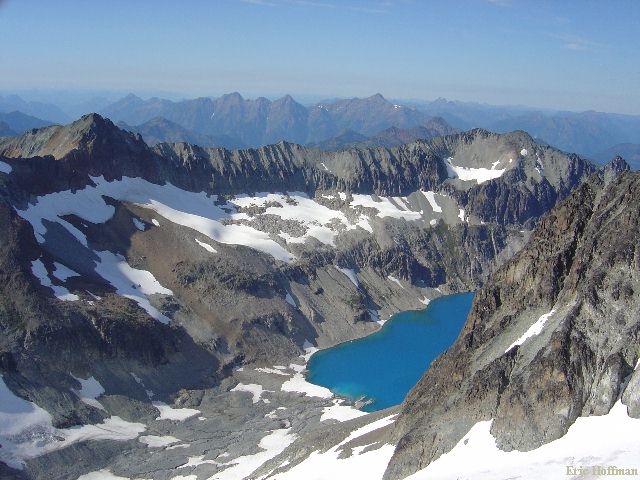
Mount Redoubt from the Route to Ouzel Lake |
|
|
Mount Spickard-South Ridge
A little before 2:00pm we started toward Mount Spickard. We had discussed two possible routes: the North Face and the South Ridge. The idea of not carrying a rope and other gear that we might need for the glacier on the north face was attractive considering we were tired from the approach. We decided to take the south ridge route which would require no rope (bring ice axe and crampons).
From Ouzel Lake we headed NE up the broad talus gully leading to the +7360' pass between Ouzel Lake and Silver Lake. After c.700 feet we climbed right out of the gully and headed west on talus to reach the small glacier SW of Spickard.
|
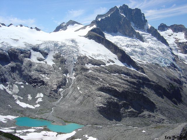
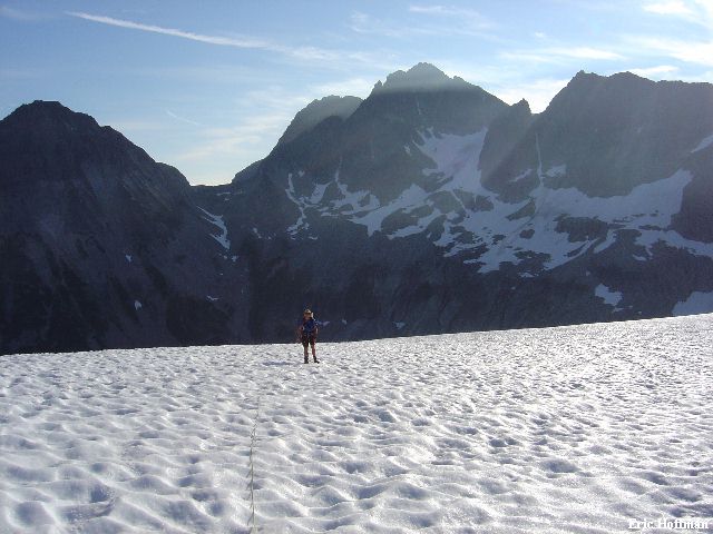
Mount Redoubt and Ouzel Lake from the Route Up Mount Spickard |
|
|
We headed up the small glacier passing one small crevasse near the top to reach the 8000' Col in the S/SW ridge of Spickard. After descending about 40 feet to the glacier on the south slope of Spickard we traversed a short distance to an obvious snow and rock gully. We climbed this for a few hundred feet, staying mostly on rock on the left side. At the top of the gully I traversed a snow patch while Sergio skirted around it on talus to the crest of the south ridge. We followed the ridge keeping on its right side until near the summit where we crossed to the left side for the final 100 feet to the summit. The climbing was less than spectacular but the views were good nonetheless.
|
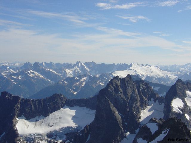
A View from the Summit of Spickard: Twin Spires (Mox Peaks) in Foreground, The Pickets in the Background |
|
|
|
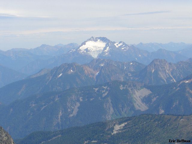
Jack Mountain-A Rare View of the Nohokomeen Glacier |
|
|
|
Custer, Rahm and Silver Lake From Mount Spickard |
|
|
We returned via the same route and found that camp had been overrun, not by rodents but by other climbers including Paul Klenke and Tom Sjolseth. Paul and Tom were planning on climbing Rahm, Custer and Spickard the following day and Redoubt the day after that. They would end up reaching thier objectives the following day but will have to return for Redoubt, no doubt in conjunction with a trip to the Twin Spires (all top 100s).
Mount Redoubt-Redoubt Glacier/South Face
We left camp at Ouzel Lake at about 6:20am. We crossed Depot Creek and climbed scree to the slabby buttress. The buttress was far easier than it had appeared from camp and we quickly reached its crest. After following the crest south we traversed slabs right until we could easily gain the Redoubt Glacier. The glacier was low angled with some hard glacier ice on the lower portion. We were heading for the +7760' col immediately south of the flying buttress SE of Redoubts summit. After a short rock scramble to cross the col, we traversed west and descended slightly on easy snow to a rock and snow gully. We caught up with 4 climbers who had left camp at the lake about an hour and a half before us at the base of the gully.
|
Mount Spickard from the Redoubt Glacier |
|
|
|
The Pickets from the Redoubt Glacier |
|
|
We climbed the gully (est. 300 ft) to a small cirque on the south face where we should have headed left to gain the snow and talus ridge. Instead we continued up the steepening gully (to about 50 degrees). I reached the top of the snow and then went left on crumbling red rock to regain the route proper at the base of a narrow couloir. I started up it veering left when it split. I continued up to a small notch were I got a view of many rappel slings around a chockstone in a cannonhole. A rappel sling above and to my right led me to believe that the summit was to my right and that I was on the wrong side of it (according to the guide you climb left to reach the summit). I would find out a bit later the summit was infact left of the cannonhole and that I was on route.
After descending the left branch of the gully I ran into Sergio and we headed up the right couloir to a notch on the ridge. We worked up and left around a corner (easy class 4, exposed) and soon arrived at the same cannonhole and chockstone I had seen from the left branch of the couloir. We crossed this then scrambled a few steep feet to the summit.
|
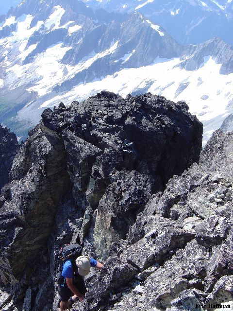
Sergio Verdina Near the Summit |
|
|
|
Bear Mountain from Mount Redoubt |
|
|
On descent we downclimbed to the cannonhole then lowered ourselves down a short step using a long sling that was tied to the rappel slings. After one more short step we traversed 20 feet to reach the top of the left branch of the couloir (not entirely obvious until you are looking down it). We downclimbed the couloir to reach a gravel ledge then went right until able to gain the snow and talus ridge. After descending the ridge for a few hundred feet we dropped into the south face cirque then retraced our steps back to camp. Allow at least 3 hours to descend from Ouzel lake to the parking area even if it only took you 4 hours to get there.
References:
Cascade Alpine Guide, Volume 3, 2nd Edition; Fred Beckey; Pages 131-133,
138-139, 392-393