The "Super-Secret
Shortcut" Exposed
www.topo.com
I met Sergio Verdina, Scott Harder and John Mefford at the Starbuck in North Bend early in the morning. A little after 6:00am we were on our way to Snoqualmie Pass, destination Mount Thompson. There is a bit of a discrepancy surrounding the name of the peak. It was named after R. H. Thomson and is shown with this spelling on the USGS map, but most references show the spelling to include the "p". However you want to spell it, the peak is probably the most difficult summit to reach in the Snoqualmie Pass area. Since I was bailing on a BBQ with the Thompson family to be here, I am obligated to spell it Thompson. The easiest route to the summit is the east ridge (class 3 and 4 with much scree). We used this route on the descent.
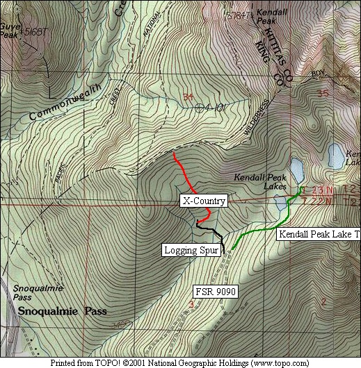
The approach from Snoqualmie Pass is long. I had been to the Kendall Peak Lakes Trailhead one rainy day (unofficial, no FS park pass required) to check out the possibility of finding a shortcut to the PCT from here. Scott was able to locate further information about a super secret shortcut. We drove I-90 to the Gold Creek exit and followed FSR 9090 for a few miles to a sharp switchback at c.4100' where the unofficial trail to Kendall Peak Lakes begins. From here we drove northwest on a bumpy, somewhat overgrown logging spur for more than a quarter mile where it ended at a logging platform. We followed a skidder track for several hundred yards (bears NNE along the edge of the clearcut) then headed Northwest though sometimes brushy forest to more open forest above. We reached the PCT at a very small saddle after gaining about 400 feet. We had managed to shave a solid 3 miles and 1100 vertical feet off the approach.
|
The "Super-Secret
Shortcut" Exposed |
|
|
We followed the PCT north reaching the Kendall catwalk in about 2 miles. In another mile we reached Ridge and Gravel Lakes. At about a half mile beyond the lakes we found ourselves directly below a notch. Here we followed a steep climbers path on the right side of a water course to reach the notch (Bumblebee Notch). We headed down the north side and deposited all unnecessary gear at a large boulder in the basin south of Mount Thompson.
|
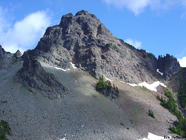
Mount Thompson from the South |
|
|
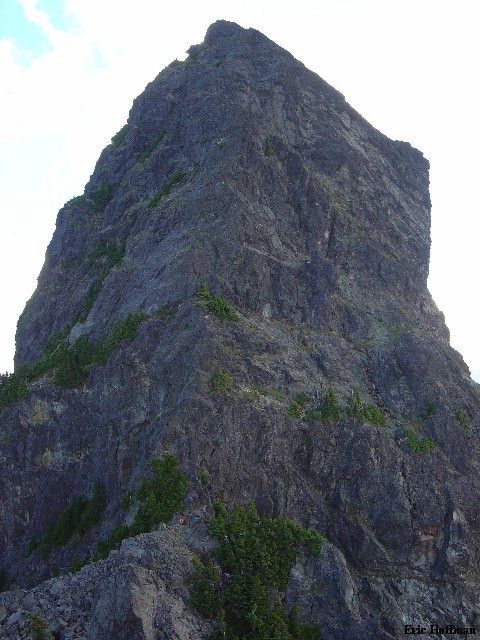
From the basin we headed NW up a talus slope and gully to reach the west ridge at c.6000 feet. I headed west to a minor point for a picture of the route. From where we had gained the ridge we climbed up a few feet (class 3) then traversed the north side of the ridge to a small notch where the climbing began.
|
The West Ridge of Mount Thompson...from the west |
|
|
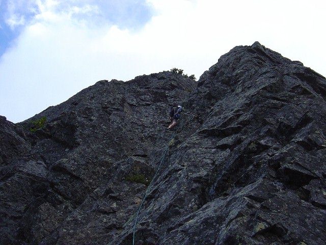
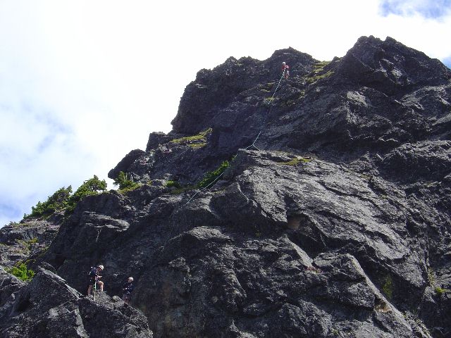
Scott , partnered up with John, took lead on the first lead from the notch. He traversed left into a chimney to climb past a small ledge then up to a big ledge with scrub trees. Just above this ledge he set a belay anchor and John followed. Sergio led the second rope, I followed. Sergio traversed left a few feet then worked into a chimney and up to a big ledge with scrub trees. Just above the ledge he set up a belay anchor and I climbed up. We had stretched this pitch to about 55 meters.
|
Scott Leading the First Pitch of the West Ridge |
|
|
The second pitch was short (30-40 meters) with low to mid fifth class on or near the crest of the ridge.
|
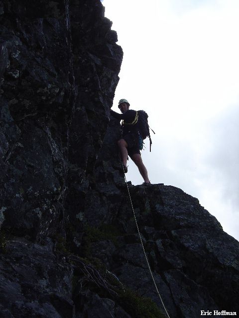
Sergio Leading on the Second Pitch |
|
|
The third pitch started from a belay at a dead tree (that sounds eerily like a Beckey description). After a bit of steeper climbing we crossed an easy slab to belay another short pitch. I thought this one was the trickiest but I'm not sure everyone agrees.
|
Sergio and Scott at the Top of the Third Pitch, John at the Top of the Forth |
|
|
From the top of the forth lead, Scott and John apparently crossed to the left side of the crest while Sergio and I went to the right. It sounded like the left side was quicker and easier than the circuitous route that we took. Whatever the case, we were all on the summit before 1:00pm. We started down the east ridge which is mostly class 3 with some class 4. A couple of rappels are feasible but we opted to down climb the upper portion then located a climbers path that led down the scree to a notch. From the notch a we descended a steep scree gully to the basin on the south side of Thompson back to our gear cache. From here we made a short ascent to Bumblebee notch and the subsequent descent back to the PCT.
|
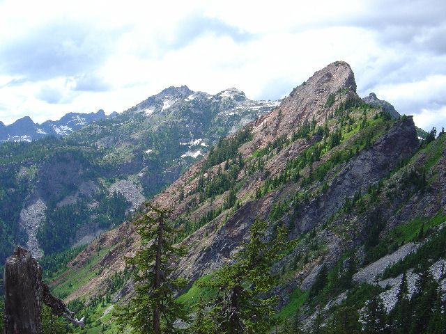
Snoqualmie Mountain and Red Mountain from the PCT |
|
|
References:
Cascade Alpine Guide, Volume 1, second Edition; Pages 160-161
Selected Climbs in the Cascades, Volume 2; Jim Nelson and Peter Potterfield;
Pages 62-66