"Did someone say Three Sisters Marathon?"
The Three Sisters Two-Thirds Marathon
North Sister Southeast and Southwest Ridges and Middle Sister North and
South Ridges
With a not so great forecast for the mountains of Washington, I started looking south for a Memorial Day weekend outing. The forecast for the Oregon Cascades was at best only slightly better, but my past trips have lead me to believe that mostly cloudy in Oregon is dryer than mostly cloudy in Washington, so Oregon it was. There seems to be nothing in the way of alpine routes in the Oregon Cascades that isn't on a volcano, but I was going to need more than just one to make me feel like I had actually used my three day weekend wisely. It only made sense to try to climb all three of the Three Sisters in a day, a feat known as a Three Sisters Marathon.
|
"Did someone say Three Sisters Marathon?" |
|
|
I got in touch with John Mefford, who I had climbed Rainier and Baker with last year and had contacted me a few weeks ago about doing a climb, and he was interested in the trip. We made a plan to drive down on Saturday, sleep at the trailhead and get an early start on the marathon on Sunday. We originally thought we would start at the Obsidian Trailhead near McKenzie Pass, but after a call to the Ranger Station on Saturday morning I was informed that the highway over McKenzie Pass was still closed by snow. The good news was that the Pole Creek Trailhead was accessible on the east side of North Sister. I was a bit surprised that the 5300' Pole Creek Trailhead at the end of FSR 15 was melted out while the 4800' Obsidian Trailhead on The McKenzie Highway (OR State 242) less than 9 miles away (cross country miles) was still closed by snow. Having read that the east side of the Three Sisters Wilderness receives 40 inches of precipitation per year while the west side receives 100 inches, I guess I shouldn't have been that surprised by the difference in snow line elevations. For information on the wilderness area, contact the McKenzie Ranger District (west side) or Sister Ranger District (east side), don't expect to find much current information on the web.
| McKenzie Ranger District 57600 Mckenzie Hwy McKenzie Bridge, Oregon 97413 (541) 822-3381 |
Sisters Ranger District 100 Pine St PO Box 249 Sister, Oregon. 97759 (541) 549-7700 |
We arrived in Sisters a few minutes after 4:00pm on Saturday to find the ranger station closed and just about everything else getting ready to. Sisters is a very touristy town that seems to have overlooked it best resource-volcanoes. If you are looking for antiques or a gift for that someone special, you are in luck. If you are looking for information on climbing, hiking or skiing in the area, get to the ranger station before it closes so that you can at least get their typical overly conservative opinions. We decided to drive up to the trailhead to check it out. The 11 mile drive from Sisters is on a well maintained, partially paved, partially gravel road. There was nothing to see at the trailhead other than it was packed with cars, a sight we could have lived without. We assumed that this meant there were a lot of people in the wilderness area.
We decided to head back to town, but on the way stopped to check out the "Sisters Cow Camp." After kicking up fine volcano dust on the dry loop road lined with people sitting around in lawn chairs, RVs and horse trailers that faded into the dust cloud as we drove by, we realized what the cow camp was all about. I wanted to drive the dusty loop again, this time faster, but apparently John didn't want to have the other taillight in his car broken out so we headed back to town. After a complete tour of Sisters (15 minutes on foot), we stopped at Bronco Billy's for some food before returning to the trailhead.
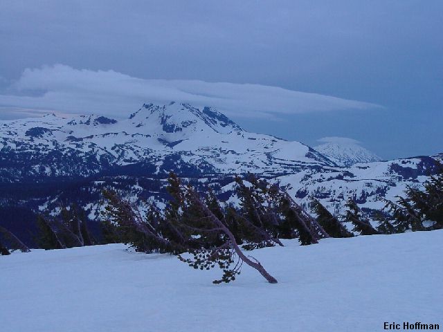
We awoke at 3:00am and were on FST 4072 around 3:35am. The first mile was mostly melted out, but by 6000', at 1.9 miles, we were in deep snow at the crossing of Soap Creek and the junction with FST 4074. After crossing the stream we continued on 4074 and made our way toward the base of the the SW Ridge, the ridge we would take nearly to the top of the North Sister. North Sister is the most difficult of the Three Sisters. This route features a steep exposed traverse at the top of the South Ridge followed by a longer, equally steep and exposed traverse around the west side of the summit pinnacle to a gully known as the "Bowling Alley" where we expected to find snow and ice mixed with class 4 rock leading nearly to the summit. It made sense to climb North Sister first since we could be there when the snow was still firm, we would still be reasonably rested and because it would take the longest.
Before 9:00am we had reached 9500' on the SE Ridge where it merges with the SW Ridge and the two became the South Ridge, for a few hundred feet anyhow. The early morning views of Broken Top, Bachelor and the Three Sisters from the SE Ridge where magnificent. The route thus far had been on talus, scree and pumice, with a bit of snow and scrambling mixed in.
|
Broken Top and Bachelor from the approach to the SE Ridge of North Sister |
|
|
|
South Sister from the SE Ridge of North Sister |
|
|
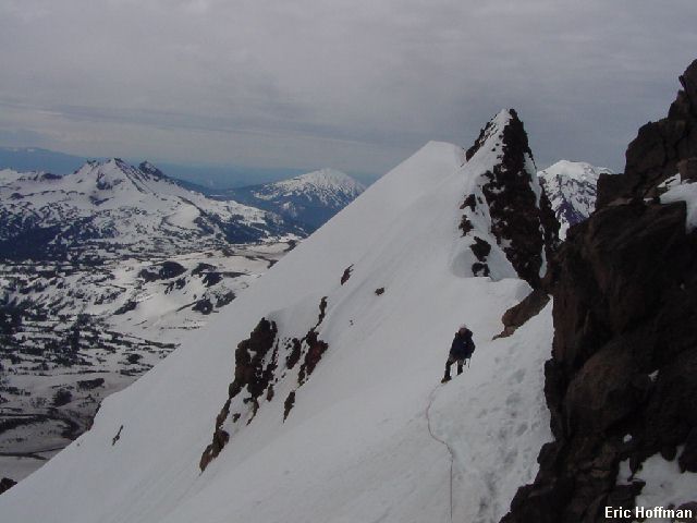
We roped up and prepared for the traverse on the east side of the ridge and around the west side of the summit pinnacle. The ridge had only one section that I was happy to be roped up on. We used a nearby horn as protection as we made the short but exposed traversed past a small gendarme on steep, thin snow.
|
John Mefford near the top of the South Ridge of North Sister |
|
|
We arrived at a minor saddle where the route moves to the west side of the summit pinnacle. A traverse of about 2 and a half pitches leads to the "Bowling Alley". The traverse is steep, reaching an angle of more than 50 degrees on the steepest sections where we used pickets for a running belay. After reaching the "Bowling Alley", we headed up 40 to 45 degree snow and ice for about a pitch and reached the final steep half pitch or so of class 4 rock largely covered with ice. I placed a couple of screws on the way up, then set up a belay for John. The South Horn was a walk up from there, but the true summit, Prouty Peak, was a bit more difficult with steep snow and scrambling.
|
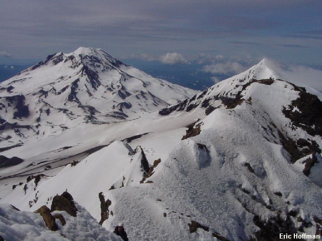
South and Middle Sisters from the summit of North Sister |
|
|
|
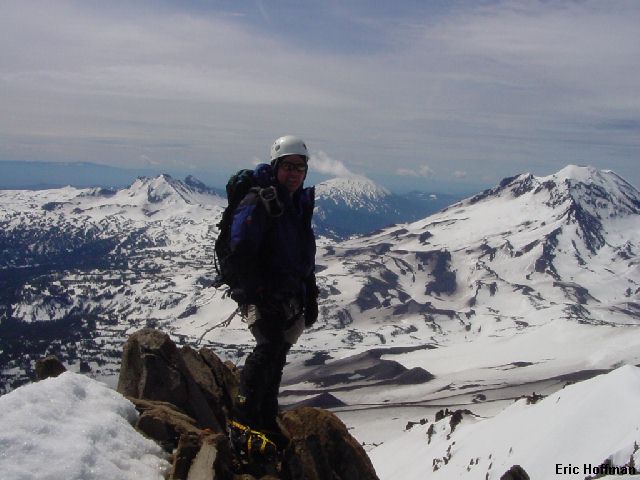
John on the summit of North Sister |
|
|
After two short rappels we down climbed the "bowling alley" and made our way back to the top of the SW/SE ridges. The plan was to descend to the North-Middle Sister Col (8840'), then make our way up Middle Sister via the North Ridge. We headed down the easy SW ridge and watched the clouds building over Middle and South Sister. We arrived at the col in less than a half hour. One down, two to go.
It was around 1:00pm as we started up the North Ridge of Middle Sister. The route offers little in the way of climbing difficulties. Most of the route is on pumice and scree but little of it had melted out. After some post-holing just above the col, the snow became firm. For a short period the angle reached about 40 degrees, but I didn't even bother getting out my ice axe given the safe run-out. A fall would have been little more than an unplanned elevation loss. It was cloudy and breezy when I arrived at the summit but occasionally I got a glimpse of my surroundings. John arrived a few minutes later and we wasted little time before we headed down the South Ridge. The South Ridge is about like the North Ridge. About the only difference is that the pumice, scree and relatively low angled snow is on the south side of the mountain..
|
South Sister at 2:00pm from the summit of Middle Sister |
|
|
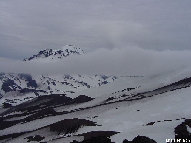
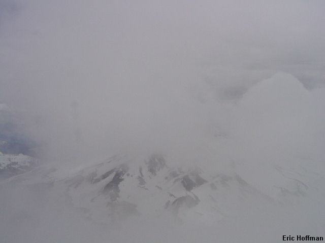
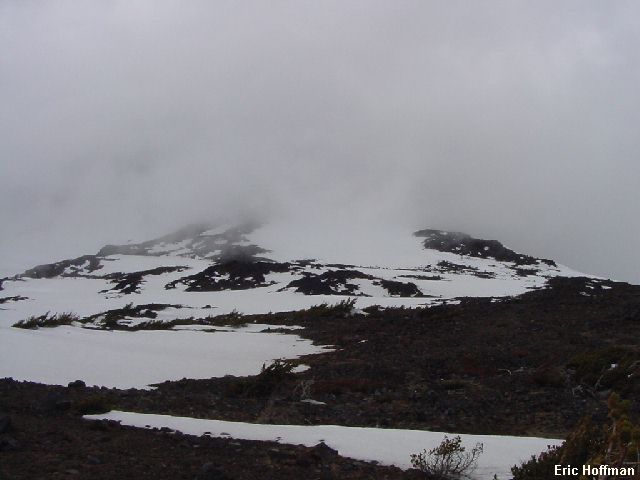
After a slow descent through the thickening clouds to about 8300', we got a view of South Sister. Its summit was completely obstructed by a dark cloud that seemed to be there to stay. It was a few minutes before 3:00pm and we still had 6+ hours of daylight left. Under good conditions this would be plenty of time to descend to the 7100' saddle between Middle and South Sister, make the 3200' ascent to the summit of South Sister and at least get close to the trailhead before dark. South Sister, aka Charity, is the highest at 10,358', but considered to be the easiest of the three due to the south side climbers trail. The North Ridge, the most direct from our location and described as class 3-4 with rockfall hazard, just didn't seem like it was going to be a good place to be given the conditions. It looked like a long way to go to get to the easier, more straight forward route on the west side. With increasing clouds we were concerned that the weather might be taking a turn for the worse and we decided we would have to settle for 2 out of 3.
|
South Sister at 3:00pm from the South Ridge of Middle Sister |
|
|
After a short traverse we dropped onto the the Diller Glacier, made a descending traverse to the Hayden Glacier moraine and continued NE toward the base of the SE Ridge of North Sister. It rained lightly at times and along the way we stopped and talked to the only three parties we had seen on mountain and wondered why there were 20+ cars at the trailhead. We arrived back at the trailhead just after 5:30pm.
References:
Summit Guide to the Cascade Volcanoes; Jeff Smoot; Pages 134-148