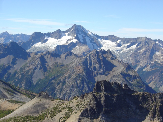
The East Face of Tupshin Peak
Devore and Tupshin are 2 of the top 100 peaks in Washington. The Bulger list ranks Devore at number 89 and Tupshin at 99. That aside, I had never been to this area before and that was reason enough to go. “Stinky” Tom Sjolseth had arranged a boat ride to Weaver Point with Norm Burke who has climbed a lot of mountains in his lifetime but was more interested in fishing on this particular weekend.
On the way up the lake Norm entertained us with stories from his past climbs. We reached Weaver Point at about 11:00AM, well before Norm ran out of stories. From here we hiked the Stehekin River Trail trail for about a quarter mile to the junction with the Devore Creek trail (FST 1244) which we followed to Bird Creek camp. Bird Creek Camp is little more than a wide spot in the trail at about 4200 Feet about 100 feet before it crosses Bird Creek. On the map this appears to be only about 5 miles but it certainly seems longer.
We had initially planned on camping in the lower basin between Tupshin and Devore but decided to camp here instead thinking we would save energy and that we should be able to reach the summits of Tupshin and Devore from Bird Creek Camp in one long day.
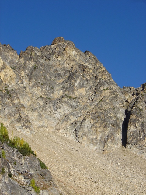
We left camp at about 7:00AM heading up the right side of the Bird Creek drainage. We stayed well above the creek but below the cliffs where we could link together grassy openings. After crossing two small gullies (perhaps 100 yards apart) we turned right and began ascending. The small gully turned into a large gully that reached the ridge separating Bird Creek from the drainage below Tupshin’s East Face at c.6700’. From here we got our first look at Tupshin.
|
The East Face of Tupshin Peak |
|
|
We hiked up the ridge a short distance until able to traverse into the basin below the east face of Tupshin. Once in the basin we traverse until below the east face then ascended scree to the base of the face (c.7800’) where we roped up. As described in the Beckey guide, there is a ramp on the right that allows access to the face. Beyond that we did not follow the description in the Beckey guide.
I took the initial lead following the ramp then working back left. With only a few 4th sections we used a running belay and reached the summit ridge about 75 feet below the top. We set up a belay station here and Tom took the traversing left on a ledge to an obvious chimney that offered a couple of moves of 5.4 and a bit of class 4 to a good belay. From there loose but easy rock led to the summit which we reached at about 11:30AM. The route was much straighter forward than I had expected, certainly more so than the original route on the west ridge.
|
Bonanza Peak from the summit of Tupshin Peak |
|
|
|
Devore Peak from the summit of Tupshin Peak |
|
|
We didn’t spend long on the summit and soon began rappelling down the face. There were stations already in place. Expect to make 5 or 6 rappels total and a little down climbing to get back to the scree slopes below.
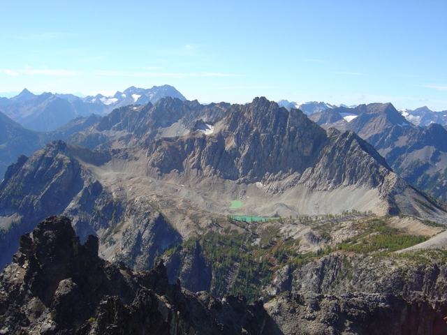
We found running water lower in the basin where we filled our bottles. Not wanting to lose our hard earned elevation we crossed the ridge back into the Bird Creek drainage at c.7000 feet hoping we could traverse the south slope of Tupshin to the head of the drainage and gain the Northwest Ridge of Devore. There was some loss of elevation on this footsore traverse but it saved a great deal of time and energy. We reached the short rock headwall at the head of the drainage and scrambled to the broad bench below White Goat Peak. After traversing the bench we followed the ridge down to the Devore-White Goat saddle and the base of Devore’s NW Ridge.
|
White Goat Peak from the traverse between Tupshin and Devore Peaks |
|
|
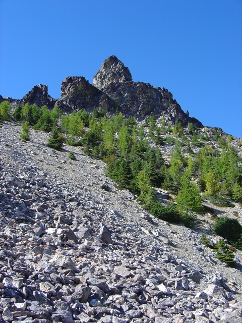
The ridge was an easy scramble unit just below the summit. Beckey says to traverse the right side until a yellow vertical wall appears then follow a gully back to the ridge. We probably left the ridge earlier than necessary but eventually found the correct gully and scrambled to the notch. There are a couple of 4th class moves on the ridge just above the notch then easier scrambling to reach the summit. It was 4:30PM when we arrived. In talking to Norm on the boat ride home we discovered that we could have stayed on the ridge with one spot where a hop across a gap was required.
|
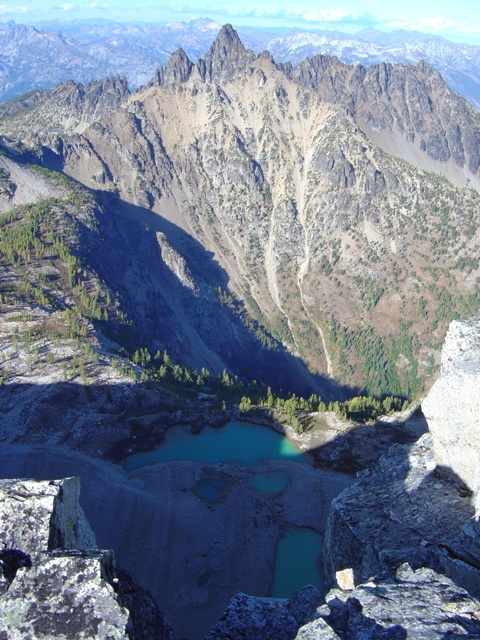
Tupshin Peak from the summit of Devore Peak |
|
|
We started down the SE Ridge after only a short time on the summit. There is a short 4th class step that can down-climbed not far below the summit. At about 8200 feet we began down a scree slope in the West Fork Devore Creek drainage. Our plan was rather than the routes described by Beckey or Goldman. It is best or head straight down slope when you leave the ridge then follow a broad gully that curves to the right and leads to a bench. Next traverse the bench then cut back left when it becomes feasible and cross the small creek. The left side of the drainage is mostly an open grass slope until near the bottom. Rather than diving into the brush we traversed into the trees until we stumble upon a rocky water course. We followed this to the valley floor and after a short bushwhack arrived on the trail. We hiked the 1.5 mile back to camp to arrive there at about 7:00PM. Considering it was nearly the Autumn Equinox, we had taken full advantage of the 12 hours of daylight available.
The next day we packed up and hiked back to Weaver Point were our ride awaited. I owe a big thank to Norman Burke for the fast ride to and from Weaver Point.
|
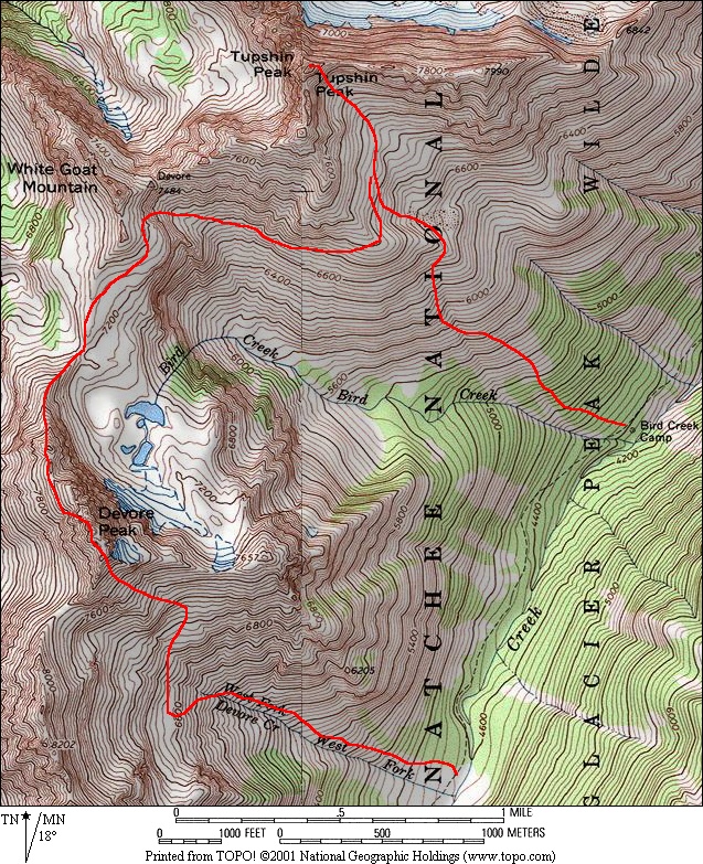
Map Courtesy of Topo! |
|
|
References:
Cascade Alpine Guide, Volume 2, 2nd Edition; Fred Beckey; Pages 211 and 212
Washington's Highest Mountains; Peggy Goldman; Pages 150-154