Hiking in the Wallowa Mountains
- Destination: Most notable, Ice Lake (7849')
- Date: May 25, 2003
- Difficulty: 3+
- Payoff: 5
- Starting Point: Wallowa Lake Trailhead (Wallowa
Lake State Park c.4650')
- High Point: above Ice Lake (c.8000)
- Round Trip Distance: c.16miles
- Equipment: The ten essentials,
bring an ice axe and a tick collar in early season,
- Mountain Skills: Route finding, moderate snow
climbing (to 35 degrees), snow assessment
The Wallowa Mountains are something of a legend according to some people I
know. Painfully, I had to pass on a ski trip or two to the area in the past few
years due to lack of time and/or finances. Finally, I had the time and finances to
at least go over and get a glimpse of these mountains, tourist style. Oregon has 27 peaks over
9000 feet, 17 of them are in the Wallowas. It was becoming difficult to resist
the attraction.
I headed south, then east, then north, then east again, arriving in
Enterprise, OR on the evening of the 23rd. My first night was in Enterprise at
the Wilderness Now Motel ($52 if you are an AAA member, $52 if you aren't but
the owner insists you tell him you are). The next morning I arrived at the
ranger station around opening time: 8am. I purchased the maps of the area and
obtained the usual ranger warning "you know, there is snow up
there".
It had been apparent well before I was informed by the ranger that there was, infact,
"snow up there." I wasn't sure what had drawn me to this area on
Memorial Day weekend, the busiest weekend of the year according to the owners of
the Strawberry Wilderness Bed and Breakfast where I would spend the next two
nights ($65 to $85 a night). Unlike my previous experience with a B and B, if
you went away hungry or caffeine deprived after Gail was done cooking, it was your own fault.
Saturday was spent relaxing and exploring Wallowa Lake State Park. Somewhere
around 11:00am, I found a sunny picnic table and took a nap in the 80+
degree weather... perhaps
this is what the Wallowa Mountains were all about, but I doubted it.
|
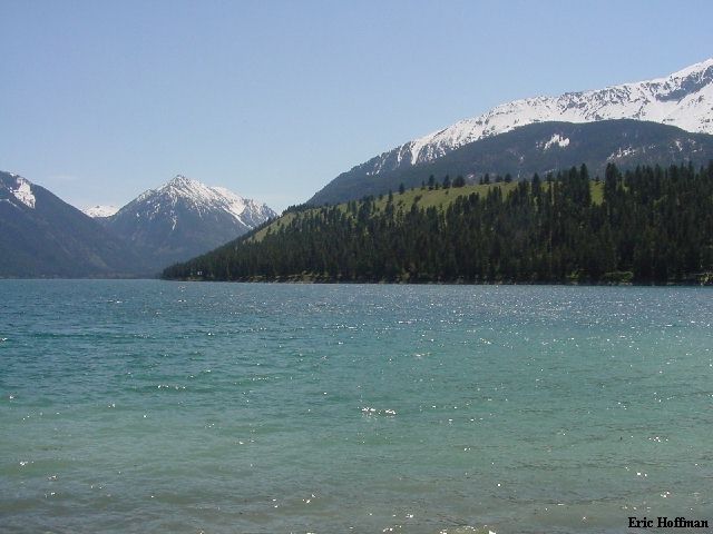
Wallowa Lake from its North End
The two obvious valleys are the East and West
Forks of the Wallowa River. Bonneville Mtn.(+8120') is the foremost mountain
on the divide between the valleys. Chief Joseph Mountain (9616') is on
the right and the most prominent from the lake.
|
|
|
After lunch at the Outlaw Cafe, I headed up the West Fork Wallowa
River Trail 2.8 miles to the Ice Lake trail and then on the Ice Lake trail
perhaps a half mile. The forecast for the following day was for temps around 70
degrees F with showers. The few locals that I had talked to shrugged
off the forecast. It appeared that they were going to be correct until about
7:00pm when the weather quickly turned from warm temperatures and blue skies to
warm with high winds and gloomy clouds.
I left the Strawberry Wilderness B 'n' B a bit after seven the next morning,
missing out on what was ,no doubt, a thorough breakfast. I arrived at the
trailhead about 15 minutes later, disgruntled to find none of the several
espresso stands along the way open. This doesn't seem to be a community of
morning people. I resumed travel on the West Fork Wallowa River Trail reaching
the point where I had left off the day before in about an hour.
|
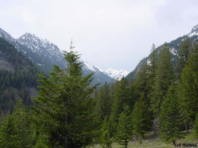
Cusick Mountain (9518') at the head of
the West Fork Valley
Taken from low on the Ice Lake Trail
|
|
|
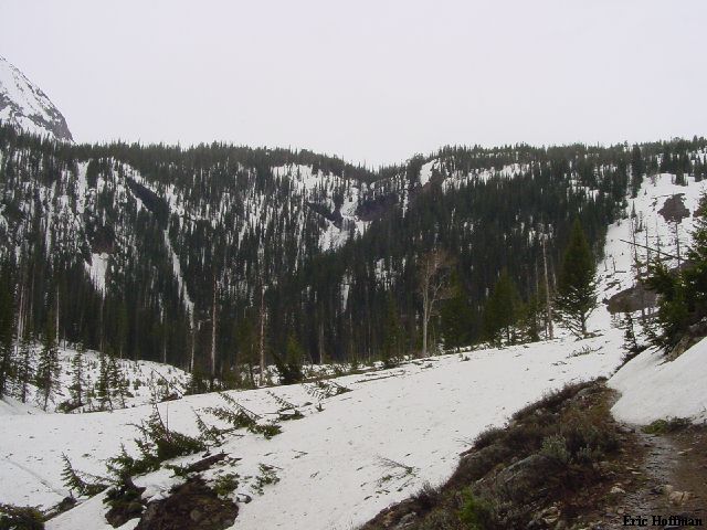
I followed the Ice Lake trail a bit over 3 miles to an avalanche basin below
7000 feet where the snow began and the trail vanished. Up until this point the
trail was snow free with a few downed trees. I continued west and started up a
moderate slope the snow near the bottom was good but gradually got worse.
|
Where dirt met snow on the Ice Lake
Trail (c.6800)
According to the map, the trail crosses Adams
Creek twice in the avalanche basin (you can sort of see the creek cascading
from the low point at center) Above the basin the trail switchbacks in and
out of the trees on the right.
|
|
|
I kept well right of Adams Creek, the creek that drains Ice Lake. At about
8000 feet I found myself looking down at the lake. Snow conditions had become
less than ideal, the winds were high and it looked like rain was imminent. I
lacked the motivation to continue. There did appear to be a reasonable safe
route up Matterhorn via moderate, semi-treed slopes then an east ridge.
Sacajawea seemed like it could present more of a problem under poor snow
conditions.
|
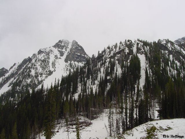
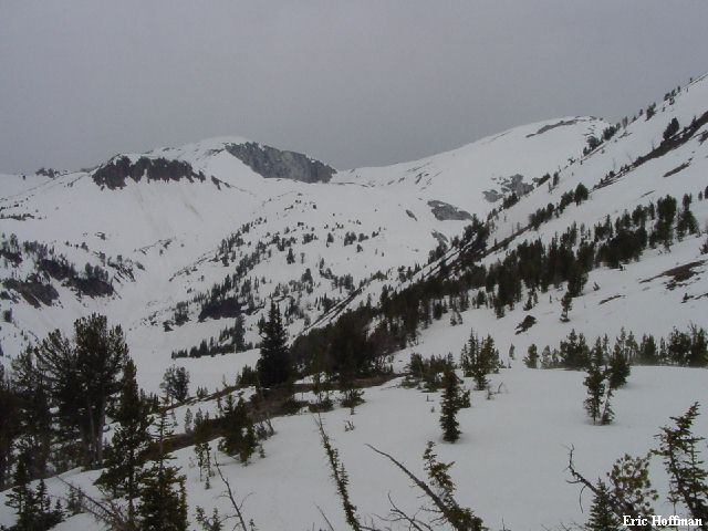
Just Another unnamed peak (+9240') WSW
of Craig Mountain
|
|
|
|
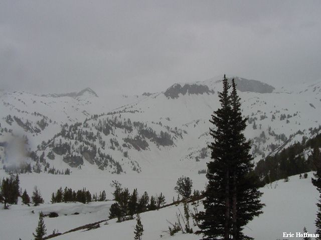
Matterhorn (9826') and Sacajawea Peak
(9838') from above Ice Lake
Sacajawea is the highest peak in the Eagle Cap
Wilderness Area (6th highest, behind Hood, Jefferson, S Sister, N. Sister
and Middle Sister). The West face of Matterhorn (not visible in this photo ) is
1800 feet of Marble and considered to be most difficult in the
wilderness area. The NE cirque (visible) is about 400 feet high.
|
|
|
|
Ice Lake, Matterhorn, and here comes the rain
|
|
|
I returned to the trailhead then headed into town for a late lunch. With a
full belly I headed back to the trailhead to check out the hydro generator
located there. Somehow I had brought work with me to the Wallowas. There isn't
wasn't much to see at the trailhead, so I headed up the East Fork Wallowa River
Trail to a fork with a bridge bridge over the river (c.1.5 miles, 900 feet of
gain). I crossed the stream and through an unlocked gate (there were no signs
telling me I couldn't). I headed up an old road another 200 feet to the dam
and reservoir. There still wasn't much to see. On the east fork trail
there are a few views of Wallowa Lake a lot of horses and not much else unless
you are willing to travel a bit farther.
|
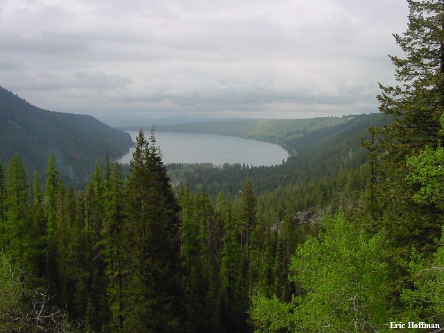
Wallowa Lake from the East Fork Wallowa River Trail
|
|
|
|
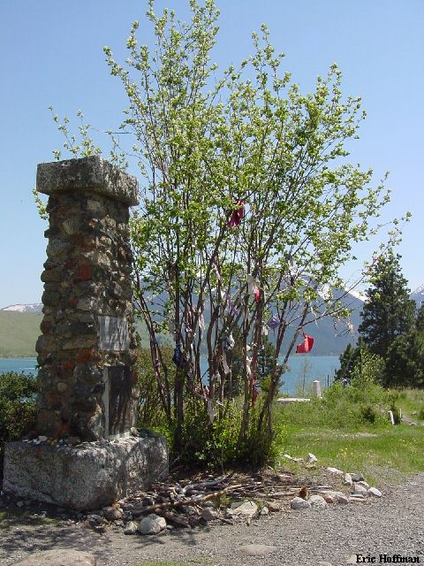
The Grave of Chief Joseph, Nez Pierce Tribe... tourism is
the new way of life at Wallowa Lake
I don't know if I could live my life here, but it
wouldn't be a bad place to be put to rest
|
|
|
References:
Exploring Oregon's Wild Areas, Second Edition; William L. Sullivan; Pages
229-236
USGS 7.5 Minute Quadrangles: Joseph, Chief Joseph Mountain, Eagle Cap and
Aneroid Mountain