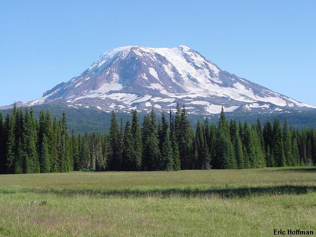
Mount Adams from Muddy Meadows
I noticed Lava Ridge the first time I climbed the North Ridge of Adams, it's hard not to. Separated by the Lava Glacier, the Lava Ridge and North Ridge routes merge above Lava Glacier Headwall at c.11,400'. I have two other trip reports to this area, both involving the North Ridge
The August 2000 North/South Traverse and July 2001 North Ridge Ascent.
Both of the reports have a photo showing at least part of Lava Ridge. Both photos also show considerably more snow than I would encounter on the upper mountain. I began the approach hike at Muddy Meadows Trailhead, located about a half mile south of the Keenes Horse Camp and junction of FSR 2329 and FSR 2329-085. At the trailhead there is a great view of Adams across tall meadow grass.
|
Mount Adams from Muddy Meadows |
|
|
The approach that I took may or may not be fastest or easiest, but it got me there with little difficulty. I did the entire approach to camp at c.7800' in my Merrell sport moccasins. The Muddy Meadows Trail (FST 13) is nearly flat, gaining only 800 feet at 2.4 miles where it crosses the PCT (c.5200'). Continuing on another 1.6 flowery miles, the trail gains another 600 feet and connects with FST 114. This trail leads to the east side of the mountain, crossing the Yakima Reservation Boundary at 3.6 miles at an area known as Devil's Garden.
|
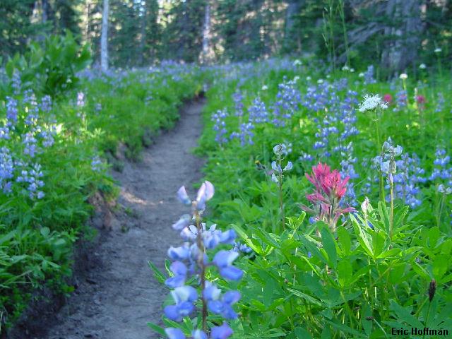
The approach part I: Hypnotic Flora |
|
|
I followed FST 114 about 1.5 miles to the crossing of the main stream running down from Lava Glacier at c.6400'. Seeing no easy way across to the trail on the other side, I turned and followed the stream toward the glacier on easy moraine. Some remaining snow patches and bridges made travel even easier. I decided to make camp an the east moraine of the glacier and wanted to keep my options open for a north ridge descent. It really didn't look like there was going to be a reasonable bivy site higher than about 8000', so I made camp in a somewhat protected area at c.7800' with running water. The camp was about 2 miles from where I had left the trail.
|
The approach part II: Lava Ridge is straight ahead, the N Ridge in on the right |
|
|
|
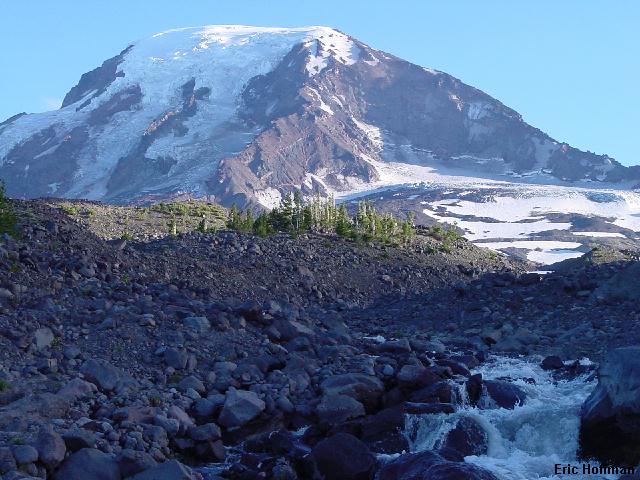
Mt Rainier from my 7800' bivy site on the Lava Glacier moraine |
|
|
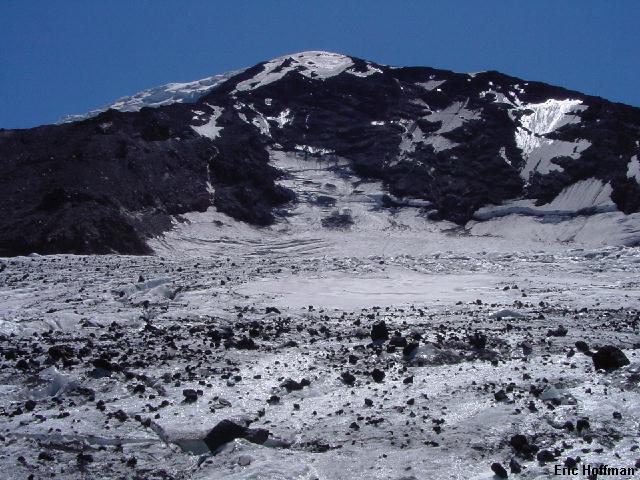
After a rather breezy night I awoke around 6:30am and got out of camp around 7:30. The winds eased but had not let up all together as I made my way to the base of the ridge. Ideally, there would have been enough snow left on the west side of the ridge to make the ascent to the ridge crest easier, but I was left with about 400 feet of mostly loose ruble. After gaining the crest, the going was easy with a bit of scrambling and not too much in the way of loose steep scree. At c.10,600' I reached snow, or was it ice. There was definitely ice, water ice first then hard glacier ice. From below it appeared that there were two parallel snow patches at the top of the ridge, both reach to about 40 degrees and run out at the Lava Glacier Headwall. I took advantage of the rocks and pieced together a broken route of rock and the snow patch on the west side. When the rock ended I cut back across to the less exposed left side and worked up between a few small crevasses to meet the N. Ridge route at c.11,400'.
|
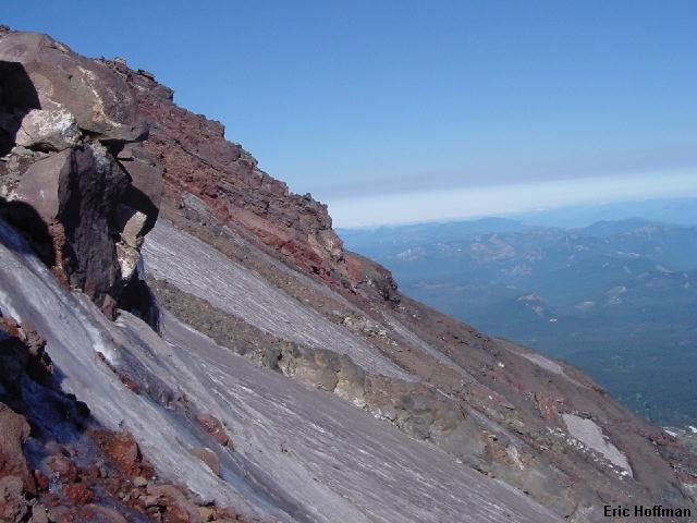
Looking across the Lava Glacier Headwall to the North Ridge |
|
|
|
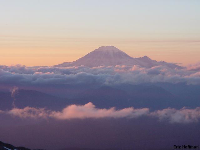
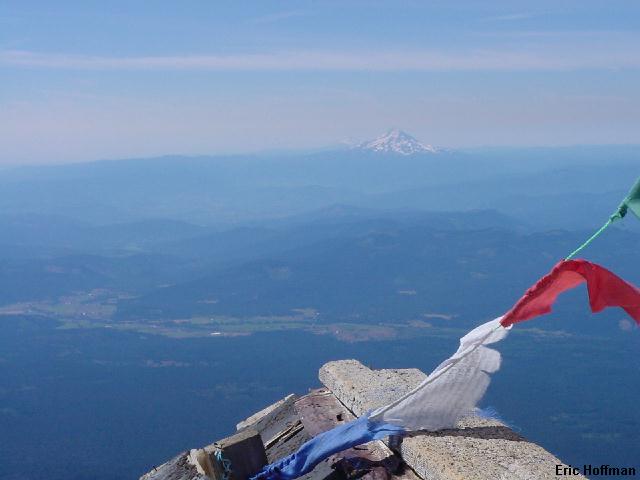
Mount Hood and Mount Jefferson from the summit of Mount Adams |
|
|
As thrilling as down climbing hard ice above a 2000 foot headwall sounded, I decided to take the North Ridge back down. It looked like it would be a snow free descent on a reasonably straight forward route. I ran in to one person at the top of the ridge who was on his way up. After a short conversation I continued down. I had hoped to find a way down to the Lava Glacier at the 8700' notch where the usual approach to the N. Ridge gains the crest, but found nothing that looked safe. After following the ridge a bit further down, I was able to easily get onto the glacier at 8400'. I started out onto the glacier and headed for what looked like an easy glacier crossing. I traversed to nearly the middle of the glacier then descended to camp on a mixture of rock, ice and running water. I arrived back at camp around 2:00pm.
|
Lava Ridge, the North Ridge and Lava Glacier Headwall from the Lava Glacier |
|
|
References:
Cascade Alpine Guide, Volume 1, Second Edition; Fred Beckey; Pages 60-63
Summit Guide to the Cascade Volcanoes; Jeff Smoot; Pages 98, 99